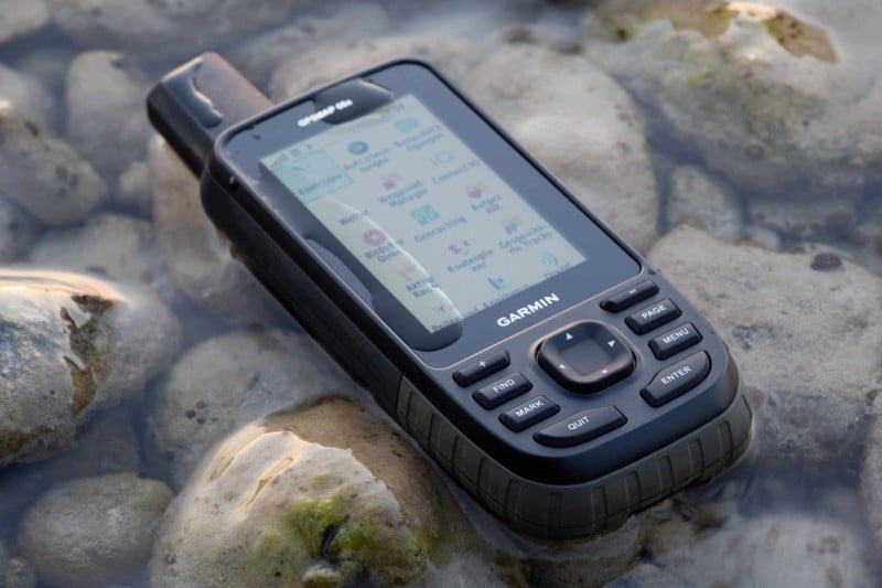
Garmin released the GPSMAP 66s & GPSMAP 66st!
The new GPSMAP handheld GPS devices provide a lot of new features like:
- 3″ screen with 240 x 400 pixels,
- multi GNSS support (GPS / GLONASS / GALILEO),
- several wireless interfaces (ANT+ / Bluetooth LE / Wi-FI),
- Garmin Connect IQ apps, data fields & widgets
- and more new stuff …
but they are still rugged and all-round GPS handhelds for severe conditions!
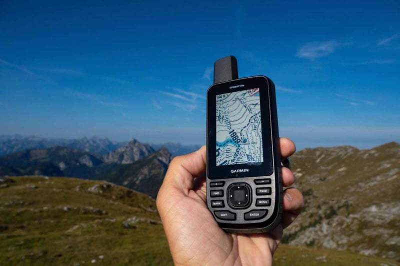
What are the differences of the GPSMAP 66s compared to the GPSMAP 64sx?
Compared – GPSMAP 66s – GPSMAP 64sx
| GPSMAP 66s | GPSMAP 64sx | |
|---|---|---|
| Physical dimensions | 2.5″ x 6.4″ x 1.4 / 6,2 x 16,3 x 3,5 cm | 2.4″ x 6.3″ x 1.4″ / 6,1 x 16,0 x 3,6 cm |
| Weight (with batteries) | 8.1 oz (230 g) | 8.1 oz (230 g) |
| Display |
|
|
| Battery |
|
|
| Battery life |
|
|
| Waterproof, ruggedness |
|
|
| GPS receiver |
|
|
| GPS antenna |
|
|
| Interfaces |
|
|
| Unit-to-unit transfer |
|
|
| Memory |
|
|
| Output format |
|
|
| Sensors (internal) |
|
|
| Sensors / devices (external) |
|
|
| Preloaded maps |
|
|
| Data |
|
|
| Navigation |
|
|
| Smartphone apps |
|
|
| Connected features (*: Bluetooth, **: Wi-Fi) |
|
|
| Connect IQ | Apps, widgets, data fields | no |
| Miscellaneous |
|
no |
Garmin GPSMAP 66s & 66st – Review
All GPSMAP 66 models include now ANT+, Bluetooth LE, Wi-FI and USB for connectivity with smartphones (Bluetooth), wireless home networks (Wi-Fi), sensors (ANT+, Bluetooth) or even desktop PCs (USB).
You get:
- Activity uploads to Garmin connect (*/**)
- Software updates (*/**)
- EPO downloads for a faster satellite reception (*/**)
- Geocaching Live for wireless integration with Geocaching.com (*/**)
- Active Weather for up-to-date forecasts and animated weather radar (*/**)
- Smart notifications (*)
- Connect IQ (*)
- LiveTrack / GroupTrack (*)
- BirdsEye Direct imagery (**)
*: Bluetooth, **: Wi-FiOne of the interesting new features is the compatibility with the Garmin Connect IQ platform. Users can customize their devices with data fields, widgets and apps, which can be helpful while cycling or hiking.
Connect IQ is not yet available for the GPSMAP 66 series, but we experienced that you find a lot of gimmicks and nonsense apps in the Connect IQ store – but also some highlights like routeCourse or the highly recommended gimporter (importing FIT/GPX files from an Android device). These apps will hopefully be available for the GPSMAP 66 in the next future.
The new 3″ display – inherited from the Oregon 7×0 series – is absolutely brilliant, even under difficult light conditions. The GPSMAP 66s/66st has similar physical dimensions compared to the GPSMAP 64s, but the bigger screen results in a different housing design (see picture above). So the GPSMAP 66s/66st might not be the perfect device for small hands!
The GPSMAP 66s/66st has the same keyboard layout as all GPSMAP devices – with an exception and one negative aspect. The power key is now located near the GPS antenna; when using the 66s with one hand it is a hassle to leave the battery save mode, as this operation is only possible by pressing the power key (all other GPSMAP devices allow to press any key).
Garmin claims a battery life up to 16 hours. Using "black" eneloop 2.550 mAh batteries we get:
Power Mode* (hh:mm):
- GPSMAP 66s: 05:15, 05:00, 05:25
- Oregon 700: 05:35, 05:30, 06:03
Energy Saving Mode** (hh:mm):
- GPSMAP 66s: 18:15, 15:55
- Oregon 700: 20:35, 17:50
* Power mode: display always on, max. backlight, GPS & GLONASS, track recording, active navigation, ANT+/Bluetooth/Wi-Fi off.
** Energy saving mode: battery save on, GPS only, track recording, no active navigation, ANT+/Bluetooth/Wi-Fi off.
In practice you get a battery life between these minimum / maximum values – depending on your usage.
The GPSMAP 66s has 16 GB internal storage (15,44 GB are usable, eg. for maps and GPX/FIT-files), expandable by a Micro-SD card (up to 32 GB).
What we really love: Garmin has improved the user interface compared to it’s predecessors – some examples:
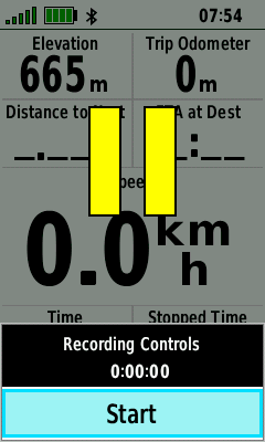
- Recording controls: Direct access to this important function by the ENTER key (screenshot bottom left).
- Power key: Opening a status page with functions like backlight control, Connect IQ widgets, bluetooth status, …
- Satellite page: Different views for each GNSS.
- Page ribbon: Now visible at the lower part of the display.
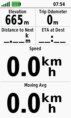
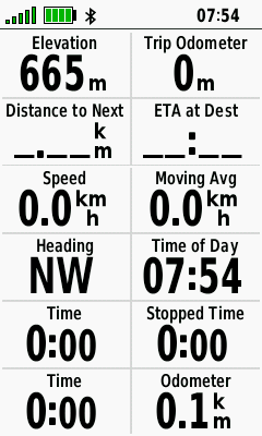
- Trip computer: Pressing the + / – keys changes dynamically the number of data fields (screenshots below).
In addition, the map drawing is slightly faster!
The GPSMAP 66 series has also some new functions – We especially like:
- New waypoint naming: You can define a prefix like "2018-Bavaria-" and a numeric suffix like "0001", every new waypoint gets the name "2018-Bavaria-0001", "2018-Bavaria-0002" …
- A very bright LED flashlight and SOS beacon.
- The inReach remote function for controlling your inReach Mini device.
Garmin GPSMAP 66s & 66st Review – GPS Data
Our map provides a track recorded with various Garmin handhelds (Oregon 700, GPSMAP 64s, Hike 1: all devices GPS & GLONASS, Hike 2: 64s/Oregon GPS & GLONASS, 66s GPS + GALILEO, Hike 3: 64s GPS & GLONASS, 66s GPS + GALILEO, inReach Mini: GPS). You can use this for GPS accuracy data comparisons and making up your own mind.
What did we find out?
- GPSMAP 66s & GPSMAP 64s are on the same high level, no difference between GPS + GLONASS or GPS + GALILEO.
- Oregon 700 tends sometimes to a slight GPS drift (e.g. in a steep-sided valley, see waypoint 2018-BAY-007); overall, its GPS accuracy is on a very good level compared to the GPSMAP devices.
- inReach Mini can not match the GPS accuracy of the GPSMAP devices, but is on a very good level too.
Recording: Trip 1 every 10 m; Trip 2 & 3 auto normal
GPS: *: GPS + GLONASS; **: GPS + GALILEO; ***: GPS
- VORINSTALLIERTE EUROPAKARTE: Für die perfekte Navigation beim Wandern, Bergsteigen oder auch Geocachen sorgt die vorinstallierte topographische Karte TopoActive Europa. Mit dieser routingfähigen Karte finden Sie mit Adresseingabe oder auch POIs Ihr Ziel.
- BEHALTEN SIE DIE ORIENTIERUNG: Neben den gängigen Satellitensystemen GPS, GLONASS und Galileo sind auch QZSS und IRNSS verfügbar. Zusammen mit der Multi-Frequenz-Technologie erhältst du so überall und jederzeit den besten Satellitenempfang.
- SUPER ABLESBAR UND WASSERDICHT: Das transflektive 2,6“ Farbdisplay ist auch bei Sonnenlicht sehr gut ablesbar. Dank Tastenbedienung können Sie das Gerät auch mit Handschuhen und unter allen Bedingungen bedienen. Wasserdicht nach IPX 7 Standard.
- BAROMETER UND 3-ACHSEN-KOMPASS: Der GPSMAP 65s ist zusätzlich mit einem barometrischen Höhenmesser und einem 3-Achsen-Kompass ausgestattet. Der Barometer gibt noch präzisere Höhendaten aus und der 3-Achsen-Kompass sorgt für die ideale Orientierung.
- PERFEKT VERNETZT: ANT+ und Bluetooth-Kompatibilität machen es möglich. Verbinden Sie bspw. Geschwindigkeits- oder Herzfrequenzsensoren mit Ihrem GPSMAP. Mit dem Smartphone gekoppelt erhalten Sie Telefonbenachrichtigungen direkt aufs Display.
- 16 Stunden Akkulaufzeit: Der GPSMAP 65 kann mit AA-Batterien sowie dem Garmin Akku Pack betrieben werden (beides separat erhältlich). Mit diesem dualen System sind Sie immer flexibel und können nach dem Batteriewechsel sofort wieder loslegen.
- GARMIN EXPLORE APP: Nutzen Sie die Garmin Explore App oder das Explore Portal, um Ihre Tour auf dem Smartphone oder am PC zu planen, Wegpunkte zu erstellen oder Ihre Tour im Nachhinein nochmal anzusehen.
Garmin GPSMAP 66s & 66st – Best For
- All-Round Use
- Hiking
- Mountain Bike
- Geocaching
GPSMAP 66s & 66st Review – Final Verdict
SUMMARY: The Garmin GPSMAP 66s and GPSMAP 66st are like their predecessors the best all-round navigation devices for severe conditions on the market. We enjoy the brilliant display, its feature set, the improved user interface, the connectivity options and the GPS accuracy.
The rugged GPSMAP 66 series is highly recommended for different outdoor activities like hiking, mountaineering and geocaching.
GPSMAP 66s – Pros
- Brilliant display
- GPS accuracy & fast satellite reception
- Buttons with click feedback
- Improved interface
- Full set of navigation features
- Wireless features
- Availability of maps
- Garmin Explore App
GPSMAP 66s – Cons
- Not so good for small hands
- Disabling battery save mode, only by pressing the power key
- No two data field option for map page
GPSMAP 66s – Score
- GPS: 100%
- Battery: 60%
- Display: 100%
- Handling: 80%
- Navigation: 80%
- Features: 80%
- Maps: 100%
- Final Verdict: 90%
- VORINSTALLIERTE EUROPAKARTE: Für die perfekte Navigation beim Wandern, Bergsteigen oder auch Geocachen sorgt die vorinstallierte topographische Karte TopoActive Europa. Mit dieser routingfähigen Karte finden Sie mit Adresseingabe oder auch POIs Ihr Ziel.
- BEHALTEN SIE DIE ORIENTIERUNG: Neben den gängigen Satellitensystemen GPS, GLONASS und Galileo sind auch QZSS und IRNSS verfügbar. Zusammen mit der Multi-Frequenz-Technologie erhältst du so überall und jederzeit den besten Satellitenempfang.
- SUPER ABLESBAR UND WASSERDICHT: Das transflektive 2,6“ Farbdisplay ist auch bei Sonnenlicht sehr gut ablesbar. Dank Tastenbedienung können Sie das Gerät auch mit Handschuhen und unter allen Bedingungen bedienen. Wasserdicht nach IPX 7 Standard.
- BAROMETER UND 3-ACHSEN-KOMPASS: Der GPSMAP 65s ist zusätzlich mit einem barometrischen Höhenmesser und einem 3-Achsen-Kompass ausgestattet. Der Barometer gibt noch präzisere Höhendaten aus und der 3-Achsen-Kompass sorgt für die ideale Orientierung.
- PERFEKT VERNETZT: ANT+ und Bluetooth-Kompatibilität machen es möglich. Verbinden Sie bspw. Geschwindigkeits- oder Herzfrequenzsensoren mit Ihrem GPSMAP. Mit dem Smartphone gekoppelt erhalten Sie Telefonbenachrichtigungen direkt aufs Display.
- 16 Stunden Akkulaufzeit: Der GPSMAP 65 kann mit AA-Batterien sowie dem Garmin Akku Pack betrieben werden (beides separat erhältlich). Mit diesem dualen System sind Sie immer flexibel und können nach dem Batteriewechsel sofort wieder loslegen.
- GARMIN EXPLORE APP: Nutzen Sie die Garmin Explore App oder das Explore Portal, um Ihre Tour auf dem Smartphone oder am PC zu planen, Wegpunkte zu erstellen oder Ihre Tour im Nachhinein nochmal anzusehen.

how can be good for montain bike if you cannot use STRAVA ?. blueshit.
so expensive and there is no way to upload a cycling train in strava.
Yep… total rubbish from Garmin. 3/10
Hello,
In fact in GPS + Galileo mode, Galileo only receives four to five satellites when at the same time my MI9 smartphone receives 10 Galileo satellites, the GPS electronic chip of this Garmin is not reliable.
It is also like that on the 64sx. (see your example in the test).
I just sold this 66s to buy a 64s which only has GPS + glonass which is much more reliable.
Hi,
you can not compare the MI9 with the GPSMAP 66; the MI9 has a dual-band GPS receiver, so you see twice as many satellites; GALILEO will be fully functional in 2020.
Cheers
I bought a Garmin 66s in Jan 2019 and it had died on the second day of a trip to Colombia in March. I returned it to the retailer in April who returned it to Garmin who replaced it with a new device four weeks later without explanation. there are obviously some devices with inherent faults out there so be wary.
Hello
Between GPSmap66s
And Oregon 700
What will u choose!?
What is ur advice!?
Adding more/flexible options for data fields in the map view (i.e. a self-defined config during navigation) should be an easy sw fix, as such options already exist in several earlier models. I hope this can be fixed in an upcoming sw version in not too long.
Hello,
What do you mean by : "No two data field option for map page"
I put four data fields on the map page ….
Maxime
I would prefer to have a only two data fields on the map page (actually we have only "small data field" with four fields)
Hello Joachim,
At the beginning I set the altitude in "barmometer variable altitude", "auto calibration disabled", so I adjusted the altitude at the beginning then several times during the hike if it changed (by comparing the points of altitude on the card 1/25000) it was not correct.
Then I put "auto calibration enabled", "variable altitude barometer" is better but still with errors.
What are your settings to have a more correct altitude?
Thank you.
Maxime
Hello Joachim,
I did not see the link for the calibration page altimétre, I have the setting exactly like yours.
https://www.navigation-professionell.de/wp-content/uploads/2018/11/gpsmap66-calibration.png
Auto calibration: off
Barometer mode: variable elevation
Pressure trending: save when power on
Calibration always by current elevation (reading from paper map)
Sometimes I’m using "auto calibration continuous" when I’m lazy or have no paper map around
Hello,
After several weeks of use, only one problem exists for me, the altitude, whatever the configuration and the setting of the altitude, this is not right, when I compare the trace with a map at 1 / 25000 IGN, there are errors in positive. I did not have these big mistakes with the eTrex Touch 35, I would like that Garmin corrects this problem.
I am on a forum and other users also have this problem.
Did you find this problem on your 66s?
Maxime
Hi,
no, I have no problems with the altimeter; when I compare the 66s with the 64s I get the following ascent/total and descent/total meters (from menu "save tracks", each device was calibrated manually at the start of the hike; tracks see above map):
Hike 2 (only one ascent/descent):
66s: 1161/1144 m
64s: 1169/1146 m
Hike 3 (with several ascents and descents):
66s: 540/531 m
64s: 536/524 m
Pretty impressive, or?
I have also made a very bad experience with altitude.
As for the 64, I use the mode with automatic and permanent calibration of pressure altitude based on GPS Altitude and I have 600m of errors after 6 km and a step in the altitude profile. At the end of the Tour, the altitude was again 300m to high !
Unusable for altitude measurement or profil storage !
I hope a quick fix of this and others bugs
Al een tweetal weken intens gebruikt, de batterij duur, na een drietal uren zijn de batterijen op (Garminpack) en loopt de GPS vast, niet een maal maar verschillende keren.
Na een paar weken geduld, de GPSmap 66st ontvangen.
Een paar batterijen, en een fiets track ingeladen en weg ermee. Wat een ontgoocheling de batterijen na 3 uur plat. Alles was uitgeschakeld, in het weekend meerdere testen gedaan, liep soms vast,was het de koude? het was nochtans maar 7 graden. De batterijen zijn er van Garmin (pack)
De batterijen worden niet volledig opgeladen via het toestel.
Wel een zeer goed scherm.
Luc
Buyer beware the interface between the 66 and the explorer app is not working properly!
I’m using the GPSMAP 66s and the Explorer App without problems … so what is not working?
I am surprised that you missed the fact that for the core functionality of the GPSMap series – navigation, these new receivers are practically useless. The Track Manager is gone, the barometric altimeter CANNOT be turned off (setting the receiver to "fixed elevation" used to do that, now that function simply locks the receiver to whatever the elevation was when you selected the function!). Setting the barometer’s auto calibration to "continuous" does nothing, I’ve done entire hikes with a consistent 100 metre error in elevation (air pressure CHANGES from day to day around here – the receiver doesn’t seem to compensate)
It seems the "fitness" engineers got hold of a GPSMap-like case and simply built a running/cycling receiver inside it. I eventually had to turn off WiFi and Bluetooth as well as ordering GPS Connect to forget about the receiver, otherwise everything I did was being uploaded to Garmin Connect, Relive, Strava – I have a Vivoactive for that, thank you very much. I tried not starting an "activity" when I start a hike, that turned off track logging altogether. I should have guessed it would, the logging options are "FIT" and "FIT + GPX" – no option to only log GPX.
I had such high hopes for this receiver with its larger display …
Hi Leifur,
navigation – why is it useless? Would be interessting if you can explain it! Which device did you use before the GPSMAP 66s/st? The "track manager" is now named "saved tracks"; regarding the altimeter: did you try to disable auto calibration and to calibrate the altimeter manually? I get very good results with this method here in the Alps – but may be the Icelandic weather is too often changing 🙂
I regret as well that the GPX only mode is not available for all new Garmin devices – but if you want to prevent the data upload to Connect you should not use the Connect App or Explore App and you should not update the device with Garmin Express – use the good old WebUpdater!
cheers!
Well, I’ve used the GPSMap 60csx and 62s (both of which I still have). Skipped the 64, didn’t seem to offer anything new. Two or three different models of the eTrex (I still have the 30 which I use exclusively for track logging). I also have the Montana 650st which I only bring along if I expect to have to hike by GPS for extended periods – my eyes can’t read the smaller displays without glasses – which is difficult in rain and fog.
I also have the inReach Explorer, actually the deLorme version, I’d have bought the Garmin one if they had switched to AA batteries (I frequently go on multi-day backpacking trips carrying spare AA batteries – built-ins aren’t very useful).
I have a Nuvi for car navigation (with a lifetime subscription for both North America and Europe) and recently bought the Vivoactive to share my exercise info with friends. I think I’ve probably missed a few (I know I had a Forerunner at one point) – I dare say you could call me a Garmin Fanboy 🙂
So – my complaints. Strangely the most annoying one doesn’t have to do with the core functionality – it is the "fitness" aspect that bothers me. I haven’t found any way to reliably turn off the automatic uploading of "activity" data without also stopping the logging of tracks. I use my Vivoactive for such uploading and had connected it with Relive and Strava. After adding the 66s for a totally different purpose (logging tracks only – no sharing) I had to make my activities "private" to stop the 66s data from going all over the place. You say break the connection with Garmin Connect – what do I then do with my Vivoactive? 🙂
The second complaint relates to ANT connections. I have a Tempe which both my 62s and 66s monitor. When I climb the local mountain (which I do most days, it’s only 780 metres high) the 62s shows a finely gradated trend with steps of 0.2°C at short intervals, the 66s listening to the same Tempe (which is actually attached to THAT receiver) misses most of the changes, the steps are few and HUGE.
The "track manager" had a couple of very useful features, one of which was the "Show on Map" function which I often used (coupled with he ability to select the displayed colour) INSTEAD of having the receiver follow the track. This helped because the track colour used for the selected track (i.e. when navigating) couldn’t be changed and sometimes didn’t offer much contrast.
Finally, the altimeter. First off, where is the guidance relating to "Auto Calibration" -> "Continuous"? I can’t find it anywhere. If this worked it would of course be the BEST option, a barometric altimeter to dampen the GPS fluctuations but without drift induced by changes in air pressure. Only problem is – it doesn’t work. You are right in saying that calibrating at the start of each outing helps, it is in fact essential (I have done a couple of hikes up that mountain with an error of 100 metres because I trusted the "continuous calibration" feature). So, yesterday I took both my 62 and 66 up the mountain. Both were set to "variable elevation", both were calibrated at the start (using a known elevation of 15 metres). It was a clear day with no unusual changes in weather, just the normal Icelandic swings in air pressure. When I came to the same exact spot two hours later the 62 said the elevation was 7 metres, the 66 said 0 metres. Needless to say the error had built up gradually – I would much rather have had a GPS-only elevation even if it fluctuated by +/- 5 metres around the true value …
My "sharing" problem in a nutshell can be seen here – you have to skip 20 or 30 rubbish tracks before you get to the ones I intended to post. Looks like I need to clean up the page (I wish Jordi hadn’t linked it to automatic uploads)
https://www.wikiloc.com/wikiloc/user.do?id=9253
And finally – a Garmin Fanboy in his natural surroundings 🙂
http://tiny.cc/eyy70y
I sent a rather long reply – maybe TOO long because it hasn’t popped up 🙂
Wow – Hornstrandir – I have been hiking there in 1982 – the "good old" GPSless time, only compass and map, however, I’m not a friend of the "fitness" aspect too, especially the mix of activities, tracks, gpx, fit … you can not turn off the automatic activity upload to Garmin, but it is avoidable by not connecting the GPSMAP to Connect; in Garmin Express you can withdraw the data upload in the settings (or update the GPSMAP with the WebUpdater).
Regarding the tempe sensor, I have no experience as I lost my sensor – so hopefully the temperature recording will get better by a firmware update. In the track manger (saved tracks) you have still the option "show on map" by pressing the MENU button (see screenshot).
Altimeter: the continuous calibration is still available but only when "barometer mode = variable elevation" (screenshot); the difference of 7 metres (62 vs. 66) would be okay for me, however, I would like to see a white paper from Garmin regarding the best practice using the altimeter (how is programmed) – but I guess that’s hopeless.
So, I wish you many fantastic hiking trips in Iceland – even with a GPSMAP 66!
https://www.navigation-professionell.de/wp-content/uploads/2018/11/gpsmap66-show-on-map.png
https://www.navigation-professionell.de/wp-content/uploads/2018/11/gpsmap66-calibration.png
Comment
how can you upload a track of 66st in strava?
Hi,
only manual upload is possible (maybe there is a Connect IQ app, I don’t know)
Hello,
The tracking difference of track records between the 66s, Oregon 700s and 64s is the antennas, the 66s and 64s are better with a helical antenna while the Oregon 700 does not.
Hello,
I finally received the 66s, I went around the functions, download a WiFi card, associated my smartphone with "Garmin Explore", only disadvantage for me, it is the button on / off badly placed to put it back running when you are saving energy.
BirdsEye satellite images download are not exploitable, personally, I created myself satellite images with Mobac and Google Earth, which I turn into JNX and IMG with specific software. They are much neater and really exploitable.
Buggy as hell. Once it’s loaded with imagery, it turns off all the time.
Great review! I notice large diferences in altitude data of 66 comparing to others models in your graphic. What you think about this diferences? Good? Bad? More precision? Thanks!
altitude data should be same as other devices – but I will keep watching it and will give you feedback!
Salve avrei bisogno di un preventivo per il GPSMAP 66s intestato a IFREMER – BREST Agence Comptable Secondarie ZI del la Pointe du Diable 29280 Plouzane
Il materiale deve essere ricapitato al Prof. Sandulli – Zoologia Biologia Marina Dip.Sc. Centro direzionale Isola C4 80143 Napoli
Grazie
Hi,
Thanks for the great review.
I currently use OpenStreetMap derived maps on my 60csx downloaded from garmin.openstreetmap.nl
Do you know if these maps can be used on the 66 models? Thanks.
Hi, yes, you can install OSM as you like, a link to more OSM maps: https://www.navigation-professionell.de/en/free-maps-garmin-gps/
Cheers
Hello,
I received a few days ago an email from Garmin France that the 66 was available at home, while it is not available at garmin US …. But it is also available at Garmin DE.
Best Regards,
Maxime
Hi, thanks for your response, I have seen that it should be available …!
Cheers
Hello,
Thank for test .
Have you tried the GPS + Galileo mode to see if the accuracy is better than GPS alone and GPS + Glonass, recording a waypoint and then averaging it ?
Regards,
Maxime
Hi,
Galileo is not yet tested, I will do so in a couple of weeks … yes, waypoint averaging is on board.
Cheers
1. What is the GPS/GNSS update rate? Can it do 10 Hz?
2. What is the update rate while using "expedition mode" for battery saving?
3. Can Bluetooth position data be sent out while in "expedition mode"?
4. Can position data be sent with Bluetooth to apps other than garmin app? For example Alpinequest on my smart phone? It has much better satellite map selection but I want better GNSS receiver than my phone has.
Thanks
Hi,
the GNSS update rate is not specified by Garmin; I guess in expedition mode it is depending on your speed, needs some further tests to find out. Sending position data to a smartphone, as I know not possible with non Garmin apps.
Cheers
Are the keys backlit ? Thinking of upgrading from my old GPSMap 60CSx where the keys are hard to distinguish in the dark.
Hi, yes, the keys are backlit. Cheers