Content
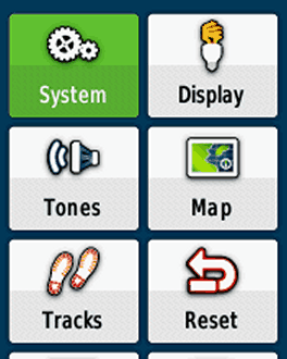
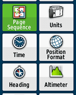
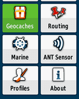
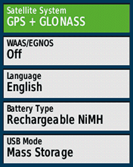
Satellite System
Choose "GPS + GLONASS", "GPS" for a better battery life.
WAAS/EGNOS
For outdoor activities you usually do not need WAAS/EGNOS signal corrections (WAAS is only available in North America, EGNOS in Europe). WAAS/EGNOS can provide a better accuracy in certain situations and is recommended for pilots and mariners.
BUT: Activate it, if your preference is "Enable all and hope the best!" (= GPS / GLONASS / WAAS / EGNOS).
Battery Type
Your choice Depends on your preferred battery type:
- Alkaline (not recommended)
- Lithium (recommended for cold environments and long run-times), e.g. Energizer AA Ultimate
- NiMH (for daily use)
- Rechargeable NiMH (highly recommended, for daily use): e.g. Panasonic eneloop
USB Mode
"Garmin" is recommended:
- The gps device is supplied with energy when connecting to an external power source (e.g. AC charger).
- Connecting the handheld to a PC you get the screen "USB Cable Detected. Would you like to go to Mass Storage?". "Yes": Activiting the mass storage, you get access to the file system and can copy data or install maps (e.g. with Garmin BaseCamp); "No": Device is powered by the external source. "Mass Storage": Mass storage is activated immediately when connecting to a PC.
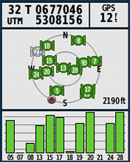
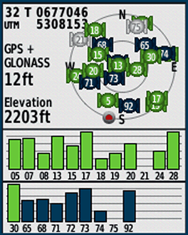
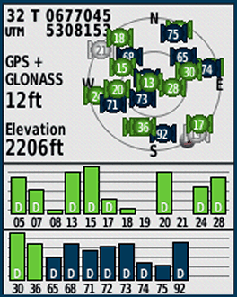
Screenshots (left to right): "Satellite System" and "WAAS/EGNOS" different settings
- GPS (WAAS/EGNOS off) Satellites: 05 – 28 GPS
- GPS & GLONASS (WAAS/EGNOS off) Satellites: 05 – 30 GPS, 65 – 92 GLONASS
- GPS & GLONASS & WAAS/EGNOS Satellites: 05 – 30 GPS, 36 EGNOS, 65 – 92 GLONASS; "D": device receives and calculates EGNOS signal corrections
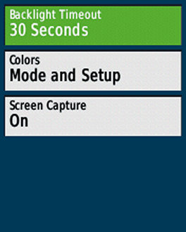
Backlight Timeout
Turns the backlight off after a given time. Choose a timeout as short as possible for battery saving, timeout depends on your activity and profile.
Colors
"Mode": Choose between "Auto, Day, Night":
- Auto: Automatic switch between day / night colors (at sunset/-rise)
- Day: Color as defined in "Day Color Scheme"
- Night: Color as defined in "Night Color Scheme"
Screen Capture
Capturing screenshots, turn "off" except you need it (tip: after a tour you can capture your trip computer for saving the statistics!)(screenshots are saved in the device folder "Garmin\scrn")
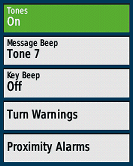
Tones
Recommendation: Tones "On"
Message Beep
Choose one, the message beep keeps you informed e.g. when the battery is low or the gps signal lost.
Key Beep
Annoying, turn "Off" ("off" is at the end of the list)
Turn Warnings
Choose different tones; warnings when navigating with routes from waypoint to waypoint or for autorouting (turn "Early / Final Turn Warning" off when you do not need it)
Proximity Alarms
Different options, e.g. when approaching a POI (turn "Proximity / Speed / Tones / Alarms" off when not in use!)(highly sophisticated topic, have a look Garmin warnings and alarms, in German)
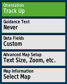
Orientation
Map orientation, depending on your activity (and profile):
- North Up: North is always at the top of the display / page, independent of the device orientation (e.g. recommended for hiking without active navigation).
- Track Up: Direction of travel is always at the top of the page (recommended for active navigation and / or activities like cycling)
- Automotive Mode: Three dimensional look, direction of travel is always at the top of the page (recommended for automotive use)
Guidance Text
When navigating, a guidance text with usefull informations like "Arriving at …" appears at the top of the map (not when using "Routing > Activity > Direct Routing"). "Always" should be avoided, because the text "Ready to Navigate" covers the map, even without active navigation. Best choices are "When Navigating" or "Never", depending on you activity or profile.
Data Fields
Choose between different informations (data fields, graphics) on top of the map. Depending on your activity and preferences, e.g. "Dashboard > Geocaching" for geocaching. Our preference is "Custom": "When Navigating > 4 small", "When Not Navigating > 0" (while navigating you have four data fields as an overlay; when not navigating the map is completely visible).
Advanced Map Setup
- Auto Zoom: Turn off (except for car driving)
- Zoom Levels: Use "Auto"
- Text Size: Use "Small" or "Medium", "Large" is usually too much.
- Detail: "Normal" map detail level is usually enough
- Shaded Relief: The shaded relief provides a better visualization (e.g. hill-shades), but in deep woods the darker map screen can reduce the visibility. For a better readability use "Do not show". When you need the relief choose "Show if Available" or at least "Auto" (shaded relief disappears when zooming in the map).
Map Information
Enable/Disable maps (only one OSM or Garmin vector map for the same country!)
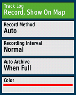
Track Log
- Do Not Record: Recommended setting when you do not need a track log, e.g. automotive profile
- Record, Do Not Show: Starts the track log, but the log is not visible on the map.
- Record, Show On Map: Starts the track log, track is visible on the map. Recommended settings for your outdoor activities (Tip: At the start point, always reset the track and trip data; see next topic).
Record Method
Recommendation: "Auto" (good choice for most outdoor activities), "Distance" is recommended for hiking, "Time" when using the device as a data logger for geotagging.
Recording Interval
Settings for the track log recording interval depending on the "Record Method", the combination "Auto / Normal" is sufficent, for hiking e.g. "Distance / 10 m / 0.01 mi"
Auto Archive
Recommended "When Full"
Color
Track log color on the map, your choice!
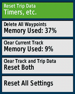
Reset Trip Data
Deleting all data from the current trip, e.g. like "trip odometer, ascent total" (but not the "odometer" = all recorded distance by the device). Should be done before starting a new trip (alternative: “Clear Track and Trip Data” as described below).
Delete All Waypoints
Deletes all waypoints on the device.
Clear Current Track
Clears the actual track (active log). Should be done before starting a new trip (alternative: “Clear Track and Trip Data” as described below).
Clear Track and Trip Data
Resets the trip data AND the track log, should be done at the tour start point (immediately before leaving!).
Reset All Settings
Reset all settings (restores the GPS device to factory default settings).
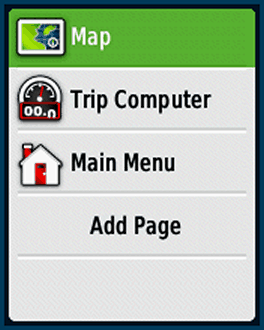
Page Sequence
Defining the page sequence (page order when pressing the "BACK" key on the device). You have two options:
- Press the "MENU" key when you are in the "Page Sequence" menu: You can remove/include all pages or restore the defaults.
- Select one element in the list with the thumb stick: Move / Insert / Remove single items or use the "Add Page" command.
Tip: Keep it simple, remove all pages you do not need!
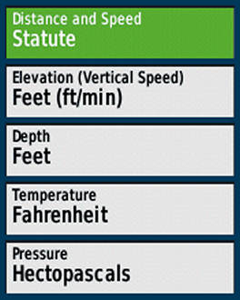
Distance and Speed
Your choice, depending on you region, activity, …
Elevation
Your choice, depending on you region, activity, …
Depth
Your choice, depending on you region, activity, …
Temperature
Your choice, depending on you region, activity, ..
Pressure
Your choice, depending on you region, activity, … (Hectopascals: international unit)
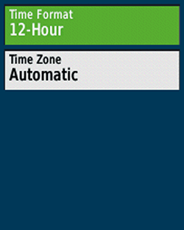
Time Format
Your choice
Time Zone
“Automatic” is recommended.
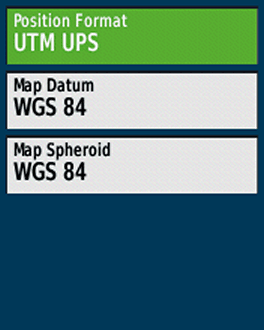
Position Format
Format for coordinates. For geocaching and marine use "hddd°mm.mmm'“, otherwise "UTM UPS“
Map Datum
“WGS 84”, except for working with paper maps (choose the same format as the paper map)
Map Spheroid
“WGS 84”, except for working with paper maps
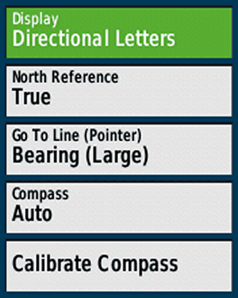
Display
"Directional Letters" or "Numeric Degrees" are the best choices for many outdoor activities ("Mils" for special use cases)
North Reference
Only relevant when navigating with compass and paper map (use the standard "True")
Go To Line
Use "Bearing" (small / large is your choice) as standard, "Course (CDI)" (Course Deviation Indicator) e.g. for sea kayaking
Compass
Use "Auto" ("Off" when you do not need the compass, might save some battery)
Calibrate Compass
Calibrate the compass at the starting point
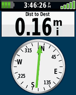
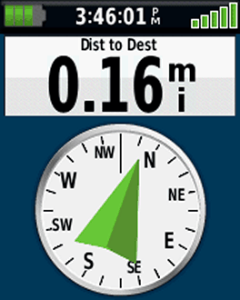
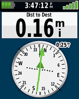
Screenshots (left to right)
- Compass: Bearing small, Directional Letters
- Compass: Bearing large, Directional Letters
- Compass: Course (CDI), Numeric Degrees
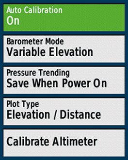
Altimeter Settings (1st screenshot)
Auto Calibration
- On: auto calibration activated
- Off: auto calibration disabled
Recommended altimeter calibration methods for outdoor activities:
- 1st choice: Manually by entering the elevation at your starting point and recalibration on tour (e.g. elevations from mountain tops)(auto calibration "off")
- 2nd choice: Manually by entering the elevation at your starting point, on tour using auto calibration "On"
- 3rd choice: Use only auto calibration "On"
Barometer Mode
"Variable Elevation" as altimeter
Pressure Trending
"Save When Power On" as altimeter on tour
Plot Type
"Elevation / Time" or "Elevation / Distance"
Calibrate Altimeter
Calibrate the altimeter by using one of these data:
- "Correct Elevation" (e.g. from a paper or digital map)
- "Correct Pressure" (e.g. from weather data)
- "Current GPS Altitude" (from your gps device; tip: wait some minutes after power on)
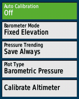
Barometer Settings (2nd screenshot)
Auto Calibration
"Off": auto calibration turned off
Barometer Mode
Use "Fixed Elevation"
Pressure Trending
"Save Always", reads pressure even when the device is turned off
Plot Type
"Barometric Pressure" (use preferably; ambient pressure calibrated to sea level, not compensate for humidity or temperature) or "Ambient Pressure" (sensor reading from the unit)
Calibrate Altimeter
Calibrate the altimeter by using one of these data:
- "Current Elevation" (e.g. from a paper or digital map)
- "Correct Pressure" (e.g. from weather data)
- "Current GPS Altitude" (from your gps device; tip: wait some minutes after power on)
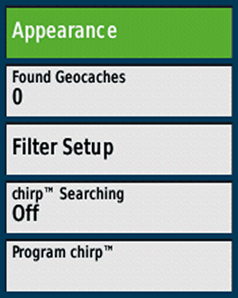
Appearance
- Geocache List: Preferably choose "Show Names" over "Show GC Codes" (e.g. "Welcome to Bavaria" instead of "GC2NJG9")
- Geocache Style: Select "Auto"
Found Geocaches
Number of found geocaches (automatically added, but you can manually edit the number by entering the menu item with the thumbstick)
Filter Setup
Define filters for geocaches, e.g. for traditional geocaches
chirp Searching
Search for a Garmin chirp
Program chirp
Programing a chirp
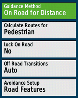
Guidance Method
Choose one method, depending on your activity (e.g. "Off Road" for the last meters to a geocache)
- "Off Road": Straight line from your current position to the destination (e.g. waypoint, geocache) or from point to point (e.g. waypoint to waypoint when navigating along a multipoint route). Direct routing is independent from trails, streets etc. on the map ("over hill and dale").
- "On Road ...": Autorouting (= device automatically calculates a route) to the destination, along trails, streets etc. in the map database (requires a routable map), choose your preferred method.
- "Prompted": After setting the destination you can choose the "Guidance Method".
Calculate Routes for
Selection depends on the activity and your preferences.
Lock On Road
"No", except for activities like road cycling or automobile driving (corrects your visible position to align with the road on the map, the real GPS position is not affected).
Off Road Transitions
"Auto" is normally fine
- "Auto": automatic transition to the next point of a multipoint route
- "Manual": manual transition to the next point of a multipoint route
- "Distance": when you are within the entered distance the device leads you to the next waypoint of a multipoint route
Avoidance Setup
Types of roads you want to avoid when using autorouting.
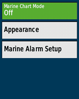
Marine Chart Mode
Depends on the used maps (e.g. Garmin BlueChart) and the activity („Fishing“, „Nautical“)
Appearance
Different map settings (sorry, no experiences!)
Marine Alarm setup
Different marine alarms, e.g. anchor drag alarm
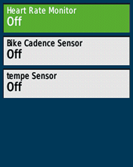
Heart Rate Monitor
"Off", except you want to pair / use a heart rate monitor
Bike Cadence Monitor
"Off", except you need it
Tempe Sensor
"Off", except you need it
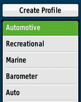
Profiles
Creating / Deleting / Naming / Moving profiles:
- Recommendation: Leave the Garmin default profiles as is and create your own profiles.
- How-to: Activate a default Garmin profile (e.g. "Recreational", function "Profile Change" in the main menu), go to "Setup > Profiles > Create Profile", your new profile has the same settings as the previously activated "Recreational" profile, then you can rename and tweak the new profile as you like.
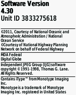
About
Software version, unit ID, licence informations
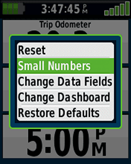
Trip Computer
Start the "Trip Computer" page, press the "MENU" key and customize the trip computer (change the dashboard, style, data fields etc.)
why can my etrex twenty and etrex 22x not measure area? the twenty used to but now it doesn’t and my new 22x doesn’t either
Can’t link my Etrex30 with Garmin Express. Message "Invalid Chart"
Hi, i use etrex30x. In "menu key" normally one time press opens related "page settings", two times press opens "menu page". But i notice recently, when long press on "menu key", opens directly "where to" page. This feature dont written in manual. Do you know any explanation or document like this hidden features.
Hi,
no, there are no other english manuals: maybe this page will help:
https://www.gpsrchive.com/eTrex/eTrex%20x0x/index.htm
Hi there,
Huge thanks for the settings. I just got an Etrex 32X and I tried to save a cycling route on a micro SD card but the unit keeps saving there’s no save tracks. I’m not sure what to do next, any tips will be highly appreciated! Thanks
Hi Adriana,
I guess you want to copy a gpx file to the SD card? You need the same folder structure on the SD, the files belong in the folder garmin/gpx!
Cheers!
My Etrex 30x deletes routes on completion. Is there a way to stop this?
Hi,
when creating a route in the route planner?
You may exceed the limits?
2,000 GPX files
2,000 waypoints
5,000 geocaches
200 routes, 250 points per route
200 saved tracks
2,000 archive tracks
Is the latest software installed?
Otherwise you can try a hard (master) reset
Such a useful site , thank you for you hard work. I have Etrex 30x is it better to use Tracks or Routes for hiking. I have routable maps ( talky toaster} when i set up a route and transfer to Etrex the route becomes "as the crow flies" ie str lines between points I have set for hiking ie non direct and set Etrex for On Road but cannot get route to go as set by basecamp. Track method seems to follow path better but is more work. Am I doing something wrong or missing a setting somehow? Beginning to tear my hair out as should be simple unless i have basic misunderstanding of process. Appreciate any guidance you could offer.
Regards Mark
Hi,
Guidance Method = On Road …
Calculate Routes for = Pedestrian
That’s it!
Are you using the same map in BaseCamp and on the device?
Sometimes it happens that a route appears as straight lines directly after opening it (the eTrex needs some time for calculating); when the GO button appears the route should follow the roads & paths.
how to take accurate and fast waypoints using garmin e trex 30x. I have tried everything but not getting the waypoints accurately with garmin etrex 30x, kindly suggest what can be done to rectify the errors
you can use waypoint averaging (but it is not fast), how ever, do not save a waypoint immediately after starting the eTrex (needs some time to get GPS signals and an accurate position), the device must have an open view to the sky.
That’s it – otherwise get a device like the GPSMAP 66sr or GPSMAP 65s
Garmin eTrex 30x: When I use the device to create a waypoint "on the fly" (i.e. while walking), the device presents a default waypoint identifier, which is a 3-digit number, e.g. 105. It automatically increments this number each time I create a new waypoint. So far so good. When I get back to base I synch it with BaseCamp, file stuff away and clear down the device memory. During this process I generally rename the waypoints, tracks etc. to something meaningful for future reference. Having done this, the waypoint numbers I have just "used up" are now free again for re-use (I have verified this by looking for waypoints on the device itself and by looking at the device memory while it is connected to BaseCamp). However the device continues to allocate new numbers from where it left off last time, so the default "next waypoint" number just keeps getting bigger and bigger and and I can find no way to reset it.
Deleting the default waypoint number and replacing it with a more desirable value while walking requires too much time and concentration. I’m looking for a slicker solution.
I know that the default "next waypoint" number can be decreased somehow because during the life of my current device I have made far, far more than 105 waypoints, and yet the present default "next waypoint" number is just 105 (at time of writing). At some point, something has made it decrease, but I cannot tell what made it do that.
Any suggestions would be much appreciated.
How can I understand the direction of travel following a GPS track?
Thankyou
Hi,
you do not get informations regarding your travel direction (e.g. arrows along the track on the map); but you can use the "pointer" data field.
Hello,
I’ve got a Etrex 30 for several years now with no problems, but since a couple of weeks it gives me an error when trying to calibrate the compass. After a lot of attempts it doesn´t calibrate anymore. Is there anything I can do to solve it?
Hi,
I would suggest to perform a factory reset – otherwise I suspect that the device is defective
Ensure the device is off
Press and hold menu and enter*
Press and release light/power
Wait to see, Do you really want to erase all user data?
Release Menu and Enter
Select Yes
The Device will reboot and then prompt you to select Language required
I have an eTrex 22x for my wife.
When I add geocaches to the SD card under \Garmin\GPX and check the menu item Geocaches it tell me I do not have any that I need to download them.
So I removed all of them from the SD card and installed them via Mapsource. That was a complete waste of time because it only every show one installed each time I transfer a geocache.
If I go to Geocache.com and install one cache via Garmin express. When I remove my 22x from my laptop and start it again it then show one geocache installed.
Now it would take me for ever to install 50+ geocaches that way.
If I go back to just coping the 50+ geocaches to the SD card they are all there under Where To? Waypoints.
Why do I not see them under Geocaches???
I can do the same thing to my old eTrex HCx and they all show under Find Geocache.
Hi,
sounds strange, all GPX files – also with geocaches – belong in the \Garmin\GPX folder (internal memory or SD card). I would start from the beginning: clean up the eTrex, delete all GPX files (waypoints, tracks, geocaches etc.) and copy the geocaches again.
Cheers
I removed all the GPX files.
Then copied just one back to the internal memory \Garmin\GPX
Again no Geocache in the Geocache Menu only in Where To: Waypoints. also on the screen you can see it.
I removed it again this time I went to Geocache.com and downloaded the same geocache.
This time it show up on the Geocache Menu.
So I download the 50+ we are going to use and all are there now.
I still have the first ones I downloaded in a folder on my laptop and they work on the eTrex HCx with no problems at all.
I will have to redo all the geocaches I have download a month ago so they will work on the eTrex 22x.
Have no idea why this problem is there.
I am new to Garmin 30x. I have a Tempe and can display temperature but how can I view max and min for a given time period please?
Hi,
sorry, not possible!
I’ve missed one of the best improvement on this device
an Ausi guy made a user profile K-lite
one of the most usefull fitcher is the double cliick
on menu that send you to what you need- my case "where to"
to upload new track
the screen is only map or data
one Q, why the device turned off when unpluged from PC ?
any way ti change it?
when the etrex is in mass storage mode and you unplug i, its always turned off, you can not change it
I have a new Etrex 22x, when I go to "where to" and try to enter an address "enter state / province" but nothing is recognized; no states or zip codes, "try adjusting parameters". I updated the unit with Garmin and seems to be running all the current maps. Any thoughts? Thanks
Hi,
all preinstalled maps should be active in the map settings – otherwise address search might not be available for your country.
Cheers
When using the 30X calculator, is there a way to do the reverse Scientific Trig functions (ie Arc tan 1.0)? Can’t find any description of the calculator anywhere …
The trig functions need to go both ways to be really useful!
You are probably the first person in the world to ask this 🙂
There is no description as far as I know … you have to try it yourself.
Cheers
Arc Tan 1.0 is 45 degrees. Some other values are easy to remember, too. It’s not a perfect solution, but remembeing some key value pairs then using the tan function with a combination of trial and error and interpolation might help overcome the lack of arc trig functions.
Hello!
Thank you for this website. It is very helpful. I am new to using GPS and and eTrex. I have a lot of questions but will start with these two. 🙂
1. What are the benefits/disadvantages of having all of the different maps? I am planning a back country bicycle trip on dirt roads.
2. When is the Turn data field point useful? I’ve tried to turn it on to see what happens if I go off of my predetermined route. Nothing happens…I continue to get _ _ _ but never a L or R directional. I’d like to know the unit will assist me if I go off my route.
Hi,
how many maps you need is a question of your use case; for a back country bicycle trip might be the velomap (https://openmtbmap.org/velomaporg/) a good choice.
Did you turn on the "turn data field" (guidance text) in the settings? However, you get directions only when navigation with routes and not with tracks; the warnings when going off a route are – in my experience – not reliable; I would not use this feature!
cheers
when i select screenshot mode, how can i adjust screen light ? Because light button turns out screen shot button.
only before / after activating screenshot mode
Lebanon Map
hi, etrex 20,When out hiking is there any way of recording the running mileage on the garmin screen, I only seem to be able to gather the total mileage after downloading the walk onto base camp..
hi, start the trip computer, MENU button, change data fields, select one field, choose "trip odometer" from the list (all mileage for the current track) – or do you want to see the mileage while moving? That’s not possible!
check: https://www8.garmin.com/manuals/webhelp/eTrex_10_20x_30x/EN-US/GUID-0A469EBD-A7AA-4CD0-AE34-FDBEA8588AFB.html
thanks for info you have answered my question..it was seeing the mileage while moving, not possible ..thanks again
I would like to know if the eTrex 20x, purchased in the US, can use Japanese street maps.
Also, please tell me what maps are already included with the eTrex 20x (US version). I cannot find this information anywhere.
Thank you!
I think it can use Japanese street maps, but I do not know if e.g. the address search is working; the 20x has only a worldwide basemap.
Cheers
I want to enter a destination by coordinates but when I try to do so the coordinates already entered on the "Enter Coordinates" screen won’t clear. I can type over them, but unless the new ones have the same number of digits, ie two letters 6 digits, the old ones remain. Also, some coordinates in the uk start with SU or SP and so on. There seems to be no way to enter these? What am I doing wrong? garmin etrex 30x
go with the arrows to the coordinate you want to change and type the new one – works!
cheers
The coordinates in the UK that start with SU, SP etc are for ordinance survey maps, I’m not sure that the Garmin can work with that system so you may need to convert them to normal GPS coordinates.
Dave P is right- the SU, SP etc. are specific to the UK Grid system. Have you tried Settings > Map, then selecting UK Grid? (I think it’s actually called British Grid on the device).
I too am a complete Garmin novice, so greatly appreciate this website. The Etrex 32x has no off switch so far as I can see! Is there any way to turn it off entirely (eg so that everything stops running) apart from removing a battery?
Hi, you must press the lower button on the right side for some seconds…!
Cheers
Hi, I am new to the world of Garmin. I am planning to walk the entire 610 mile route of The Western Front. Starting at Dunkirk and finishing at Pletterhouse on the Swiss, German and French borders. I have been given a Garmin 30x to record my journey. I don’t want to use it to map read but I do want a record of my route to review when I finish the walk. How can I do this please. I am setting of from Dunkirk on 4th August 2019 (in 4 days time)
Hi Alan,
the 30x is a great choice for long distance hiking!
– Every day
before hiking
1: calibrate the altimeter: setup > altimeter > calibrate altimeter
2: start logging: setup > tracks > track log > record > show on map.
3: clear the track log: reset > clear track and trip data.
after your daily hike
1: turn the track log off (= do not record)
2: save the track: track manager > current track > save track.
General settings
1: as recording method & interval you can choose auto /normal or distance / 0,01 km = every 10 m.
2: activate auto archiving: setup > tracks > auto archive > when full
3: altimeter settings as in the description above
Have fun!
I have the etrex 30x. I have turned off the proximity alarms, but how do I turn off the arrival alarm?
Hello, can you test folllowing issue may have your device to?
I have issue with trip computer, i walked some minute without stopped in deep forest then my etrex trip computer said i stopped little bit, gps signal if very strong.
Hi. I just got mine and don’t know much about it. I tested the trip computer outside and whenever I stopped for 3 seconds, the "stopped time" would begin counting. Then I walked around inside a brick building. The "stopped time" began counting again even when I was walking . I always had good GPS signal.
Maybe its just the deep forest?
I am face to face that issue just deep forest, i tested again in city today, under the bridge, under the one of big tree i facing that issue.
What is your firmware version?
Hi, turn the "message beep" off! Cheers
Hello, i have etrex 30x latest firmware v3.0
I have issue with trip computer, i walked 60 minute without stopped in deep forest then my etrex trip computer displayed 58 minute for stopped time, gps signal if very strong.
What is problem? Am i tweak something on my device?
You walked too slow 🙂
The eTrex recognizes speed below (approximately) 2,5 km/h as "stopped" (only devices like the Oregon allow to turn this auto pause feature off)
Cheers!
Hello, I am not i am sure 🙂
I walked about beetween 4 km/h or 5 km/h.
Hi,
that`s the only explanation I know; the eTrex has some kind of algorithm to count a "slow speed" as stopped.
I have noticed something like this, too. The eTrex Trip computer overstates the amount of stopped time. When walking I normally do about 5.5 Kph and I don’t stop except for gates, stiles and calls of nature, so my actual stoppage time is a very small proportion of my elapsed time. One thing I have noticed is that when I synch the track to BaseCamp, the stats displayed on the BaseCamp track are much more like what I would expect, and in particular, the stopped time and moving averages are much more like what I’d expect. Not ideal if you really need accurate numbers as you go along, but maybe better than nothing.
Hello,
Very detailed informations.
How can i mark my camp area before long trip in deep forest, then i wanna go back to my camp area.
thanks
Hi,
when you are at the camp press the thumbstick for a while and create a new waypoint, later you can select this waypoint a destination. Otherwise move the Cursor with the stick on the map to the camp, press the stick, choose one item from the list and save it as a waypoint.
I hope this helps!
Great, thanks.
Hi,
I just purchased an etrex32x and Blue Chart g3 covering Australia and New Zealand.
I tried it by driving to a bridge. I was alright seeing the street maps . Then I changed to the Marine map to make sure it shows the depth and countour of the river which it did. Then walking back to my car and about to drive I check on the etrex32x. It doesn’t show street mad any longer.
Y th he reason I bought this item is to paddle alone in the water. Please let me know it the item only recognises one map at a time. Thanks
Hi,
no, the eTrex recognizes several maps at one time, you can enable these maps in the settings; but the maps have a draw order: a map with a high order covers a map with a low order. BlueChart are higher than Topo maps!
I would recommend to use profiles: enable the Blue Chart map in the Marine profile and the preinstalled map e.g. in the Automotive profile. Configure each profile as you need it. Switch between these profiles when paddling and driving.
Thank you so much for putting this together! I was wondering if you might know if turning track recording off conserves battery life?
Cheers!
Hi,
no, I don’t think that turning track recording off saves battery as the GPS chip is still refreshing the position (only ultratrac mode would help = GPSMAP 66s/66st, fenix 5 …).
cheers
If i test it then i will wrote.
How to set Garmin 30x to show co-ordinates to identify the position of a survey stake ?
Do you know if there is a way to make roads darker and/or bolder when looking at the map?
Hi, no, not on the device, may be you find some OSM maps providing this look https://www.navigation-professionell.de/en/free-maps-garmin-gps/
cheers!
Joachim, I had given up hope of finding useful online advice, presented in a clear and systematic manner . . . until I found this site. I heartily congratulate you for your clear thinking and your interest in assisting users of these devices.
Hi John,
thanks for your reply, I appreciate it. Feel free to ask if you have questions!
Cheers
What a wonderful resource! Thank you so much for making it available and maintaining it. I just started using an eTrex 30x, I had an eTrex Vista HCx before (but it recently got broken). On the HCx I had a time of day datafield in the Trip Computer that showed hours, minutes AND SECONDS which is important for my use. On the 30x, seconds are basically shown nowhere. The only option I could find is to add a large data field to the map. But that data field takes 1/3 of the screen! Is there any other place where I can display (or set it to display) the current time INCLUDING THE SECONDS? Thank you!
Hi, e.g. in the trip computer; open this application, press the MENU button, choose "change data fields", select one, click with the thumb stick and select "time of day" for one field.
Cheers!
Thank you but I tried that already. It displays hours and minutes but not seconds.
quite interesting, I have no eTrex 30X but a eTrex 30, it displays the seconds, see https://www.navigation-professionell.de/wp-content/uploads/2019/04/etrex-30-time.png
May be Garmin changed it!
It is indeed different on my unit. You seem to have Big Numbers enabled, in which case the top field is wide enough to display also seconds. (Maybe it also works when Small Numbers is on.) If I enable Big Numbers on the 30x, there are two Big Number fields at the bottom of the page, like in your image. The top row remains split in two fields. Each one of these four may be set to Time of Day, but displays only hh:mm. I also notice from the screenshot on this page that most pages have a battery indicator, Time of Day including seconds, and Satellite reception strenght. How useful! My 30x displays at the top of the Trip Computer page "Sunrise in 7h 9 min", with a quite large image of a rising sun. Blingbling that I don’t need. If only this was a changeable data field, but it isn’t.
Thanks again for trying to help me. My question remains if there is any way on the 30x (except on the Map page as described) to display current time including seconds. I guess there isn’t. 🙁
Just to clarify, by "from the screenshot on this page", I mean: "from the screenshots higher up on this webpage"
Etrex 30X. Software Version 3.00.
In COMPASS or TRIP COMPUTER page: Press the MENU button and select "Change Dashboard" then "Large Data Fields".
You will now have battery indicator, Time of Day including seconds, and Satellite reception strength on top of the pages.
Hi. When zooming-in to obtain more map detail while navigating the current position and track/route often disappear from the active screen. Is it possible to always centre on current location when changing the zoom?
Hi, you can center the map by pressing the BACK-button. Cheers
Hi Etrex 20x
How can I measure distance between 2 waypoints in feet?
I have UNITS …distance and speed = Statutebut I still get distance in "miles" like 0.2 and 0.4 mi.
I prefer distance this small to be in feet.
thanks tom
Hi, checked it with an eTrex 30; setting = statute; when the distance to a point is about 500ft you get e.g. in the data field "distance to destination" feet, when the distance is > 520 ft you get miles.
cheers
A similar thing happens in BaseCamp, whether you use imperial or metric. The distance along a track is shown in Metres until it reaches 1000m, at which point it is shown in Km, but only to 1 decimal place. So as soon as you reach 1Km, you lose 2 dp of accuracy. The only solution I know of is to look at the route in smaller chunks e.g. to make an intermediate waypoint such that none of the distances between waypoints is as long as 1Km, then add them up by hand.
Hi
How to customize recording of waypoints in ascending order like A1,A2,.. using garmin etrex 20x rather than the numbers.
thank you
i have my Garmin 30x i have used it for 8 months but recently it just showing battery low no matter how i replace the batteries
is there any solution for this?
I guess you did not setup the correct battery type in the system settings – so it does not show the real charging status
Good info here thank you. How do I get the etrex 20x to display a stand alone elevation profile page of the route I am navigating? In my edge 800 I can easily swipe from the current active route/map page to a full page elevation profile of that route on the next page so i can see the hills approaching as I ride my bike. How do I get the etrex set up the same way please? Thanks.
Hi, as I remember this feature is only provided by the 30x, not by the 20x.
Cheers
Very useful piece of material.
Ditched my etrex 20 when buttons disintegrated and bought Etrex 30x. Now have a 3 axis compass. So much easier to Geocache. Used this site to set it all up and reference for future tweaking. Thanks for the effort to create this site. Maybe Garmin should recommend it as much better than manual, IMHO.
Many thanks for your comment!
I’ve had my Etrex 20 for several years & use it primarily for geocaching. When out with friends caching I often find my device takes much longer to settle down, is definitely NOT as accurate to getting to ground zero as my one friend who uses a Magellan & another who uses an older Garmin gps map series-the ones with the antenna sticking up. I’ve been told that the Garmin all use the same software & should be same accuracy, yet when they get to GZ I’m still several feet &/or yards away. Is there any way to either set up my GPS for greater accuracy or ???? Thanks.
Hi, you can try it with GLONASS (if deactivated) and hold the device horizontally for best satellite reception – that’s all you can do!
Cheers!
This is a most helpful website!
Thank’s for your comment and a happy new year!
We go to Europe , How. to program my Etrex 20 ?
Hi, nothing special, may be the units and the time format – that’s it
Cheers
Wow, clear and concise. Great page.
Thank you very much for the detailed instructions. I just bought an etrex 20, and I’ll certainly use your site for reference.
BTW, just for the fun of it, I used the coordinated shown in the photos to locate your home in Muensing in Google Earth. Nice garden you have there! 🙂