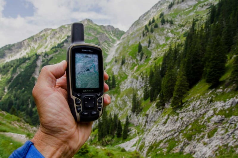
- VORINSTALLIERTE EUROPAKARTE: Für die perfekte Navigation beim Wandern, Bergsteigen oder auch Geocachen sorgt die vorinstallierte topographische Karte TopoActive Europa. Mit dieser routingfähigen Karte finden Sie mit Adresseingabe oder auch POIs Ihr Ziel.
- BEHALTEN SIE DIE ORIENTIERUNG: Neben den gängigen Satellitensystemen GPS, GLONASS und Galileo sind auch QZSS und IRNSS verfügbar. Zusammen mit der Multi-Frequenz-Technologie erhältst du so überall und jederzeit den besten Satellitenempfang.
- SUPER ABLESBAR UND WASSERDICHT: Das transflektive 2,6“ Farbdisplay ist auch bei Sonnenlicht sehr gut ablesbar. Dank Tastenbedienung können Sie das Gerät auch mit Handschuhen und unter allen Bedingungen bedienen. Wasserdicht nach IPX 7 Standard.
- BAROMETER UND 3-ACHSEN-KOMPASS: Der GPSMAP 65s ist zusätzlich mit einem barometrischen Höhenmesser und einem 3-Achsen-Kompass ausgestattet. Der Barometer gibt noch präzisere Höhendaten aus und der 3-Achsen-Kompass sorgt für die ideale Orientierung.
- PERFEKT VERNETZT: ANT+ und Bluetooth-Kompatibilität machen es möglich. Verbinden Sie bspw. Geschwindigkeits- oder Herzfrequenzsensoren mit Ihrem GPSMAP. Mit dem Smartphone gekoppelt erhalten Sie Telefonbenachrichtigungen direkt aufs Display.
- 16 Stunden Akkulaufzeit: Der GPSMAP 65 kann mit AA-Batterien sowie dem Garmin Akku Pack betrieben werden (beides separat erhältlich). Mit diesem dualen System sind Sie immer flexibel und können nach dem Batteriewechsel sofort wieder loslegen.
- GARMIN EXPLORE APP: Nutzen Sie die Garmin Explore App oder das Explore Portal, um Ihre Tour auf dem Smartphone oder am PC zu planen, Wegpunkte zu erstellen oder Ihre Tour im Nachhinein nochmal anzusehen.
In this review we take a closer look at the Garmin GPSMAP 64sx outdoor GPS handheld! The GPSMAP 64sx was launched together with the GPSMAP 64x in summer 2019. A surprise for us, since 2018 already saw the introduction of the GPSMAP 66 series – handheld devices that could have been considered as the successor to the 64!
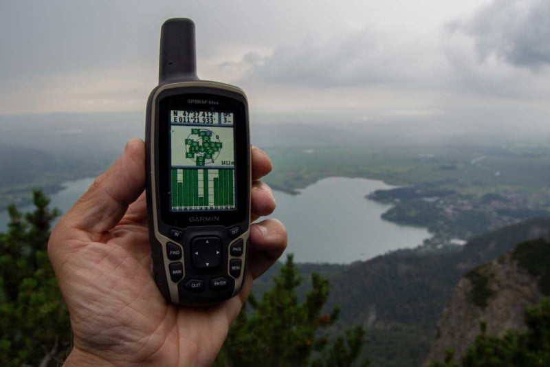
We are happy that the GPSMAP 64 devices are still alive – they are among the most popular GPS devices on the market and have been inspiring GPS-savvy outdoor enthusiasts for many years! Furthermore, compared to the GPSMAP 66s, the GPSMAP 64sx has its advantages:
• A handier housing
• Connection for an external GPS antenna
• Exit battery save mode with each key
• No mix of GPX tracks and FIT activities
The GPSMAP 66s scores with a larger high-resolution display, comprehensive connectivity and an immense mix of features!
Which new features has Garmin added to the GPSMAP 64sx?
Compared to its direct predecessor – the GPSMAP 64s – the GPSMAP 64sx offers in addition:
• Small cosmetic changes in the setup (menus: Tracks, Reset)
• More internal memory: 8 GB vs. 4 GB (7.7 GB vs. 3.2 GB available).
• EPO download: file EPO.BIN (Extended Prediction Orbit) for faster position acquisition.
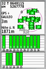
• GNSS: In addition to GPS and GLONASS, GALILEO is now also available; so you have the options:
- GPS
- GPS + GLONASS
- GPS + GALILEO
WAAS/EGNOS can be activated as usual.
However, further technological innovations from our wish list are missing, e.g. a modern USB connection (Micro-USB or USB-C instead of the built-in Mini-B). One reason for this could be a differentiation from the GPSMAP 66 series.
But what’s really a pity: With probably little effort Garmin could have added some improvements to the menu, e.g. functions to browse and sort the tracks in the track manager.
GPSMAP 64sx Review – GPS Receiver
All Garmin GPSMAP handsets with the typical Quad Helix antenna set the standard for GPS reception. This also applies to the GPSMAP 64sx, whose reception performance can be further increased by using an external GPS antenna.
When synchronizing with the Garmin Connect App – which requires a smartphone connected via Bluetooth – the file "EPO.BIN" with current satellite data (A-GPS, assisted GPS procedure) is transferred to the 64sx. According to the Garmin support pages, such data is valid for up to 14 days; regular synchronization is therefore advisable. For comparison, the GPSMAP 64s has a HotFix* satellite prediction, so it doesn’t need an external file.
But our GPSMAP 64sx test copy always needs – for whatever reason – much longer than the 64s to determine its position after switching on: For example 03:30 mm:ss vs. 00:26 mm:ss! However, other users do not report this problem.
The situation is different with track recordings, which are typically very accurate.
*: HotFix satellite prediction technology is a feature available on automotive devices to decrease satellite acquisition time dramatically. By using data collected over the period of a few days of regular use, the device will predict the position of the satellites for up to 3 days. If the GPS device has not been used for a few days it will acquire the satellites normally. (Source: Garmin Support)
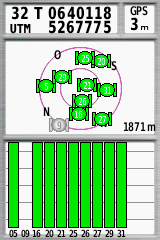
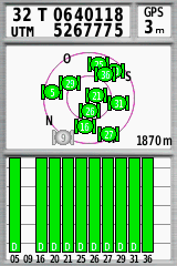
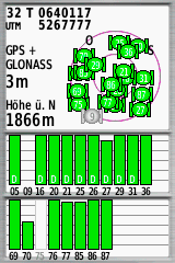
GNSS settings (left to right):
- GPS
- GPS + EGNOS
- GPS + GLONASS + EGNOS
- GPS + GALILEO + EGNOS
GPSMAP 64sx Review – Battery Life
Garmin specifies 16 hours as battery life. We have tested the 64sx with eneloop batteries. In our standard modes we get the following times (in hh:mm):
Energy saving mode (all consumers off, e.g. display backlight, GPS only)
• 20:40*
• 20:30*
• 22:45**
• 21:25**
Power mode (all consumers on)
• 10:45*
• 13:00**
• 12:55**
(* "white" eneloop batteries; ** "black" eneloop pro batteries)
Depending on the use case, the times you can expect are between these values. The 16 hours given by Garmin are therefore very realistic.
The GPSMAP 64sx can also be used with the Garmin NiMH battery pack, which is rechargeable in the device but is quite expensive and the charging process takes some time. Other rechargeable batteries can also be used. It is sufficient to place a small piece of hard plastic on the switch in the battery compartment.
GPSMAP 64sx – Display
Short version: The 2.6-inch display is easy to read under all light conditions.
Resolution in comparison to other current Garmin handheld devices:
• GPSMAP 64sx: 1,940 pixels/cm² (3.6 x 5.5 cm, 160 x 240 pixels)
• GPSMAP 66s: 4,010 pixels/cm² (3.8 x 6.3 cm, 240 x 400 pixels)
• eTrex 32x: 4,987 pixels/cm² (3.5 x 4.4 cm, 240 x 320 pixels)
• Oregon 700: 4,010 pixels/cm² (3.8 x 6.3 cm, 240 x 400 pixels)
• eTrex Touch: 1,940 pixels/cm² (3.6 x 5.5 cm, 160 x 240 pixels)
In terms of resolution, the GPSMAP 64sx is at the lower end of the scale. The difference – e.g. between the GPSMAP 64sx and the GPSMAP 66s – can only be seen in a direct comparison. The lower resolution is not so essential for outdoor practice. The display size is more important, the 21% more surface area of the 66 is very helpful when viewing the map.
GPSMAP 64sx – Interfaces
You get:
• Highspeed USB (type Mini-B) for data exchange and power supply.
• ANT+ to connect to a heart rate, speed, cadence, combined speed/cadence, temperature sensor, Garmin chirp or VIRB action camera and to exchange data with compatible Garmin devices (transfer waypoints, routes, tracks & geocaches).
• Bluetooth for transferring photos and custom maps from device to device (analogous to ANT+) or connecting to a smartphone (functions: live tracking, smartphone notifications, EPO download).
A more feature-rich Bluetooth interface would be great, at least for downloading GPX files from a smartphone. Android users can do this via USB and OTG.
Great news – the GPSMAP 64sx is now compatible to the Garmin Explore app!
GPSMAP 64sx Review – Handling & Operation
The Garmin GPSMAP 64sx is easy to hold thanks to its slightly tapered housing. One hand operation is possible without any problems, the same applies to the use with (thinner) gloves – the GPSMAP 64sx is like the GPSMAP 66s a GPS device for winter use.
Exiting the helpful battery save mode is possible with any key. This gives the 64er a clear practical advantage over the 66er, where this is only possible with the on/off button.
As with all Garmin GPS handhelds, there are several pre-configured profiles for different outdoor activities to choose from. The 64sx can be expanded with additional individual profiles and at the same time personalised to a high degree.
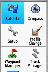
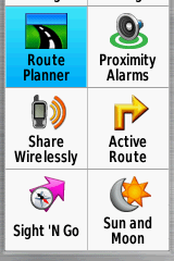
The two screenshots on the right display our main menu for a "Hiking" profile: 12 applications, plus a map, travel computer and elevation profile page – that’s all!
GPSMAP 64sx – Functionality
The Garmin GPSMAP 64sx offers the "classic" functionality of Garmin handheld devices that has been proven over many years. This includes navigating with tracks, routes, waypoints, POIs and geocaches, but also the many small goodies such as proximity alarms, barometer, calendar and alarm clock – to name just a few.
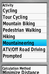
Auto-Routing is based on Garmin’s ActiveRouting technology (figure top right). Depending on the activity (mountain biking, hiking, …) and the map, the route and the distance calculated by the device can vary.
Navigating with tracks is, as usual with Garmin, quite minimalistic – you simply have to follow the magenta-colored route on the map! Routing to the starting point of a track is only possible with some tricks, nor is there any warning when deviating from the track – other devices offer more (e.g. from TwoNav).
Various functions are available for special tasks, e.g. waypoint projection, Man Overboard (MOB), Sight 'n Go and compass (CDI). Geocachers can also enjoy paperless geocaching.
To sum up: The GPSMAP 64sx can handle any task! However, mastering all navigation functions requires some training and practice.
GPSMAP 64sx In-Depth Review – Maps & Accessories
The Garmin GPSMAP 64sx only comes with a pre-installed base map. This is surprising as even the eTrex 32x has Garmin’s TopoActive map installed (an OSM based map of Europe). However, there is enough storage space – almost 8 GB internal and an optional MicroSD card (up to 32 GB) – for additional maps. This can be free OSM maps, one of the many commercial Garmin maps, BirdsEye satellite images, custom maps, nautical maps or others.
The scope of delivery is minimalistic. There is only one USB cable in the sales package. At least one carabiner clip (*) for attaching to the backpack could be included. This practical and recommendable holder costs another $25.-, a simple handlebar holder for bicycles (*) costs $9.-. The predecessor also had a yearly subscription for BirdsEye satellite images on top.
(* affiliate link)
- VORINSTALLIERTE EUROPAKARTE: Für die perfekte Navigation beim Wandern, Bergsteigen oder auch Geocachen sorgt die vorinstallierte topographische Karte TopoActive Europa. Mit dieser routingfähigen Karte finden Sie mit Adresseingabe oder auch POIs Ihr Ziel.
- BEHALTEN SIE DIE ORIENTIERUNG: Neben den gängigen Satellitensystemen GPS, GLONASS und Galileo sind auch QZSS und IRNSS verfügbar. Zusammen mit der Multi-Frequenz-Technologie erhältst du so überall und jederzeit den besten Satellitenempfang.
- SUPER ABLESBAR UND WASSERDICHT: Das transflektive 2,6“ Farbdisplay ist auch bei Sonnenlicht sehr gut ablesbar. Dank Tastenbedienung können Sie das Gerät auch mit Handschuhen und unter allen Bedingungen bedienen. Wasserdicht nach IPX 7 Standard.
- BAROMETER UND 3-ACHSEN-KOMPASS: Der GPSMAP 65s ist zusätzlich mit einem barometrischen Höhenmesser und einem 3-Achsen-Kompass ausgestattet. Der Barometer gibt noch präzisere Höhendaten aus und der 3-Achsen-Kompass sorgt für die ideale Orientierung.
- PERFEKT VERNETZT: ANT+ und Bluetooth-Kompatibilität machen es möglich. Verbinden Sie bspw. Geschwindigkeits- oder Herzfrequenzsensoren mit Ihrem GPSMAP. Mit dem Smartphone gekoppelt erhalten Sie Telefonbenachrichtigungen direkt aufs Display.
- 16 Stunden Akkulaufzeit: Der GPSMAP 65 kann mit AA-Batterien sowie dem Garmin Akku Pack betrieben werden (beides separat erhältlich). Mit diesem dualen System sind Sie immer flexibel und können nach dem Batteriewechsel sofort wieder loslegen.
- GARMIN EXPLORE APP: Nutzen Sie die Garmin Explore App oder das Explore Portal, um Ihre Tour auf dem Smartphone oder am PC zu planen, Wegpunkte zu erstellen oder Ihre Tour im Nachhinein nochmal anzusehen.
Garmin GPSMAP 64sx Review – Summary
With the successor of the GPSMAP 64s, you get a rugged GPS handheld that does credit to the proven GPSMAP 64 series. The GPSMAP 64sx has all the features of the last generation, enhanced with a few fine details. The GPSMAP is still suitable for any outdoor activity – we would prefer the new eTrex 32x only for weight-optimized tours.
If you can not decide between the GPSMAP 64sx and the GPSMAP 66s, you can make your decision based on the following suggestions: Do I need the additional functionality of the 66er? Is a larger display important for me? Do I accept the slightly more bigger case of the 66? Whatever you decide, you can’t really do anything wrong!
GPSMAP 64sx – Pros
- Reliable
- Accurate track recordings
- Operation with gloves
- All navigation features
- Huge rang of maps (Garmin, OSM, …)
- Wireless data exchange via bluetooth & Explore app
GPSMAP 64sx – Cons
- No separate coverage of USB / antenna socket
- Outdated USB interface
GPSMAP 64sx – Rating
- GPS: 80%
- Battery: 80%
- Display: 80%
- Handling: 80%
- Navigation: 80%
- Features: 80%
- Maps: 100%
- Final Score: 80%
- VORINSTALLIERTE EUROPAKARTE: Für die perfekte Navigation beim Wandern, Bergsteigen oder auch Geocachen sorgt die vorinstallierte topographische Karte TopoActive Europa. Mit dieser routingfähigen Karte finden Sie mit Adresseingabe oder auch POIs Ihr Ziel.
- BEHALTEN SIE DIE ORIENTIERUNG: Neben den gängigen Satellitensystemen GPS, GLONASS und Galileo sind auch QZSS und IRNSS verfügbar. Zusammen mit der Multi-Frequenz-Technologie erhältst du so überall und jederzeit den besten Satellitenempfang.
- SUPER ABLESBAR UND WASSERDICHT: Das transflektive 2,6“ Farbdisplay ist auch bei Sonnenlicht sehr gut ablesbar. Dank Tastenbedienung können Sie das Gerät auch mit Handschuhen und unter allen Bedingungen bedienen. Wasserdicht nach IPX 7 Standard.
- BAROMETER UND 3-ACHSEN-KOMPASS: Der GPSMAP 65s ist zusätzlich mit einem barometrischen Höhenmesser und einem 3-Achsen-Kompass ausgestattet. Der Barometer gibt noch präzisere Höhendaten aus und der 3-Achsen-Kompass sorgt für die ideale Orientierung.
- PERFEKT VERNETZT: ANT+ und Bluetooth-Kompatibilität machen es möglich. Verbinden Sie bspw. Geschwindigkeits- oder Herzfrequenzsensoren mit Ihrem GPSMAP. Mit dem Smartphone gekoppelt erhalten Sie Telefonbenachrichtigungen direkt aufs Display.
- 16 Stunden Akkulaufzeit: Der GPSMAP 65 kann mit AA-Batterien sowie dem Garmin Akku Pack betrieben werden (beides separat erhältlich). Mit diesem dualen System sind Sie immer flexibel und können nach dem Batteriewechsel sofort wieder loslegen.
- GARMIN EXPLORE APP: Nutzen Sie die Garmin Explore App oder das Explore Portal, um Ihre Tour auf dem Smartphone oder am PC zu planen, Wegpunkte zu erstellen oder Ihre Tour im Nachhinein nochmal anzusehen.

I want to use the GPS both for automotive routing as well as hiking when I travel—heading to Sicily this Summer. Will it give me turn by turn functionality like a car GPS if I download Garmin’s expensive roadmaps?
yes, you can, but it is only a help and does not replace a real car navigation system
I have a garmin 76s downloaded with pacific coast contour maps from Washington State to northern Vancouver island. Can thr Garmin 64sxMap be downloaded, or is the contour map already installed?
Thanks Dale
Hi,
no, for my region there are no contour maps, I guess you have to install it yourself; check:
https://www.navigation-professionell.de/en/how-to-install-contour-lines-garmin-edge/
I’m new to the GPS world. We hunt all over. I want to set a home base and then set out on foot all day with worry about getting lost. Will the 64 let me set home/camp and then get me back to there easily with worry about getting lost?
yes, that’s one of it’s basic functions!
I see all the talk about hunting but how does this device work for fishing/ice fishing to go back to the same spot that I caught all of those fish last week???
Hi,
you can mark your spots as waypoints and go back with direct routing (straight line to a spot) in combination with CDI (you can see your deviation caused by wind and currents on the map screen).
Bought the 64 sx. Any Canadian user that help me get started ? I key in British Columbia in the address field when asked, it does not even recognise it! Or I have to buy and download a gps map before anything else?
Can I get the xhunt chip for New York for the 64sx
yes, the 64sx is compatible, check: https://onxmapssupport.zendesk.com/hc/en-us/articles/115002921008-Is-my-GPS-compatible-with-the-Hunt-Chip-
Mark check out Backroad GPS Maps . They will have superior mapping of all Canadian Provinces. Garmin does a good job covering USA but does little in Canada.
If you compare the GPSMAP 66 with the GSPMAP 64 on screen size don’t forget te mention with the 66 it is only possible to have 4 small data fields and not 2 like the 64. This means effective the size of the usable screen is much smaller than the 64 that is the reason to stick to the 64 in stead of the 66
Can my gpsmap 64sx tell me how far I have gone. I use it when trail riding my horse and I haven’t figured out how to find our distance traveled. Thank you Glenn’s
Hi Glenn,
yes,
1: Start the track lore before riding (and stop it after your ride):
Setup > Tracks > Track log > Record show on map
2: Reset the trip computer
Setup > Reset > Clear track and trip data
3: When riding you can check your distance on the trip computer
data fields: https://www8.garmin.com/manuals/webhelp/gpsmap64/EN-US/GUID-37A0AE2A-98CD-4463-ADB9-13749D79B09F.html
4: After your ride disable the track log in the setup
in addition: https://www.navigation-professionell.de/en/garmin-gpsmap-64-series-setup/
Cheers
……………….. they dont know what kind of hotfix system uses their own units. will keep you posted about how is it gonna be fixed.Martin
Hi Martin,
please to not post any discussion with the support team, especially with it’s name written – this is not fair to him (support is a tough job).
Thanks!
Dear Joachim Bardua : I did not know about it . So Sorry . Thnak for your comment
Hello : This is my second opinion about 64SX and now , thanks to the Garmin Useless support team , I´m agree with you that 64SX needs 3.20 min to take fix and 64s 27 seconds .
They don´t even answered my questions about when this will be fixed . Just in case that may help , if you turn on 64SX and set to auto-locate , it will takes position very fast (not like 64s did) but much more better than the normal way on 64SX . EPO.bin is not even the shadow of what hotfix was . Connecting to Garmin app does not solves it at all . I´m working on a test to plant a fix manually on the unit . As soon as Iget this , will be shared . I will like to tell you again for your great review . Thanks Martin
Hi,
thanks for your comments, I’m curious about your fix (because I no longer use the 64sx …).
Chhers
Very good! Thank you for the review. If I were to use it in the woods, forest canopy like the Amazon, which one would give me a better signal? eTrex 32x or GPSMAP 64sx?
Hi, I have no experience in environments like the Amazon, but as helix antenna (GPSMAP) is more sensitive to multi-pathing (e.g. signal reflections by leaves, especially when wet) compared to a patch antenna (eTrex).
However, I would use the GPSMAP 64sx and – when necessary – add a external patch antenna (e.g. a Tallysman dual-feed antenna).
Cheers
Regarding the antenna, you can check: https://www.u-blox.com/sites/default/files/products/documents/GNSS-Antennas_AppNote_%28UBX-15030289%29.pdf
chapter 4.1
The answer to your question is ABSOLUTELY YES !! Quad helix antenna gives you a four faces antenna , when one face can not see the sky , other faces does it .
Built in patch antenna (like Etrex , Oregon etc ) only has one face .
I had many Garmin units (Etrex,Oregon,Montana) and when i bought a 62s unit , never came back to patch antenna . After 62 i had a 64s and now a 64Sx ,and I uses it in the middle of woods and cannyons in Patagonia Argentina .Deep forest and dense trees . The only advantage on patch antenna is that (generaly) unit with this antenna ofer moch battery run . If you need more help , just let me know it .Martin
You made the best review of this unit !!!
This "When synchronizing with the Garmin Connect App – which requires a smartphone connected via Bluetooth – the file “EPO.BIN” ….
Your review answered me a question that the useless garmin support people never did . I was allways asking why my old 64s had a much faster fix than my new 64sx . thank to your help ,I synced it with smartphone and downloaded the EPO.BIN and now i fix (cold) in 3 or 5 seconds . Your review is magnifficent . If you need any help or test to do with a 64sx unit , please let me know it .Thank you so much Martin
Thanks for your comment – if I need help I’ll come back to you!
Hi,
How exactly you did it? I’ve tried Garmin Connect with an Android phone, tried Garmin Express on a PC … There is a EPO.BIN file in garmin\gps but it does not seem to change. I’ve even renamed it and tried again – no new file, at all!
Hi Boris,
I tried it several times (Garmin Express, Connect App Android), but I do not get a new EPO.BIN file – I guess Garmin changed something!
Cheers
Very good review, this will help me my choice. I like the 66 but it’s very expensive.