Garmin GPSMAP 66s & GPSMAP 66st – Setup guide – our recommended settings for hiking. You can use these settings as a template for your own GPSMAP profiles, e.g. for mountaineering, backcountry skiing, …! Or you download our custom profiles for hiking and barometer.
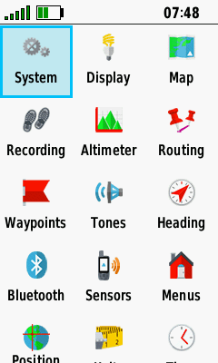
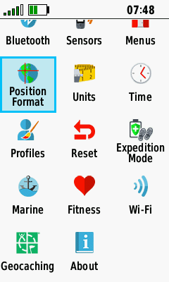
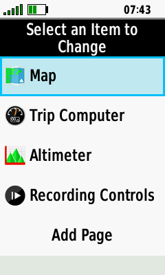
- Customized setup menu (MENU button > Change item order): Most used items at the top
GPSMAP 66s/st Setup – System
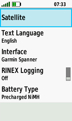
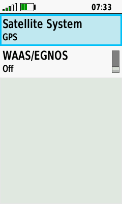
- Satellite System: GPS only (GALILEO or GLONASS when necessary, e.g. in deep sided valleys)
- WAAS/EGNOS: Off
- Schnittstelle: Garmin Spanner
- AA-Batterietyp: Precharged NiMH (e.g. eneloop)
GPSMAP 66s/st Setup – Display
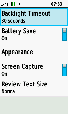
- Backlight Timeout: 30 seconds
- Battery Save: On
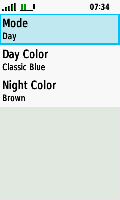
- Appearance – Mode: Day
GPSMAP 66s/st Setup – Bluetooth
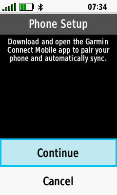
- Bluetooth: Only for data exchange with Garmin Explore, otherwise disabled.
GPSMAP 66s/st Setup – Wi-Fi

- Wi-Fi: Disabled.
GPSMAP 66s/st Setup – Map
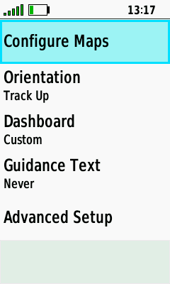
- Orientation: Track Up (sometimes switching to North Up).
- Dashboard: Custom (When Navigating: Small Data Fields; When Not Navigating: None)
- Guidance Text: None
- Advanced Setup: Look at the screenshot

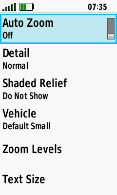
GPSMAP 66s/st Setup – Recording
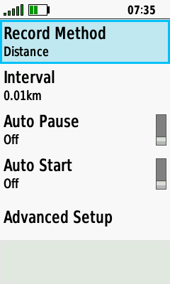
- Record Method: Distance
- Interval: 0.01km (= 10 m)
- Auto Pause: Off
- Auto-Start: Off
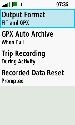
- Advanced Setup: Look at the screenshot
GPSMAP 66s/st Setup – Routing
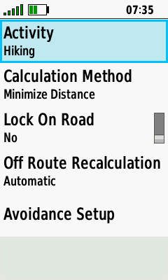
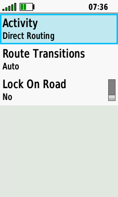
- Activity: Hiking (occasionally using "Direct Routing")
- Calculation Method: Minimize Distance
- Lock On Road: No
GPSMAP 66s/st Setup – Expedition Mode

- Prompted (turning the GPSMAP off, you can enter the expedition mode)
GPSMAP 66s/st Setup – Waypoints
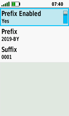
- Prefix Enabled: Yes
- Prefix: e.g. 2019-BY- (BY = Bavaria)
- Suffix: 0001 (new waypoints are named 2019-BY-0001, 2019-BY-0002 …)
GPSMAP 66s/st Setup – Tones
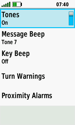
- Tones: On
- Message Beep: On
- Key Beep: Off
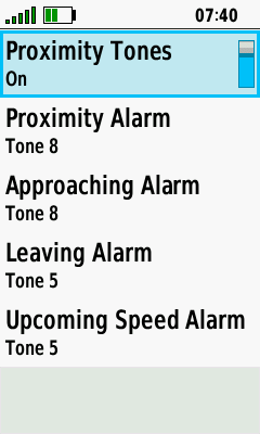
- Turn Warnings / Proximity Alarms: On

GPSMAP 66s/st Setup – Heading
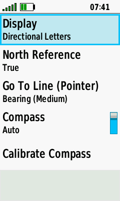
- Display: Directional Letters
- North Reference: True
- Go To Line: Bearing (Medium)
- Compass: Auto on
GPSMAP 66s/st Setup – Altimeter
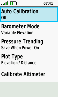
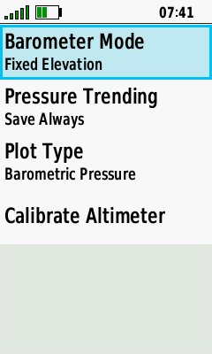
Left screenshot: When hiking
- Auto Calibration: Off (manual calibration by entering the current elevation)
- Barometer Mode: Variable Elevation
- Pressure Trending: Save When Power On
- Plot Type: Elevation / Distance
Right screenshot: GPSMAP as a stationary barometer (a separate profile "barometer" is in use)
GPSMAP 66s/st Setup – Geocaching
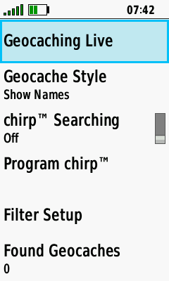
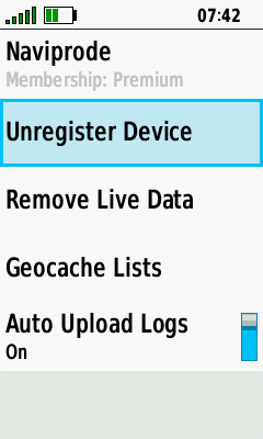
- Geocache Live: Right screenshot
- Geocache Style: Show Names
GPSMAP 66s/st Setup – Sensors
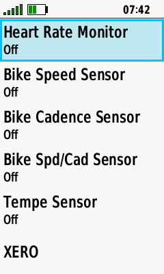
- Sensors: Off (saves battery), except a tempe sensor (occasionally)
GPSMAP 66s/st Setup – Fitness
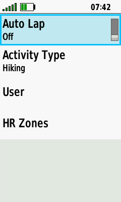
- Auto Lap: Off
- Activity Type: Hiking (for a proper classification in Garmin Connect)
GPSMAP 66s/st Setup – Marine
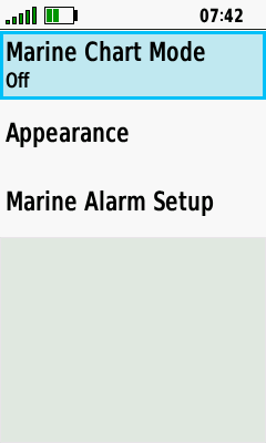
- Sorry, no experiences (all items are turned off)
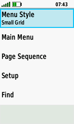
- Menu Style: Small Grid
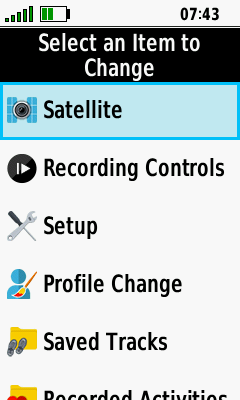
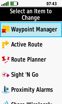
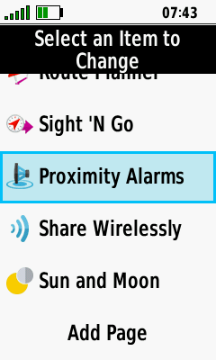
- Main Menu: Customized (order look at the screenshots, 1st row)(main menu is opened by pressing the MENU button twice)
- Page Sequence
- Page Ribbon Display: Off
- Edit Page Sequence: Map / Trip Computer / Altimeter / Recording Controls (look at the screenshots, 2st row)
- Setup / Find: Customized (Setup: look at the screenshots in the first section of this page; Find: Most used items at the top, e.g. tracks, routes, waypoints, use map)

GPSMAP 66s/st Setup – Position Format
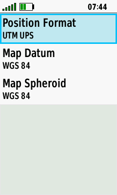
- Position Format: UTM UPS
- Map Datum / Map Spheroid: WGS 84
GPSMAP 66s/st Setup – Units
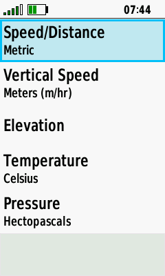
- Units: Look at the screenshot
GPSMAP 66s/st Setup – Time

- Time Format: 24 Hour
- Time Zone: Automatic
GPSMAP 66s/st Setup – Profiles
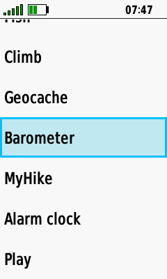
- Custom Profiles: Barometer, MyHike, Alarm clock, Play (for testing)
am using 66s it switches OFF while am still in the middle of say browsing the menu,even if the battery is fully charged,and the time out setting is still far from over.What could be the trouble and its remedy?
I would try other batteries; I would not have any other idea now either
Expedition Mode and Proximity Alarms:
When doing Geocaching I pick the next one to go to then tell it go.
It show where it is and how to get to it.
Then Expedition Mode starts and I have to check when getting close to the cache.
If I leave it in Expedition Mode I do not get any Proximity Alarms.
Is there a way to get Proximity Alarms in Expedition Mode.
Right now I having to keep pressing the power button to resume so I can hear the Proximity Alarms that I an near a cache.
To have to keep pushing the power button so I do not miss a cache is a real pain plus it eats up your battery when you are out all day doing 30 plus caches.
Hi,
I never tried to get proximity alarms in expedition mode – but I guess it’s NOT possible
I can confirm, guess Garmin removed it … for whatever reason
Setup Fitness for the 66s
I do not see Activity Type??
only
Auto Lap (off)
User
HR Zones
I have the latest firmware
All other setting no problem.
A big thanks for you setup of the 66s
Hello Anton,
as I understand, the activity recording can not be deleted (reseted) in the "Recording Controls" (https://www.navigation-professionell.de/wp-content/uploads/2020/01/gpsmap-66-delete-activity.png).
I have never seen this problem, it is working on my GPSMAP 66s (software version 3.40). May be you have an old version (https://www8.garmin.com/support/download_details.jsp?id=14337)?
Have you tried to perform a hard reset? Otherwise it is a bug and we must hope that Garmin is solving it.
Cheers!
Hallo again,
That is exactly the problem. They cannot be reseted, neither in this way, nor by any other way that I try.
Best regards !
Hi,
You . must open the "Recording Controls" application and reset the current activity with "Discard"
Cheers
I found that the following fields have not cleared after deleting the activity: (Ascent Total, Descent Total, Min Elevation, Max Elevation and Calories). So every next track resulting in erroneous data output. How can I reset the data mentioned above ?
Hi,
no, I did not checked this case, so I can not answer your question (and I’m not a fanboy of auto-calibration, it’s always turned off).
Cheers
I am struggling with my 66S – I bought it as a replacement for my 62ST for the bigger display – the fitness features (everything needing to be an "activity") are really irritating me (I have a vivoActive strapped to my arm – I don’t need another fitness device). I tried not starting an activity, that didn’t work for the obvious reason that the receiver then didn’t save a track log at all (after all, "GPX only" isn’t even an option). I was also shocked to find that deleting an activity also deleted the GPX file logged and stored in current.gpx (I thought it would only delete the .FIT file).
For a while I thought I could get away with simply keeping an "activity" going forever (well, presumably a .FIT file would keep growing so I’d have to do a cleanup every now and then – but that would be manageable). What I found, however (and this is really the reason for this post) is that despite having the altimeter set to auto-calibrate on startup, that does NOT seem to happen in the middle of an "activity". I might turn off the device at a (correct) elevation of 20 metres but on restarting it the next morning, find the altimeter reading 100 metres (pressure changes tend to be both rapid and large here in Iceland). My assumption is that the device is simply picking up where it left off – with no auto-calibration. Saving the current activity and starting a new one seems to force a re-calibration. Does this match your observation?
Thank you for this 66st setup information which I used to tweak some of my settings.
May I ask why you do not use Autocalibration of the altimeter? I have read elsewhere (Geocaching Forum) that once you have done a manual calibration at the starting point (the best method) and allowed say 15 minutes, then turn Autocalibration on for the rest of the hike. The time interval is needed so that the Autocalibration uses the newly entered manual elevation and not the previous one. This is claimed to give the best altitude accuracy.
Also, have you found that the 66st always dramatically overestimates the total ascent on the trip computer and in the summary data of the exported GPX track?
I have found that if a single trackpoint is deleted from the GPX file in BaseCamp to force a recalculation of the summary data, the total ascent immediately drops down to a much more realistic figure (but still high compared to manually counting contours). Do you see this behaviour too?
I look forward to your reply.
Thanks again
Hi Mick,
I found that the best results are provided when manual calibrating at the starting point and re-calibrate on tour, e.g. at a mountain hut with known elevation and at a summit; 2nd best method is as you described, but autocalibration depends on GPS accuracy, e.g. in canyons with bad GPS reception the height might differ and this influences the altimeter reading … – that’s the theory, when I’m lazy or do not need exact altimeter readings I prefer you method! Regarding your other questions, I did not checked it, I will keep an eye on it.
See also: https://support.garmin.com/en-US/?faq=WlvNrOungC28xGtwB7hLY5&productID=669284&searchQuery=data&tab=topics&textPage=4
Cheers!