Content
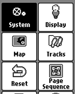
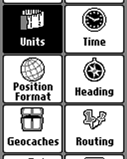
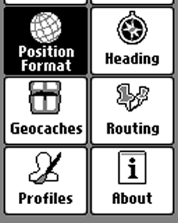
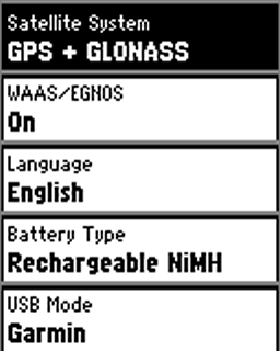
Satellite System
Choose "GPS + GLONASS", "GPS" only to get more battery life.
WAAS/EGNOS
For outdoor activities you usually do not need WAAS/EGNOS signal corrections (WAAS is only available in North America, EGNOS in Europe). WAAS/EGNOS can provide a better accuracy in certain situations and is recommended for pilots and mariners.
BUT: Activate it, if your preference is "Enable all and hope the best!" (= GPS / GLONASS / WAAS / EGNOS).
Language
Your choice!
Battery Type
Depends on your preferred battery type:
- Alkaline (not recommended)
- Lithium (recommended for cold environments and long run-times), e.g. Energizer AA Ultimate
- Rechargeable NiMH (highly recommended, for daily use): e.g. Panasonic Eneloop AA
USB Mode
"Garmin" is recommended:
- The gps device is supplied with energy when connecting to an external power source (e.g. AC charger).
- Connecting the handheld to a PC you get the screen "USB Cable Detected. Would you like to go to Mass Storage?". "Yes": Activiting the mass storage, you get access to the file system and can copy data or install maps (e.g. with Garmin BaseCamp); "No": Device is powered by the external source. "Mass Storage": Mass storage is activated immediately when connecting to a PC.
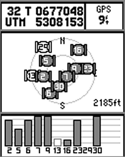
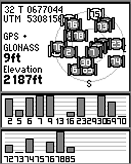
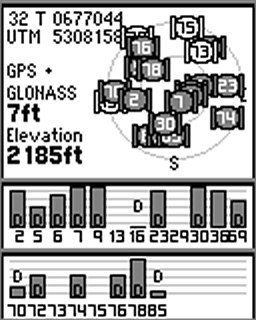
Screenshots (left to right): "Satellite System" and "WAAS/EGNOS", different settings
- GPS (WAAS/EGNOS off) Satellites: 02 – 30 GPS
- GPS & GLONASS (WAAS/EGNOS off) Satellites: 02 – 30 GPS, 69 – 85 GLONASS
- GPS & GLONASS & WAAS/EGNOS Satellites: 02 – 30 GPS, 36 EGNOS, 69 – 85 GLONASS; "D": device receives and calculates EGNOS signal corrections
Backlight Timeout
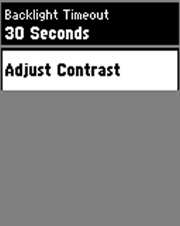
Turns the backlight off after a given time. Choose a timeout as short as possible for battery saving, timeout depends on your activity and profile.
Adjust Contrast
Your choice!
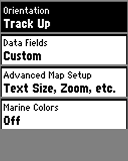
Orientation
Map orientation on the display, depending on your activity (and profile):
- North Up: North is always at the top of the display / page, independent of the device orientation (e.g. recommended for hiking without active navigation).
- Track Up: Direction of travel is always at the top of the page (recommended for active navigation and / or activities like cycling)
- Automotive Mode: Three dimensional look, direction of travel is always at the top of the page (recommended for automotive use)
Data Fields
Choose between different informations (data fields, dashboards) on top of the map. Depending on your activity and preferences, e.g. "Dashboard > Geocaching" for geocaching. Our preference is "Custom": "When Navigating > 4 small", "When Not Navigating > 0" (while navigating you have four data fields as an overlay; when not navigating the map is not covered by data fields).
Advanced Map Setup
- Auto Zoom: Turn off (except for car driving)
- User Waypoint Zoom Level: "Auto" is normally fine
- User Waypoint Text Size: Use "Small" or "Medium", "Large" is usually too much.
Marine Colors
"Off" for most outdoor activities ("On" sets the ocean color in the basemap to a lighter color)
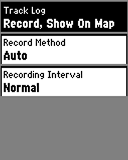
Track Log
- Do Not Record: Setting when you do not need a track log.
- Record, Do Not Show: Starts the track log, but the log is not visible on the map.
- Record, Show On Map: Starts the track log, track is visible on the map. Recommended settings for your outdoor activities (Tip: At the start point, always reset the track and trip data; see next topic).
Record Method
Recommendation: "Auto" (good choice for most outdoor activities), "Distance" is recommended for hiking, "Time" when using the device as a data logger for geotagging.
Recording Interval
Settings for the track log recording interval depending on the "Record Method", the combination "Auto / Normal" is sufficent, for hiking e.g. "Distance / 10 m / 0.01 mi"
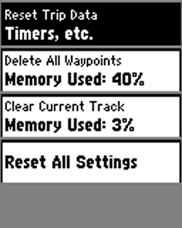
Reset Trip Data
Deleting all data from the current trip, e.g. like "trip odometer, ascent total" (but not the "odometer" = all recorded distance by the device). Should be done before starting a new trip.
Delete All Waypoints
Deletes all waypoints stored on the device.
Clear Current Track
Clears the actual track (active log). Should be done before starting a new trip.
Reset All Settings
Reset all settings (restores the gps device to factory default settings).
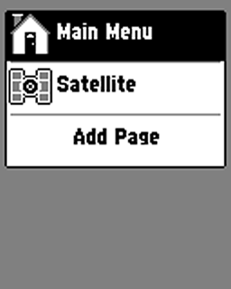
Page Sequence
Customize your main menu by adding, removing pages or changing the page order (main menu = you can scroll trough this menu by pressing the "BACK" key). You have three choices for customizing:
- Use the item "Add Page"
- Click on an item with the thumbstick
- Press the "MENU" key
Tip: Keep it simple! Add the pages you really need!
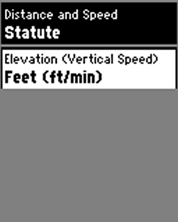
Distance and Speed
Your choice!
Elevation
Your choice!

Time Format
Choose between "12-Hour" or "24-Hour" format
Time Zone
"Automatic" is recommended
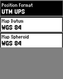
Position Format
Format for coordinates. For geocaching and marine use "hddd°mm.mmm'“, otherwise "UTM UPS“
Map Datum
“WGS 84”, except for working with paper maps (choose the same format as the paper map)
Map Spheroid
“WGS 84”, except for working with paper maps (choose the same format as the paper map)
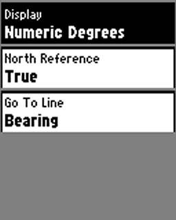
Display
"Directional Letters" or "Numeric Degrees" are the best choices for many outdoor activities ("Mils" for special use cases)
North Reference
Only relevant when navigating with compass and paper map (use the standard "True")
Go To Line (Pointer)
Use "Bearing" as standard, "Course (CDI)" e.g. for sea kayaking
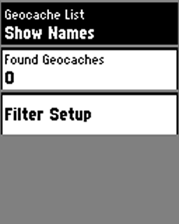
Geocache List
Preferably choose "Show Names" over "Show GC Codes" (e.g. "Welcome to Bavaria" instead of "GC2NJG9")
Found Geocaches
Number of found geocaches (automatically added, but you can manually edit the number by entering the menu item with the thumbstick)
Filter Setup
Define filters for geocaches, e.g. for traditional geocaches

Off Road Transitions
"Auto" is normally fine
- "Auto": automatic transition to the next point of a multipoint route
- "Manual": manual transition to the next point of a multipoint route
- "Distance": when you are within the entered distance the device leads you to the next waypoint of a multipoint route
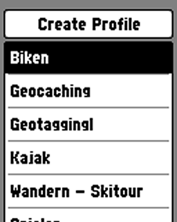
Create Profile
Creating / Deleting / Naming / Moving profiles:
- Recommendation: Leave the Garmin default profiles as is and create your own profiles.
- How-to: Activate a default Garmin profile (e.g. "Geocaching", function "Profile Change" in the main menu), go to "Setup > Profiles > Create Profile", your new profile has the same settings as the previously activated "Geocaching" profile, then you can rename and tweak the new profile as you like.
About
Software version, unit ID, licence informations
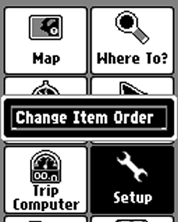
Main Menu
Go to the "Main Menu" page, press the "MENU" key and by using the "Change Item Order" function you can customize the main menu (change the order, remove or add items/pages). Tip: Keep it simple, remove all items you do not need for the active profile!
Thank you for this very useful guide. Along with the questions you have answered for people, it is the best guide to using my etrex10 I have found yet. I appreciate all the work you must have put into it.
Hello, my etrex 10 does no longer responds when going up, using the directional button — it only goes right, left and down. Any advice on how I can try to fix it myself?
Hi,
disassemble and hope for the best … and you can check Ebay for spare parts.
Hi, is there a way i can upgrade a etrex 10 device to etrex 30? Thanks appreciate it.
Hi,
I’m a new user of the ETrex 10. Previously had the Etrex Legend which has stopped being reliable (turns itself off at odd moments).
Can you tell me how to see the total ascent since last re-set on the Etrex 10 please.
And how to reset the total ascent.
Hi,
the eTrex 10 has no data field for the ascent and does not provide any ascent data.
Hi, thanks for all your efforts in putting this guide together! I wondered if there was any way that I can my Etrex 10 to give me an alarm if I wander off a route that I have imported as a GPX file? I’ve been caught a couple of times when I’ve inadvertently wandered off a track, always managed to get back on the route but only because I’m constantly looking at the screen to make sure I’m on course! Was recently caught out because I missed a path and because I was thinking about something else, I walked for 30 minutes before realising I was actually going the wrong way…..
Thanks!
Hi,
no, the eTrex 10 does not provide a functionality like this!
Cheers
etrex 10 after update current version i cant turn on device. then i tried to erase everything using menu+center+power but failed.
i cannot conect with pc also.. what i do now?
check this page, especially forced mass storage: https://www.gpsrchive.com/eTrex/eTrex%20×0/index.htm
Hi Joachim Bardua
I am Sridhar From India. this useful to me. i think i update a wrong one for etrex 10. now this device not running. how to install old version again? i bought this yesterday only and i saw the notification on garmin express that updates available then i install it. Right now my device not running…
how to solve this problem..?
Hi, I can not help you, please check the link and try to force the mass storage, if you have access to the eTrex you can manually install the software:
https://www.gpsrchive.com/eTrex/eTrex%20×0/index.htm (select "eTrex 10", then "troubleshooting")
Hi – Is there a way to use this device where someone at home can track my location as I do a long thru hike? Or is there no way to do that with this particular device.
Thank you I appreciate it, -L
Hi,
not, it is not possible – I can recommend to get a Garmin inReach Mini for tracking your position
Cheers
I only want to use my etrex 10 to track my hikes in case I need to retrace my steps to get back, along with the miles hiked. I haven’t been able to do this yet, I guess because I don’t understand all the instructions given online. What’s the best and easiest way to do this. Whenever I try to map my hike I end up with a hundren different lines going in every direction and a 4 mile hike ends up being a 57 mile hike.
Hi Michael,
the most important steps:
When starting a hike
1: Setup
Record Method & Interval: auto/normal (is sufficient)
Track Log: Record, Show On Map
2: Reset
Reset Trip Data & Clear Current Track (I recommend to do this after step 1 and after gearing up, e.g. put on shoes etc)
After your hike
1: Setup
Track Log: Do Not Record
2. Track Manager
Current Track: Save Track
3: Reset (optional)
Reset Trip Data & Clear Current Track
At home
1: Copy the track to your computer, e.g. using Windows Explorer, Mac Finder and/or Garmin BaseCamp
2: Delete the saved track on your eTrex, because the eTrex 10 has only little memory (optional)
Enjoy!
Can I delete some waypoints without deleting all of them
Waypoint-Manager > Open the waypoint > press MENU button > Delete
Cheers
Good evening sir,
I want information below as:COMPUS, WHERE TO,MARK WAYPOINT, WAYPOINT MANAGER, TRACK MANAGER,ROUTE PLANER,ACTIVE ROUTE, WAYPOINT AVERAGE ING,MAN OVERBOARD .thq u sir please give me details of above.
Hello,
I can not provide these informations – needs a lot of time like writing a book, no time for this, sorry!
Hi ,
Please COMPUS ,mark waypoints and Route brief please
I want to mark location of a line of fence posts through a wooded area. Don’t want a track line just a show of the waypoints at each post.
you must mark the fence posts as waypoints (use "Mark Waypoint" application or long pressing the thumb stick while on map page ) and disable the track log (setup > tracks > track log > do not record)
how to recover waypoints in gps because during connect with pc it cant show i think it will be hidden so please reply fast and try to help to unhide way points……………………………
I have made a Format:// to my Garmin etrex10. 🙁
Can i restore it?
I guess not, it’s for the trash bin! As I know even Garmin does not install the software, but ask the Garmin support!
Cheers
How do I delete way points that are no longer relevant?
Waypoint Manager > open Waypoint > MENU button > delete or Waypoint Manager > MENU button > delete all
Cheers
how do i do simple cookie tracking, all i want is to follow my path back
how do I do simple cookie tracking. all I want to do is find my way back on the same path.
I owned a Garmin e-trex v1 8 years ago, it was easy to use and reliable i sent to a lot of places you dont want to get lost in.. I bought the Garmin e-trex10 and find it impossible to use. Its a nightmare.. IT was designed by an insane man on acid or what ever.. I dont dare rely on it, I use my old military compass and count steps.. that works..
Would I recommend the Old original etrex v1 yes, the new Garmin etrex 10.. No I reate it a ZERO and dangerous to rely on if there is a chance that you may get lost…..
I’ve had mine for about one year now and have reached the same conclusion, more then once I was ready to return it to Cabela’s but was determined to make it work. Should have returned it when I had the chance.
Is it possible to prevent the adding of waypoints whilst on the move. It seems too easy to simply press and hold the thumbstick to add new waypoints, and I want to stop the user from doing this.
no, you can not disable the thumbstick or change it’s functionality; you must find a better way for carrying the device, e.g. with the backpack tether: https://www.navigation-professionell.de/en/garmin-backpack-tether-review/
How do I convert a waypoint to a geocache? I would like to set up a private Easter egg hunt for young kids on the family farm, mark the locations and then convert it from waypoints to geocaches. Thank you.
Hi,
sorry, at the moment I can not help you as I’m off and have no Garmin around, may be Google can help how to create a geocache:
http://bit.ly/2HEGaoq
cheers
question on etrex 10
hi can you explain how to change from distance walked to way point that is showen on trip odometer along with compass, to distance to reach waypoint along with compass.
In short i wish to know distance to walk, in place distance coverd.
hope i made sence.
thanks for any reply sent.
Hi,
open compass page, press "menu" button, then "change data fields", activate the field and choose "Distance to Dest." – that’s it. Hope this answers your question!
Cheers
I want to add marine coordinates from a map and assign a way-point number to it. How? Thanks
Hi,
for a paper map:
1: Setup > Position Format: select the right format, map datum and map spheroid (should be printed somewhere on the map, use this)
2: In the menu > Mark waypoint > move the thumbstick to the location field, press the stick, than you can change the coordinates. (or use a waypoint from the waypoint manager)
3: For reading the coordinates from a paper map you need a map romer
Digital map:
Normally you must change only the format (depending on the format used in the digital map, hddd°mm.mmm' is best for marine), furthermore see 2.
Cheers!
How do I find the battery condition on the E-trex 10, to keep track of battery power
Hi, as I remember (I do not have an eTrex at the moment) pressing the "light" button
Hi, now I could check it: press the light button once, then you get this information!