You can use these instructions for the following GPSMAP devices:
- GPSMAP 64
- GPSMAP 64s
- GPSMAP 64sc
- GPSMAP 64st
- GPSMAP 65
- GPSMAP 65s
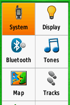
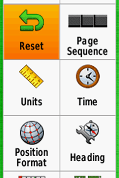
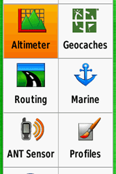
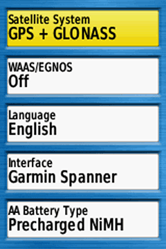
GPSMAP 64s: System
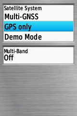
GPSMAP 65s: Satellite System
Satellite System
GPSMAP 64 series
Choose "GPS + GLONASS"; but "GPS only" for a better battery life.
WAAS/EGNOS
For outdoor activities you usually do not need WAAS/EGNOS signal corrections (WAAS is only available in North America, EGNOS in Europe). WAAS/EGNOS can provide a better accuracy in certain situations and is recommended for pilots and mariners.
BUT: Activate it, if your preference is "Enable all and hope the best!" (= GPS / GLONASS / WAAS / EGNOS).
GPSMAP 65 series
You can choose between
- Multi-GNSS
- GPS only
- Demo Mode (GPS off)
In addition you can activate Multi-Band.
When the best accuracy is needed you must use Multi-GNSS and Multi-Band. For saving power you should use "GPS only".
Language
Your choice
Interface
"Garmin Spanner" is recommended:
- The gps device is supplied with energy when connecting to an external power source (e.g. AC charger).
- Connecting the handheld to a PC you get the screen "USB Cable Detected. Would you like to go to Mass Storage?"."Yes": Activiting the mass storage, you get access to the file system and can copy data or install maps (e.g. with Garmin BaseCamp)."No": Device is powered by the external source, the Garmin NiMH battery pack is charged, you can play with the device and NMEA data is send to the PC (recommended software for displaying the data: Fransons GpsGate in combination with VisualGPS)
AA Battery Type
Depends on your preferred battery type (menu is disabled when using the Garmin NiMH battery pack!).
- Alkaline (not recommended)
- Lithium (recommended for cold environments and long run-times), e.g. Energizer AA Ultimate
- NiMH (for daily use)
- Precharged NiMH, for NiMH batteries purchased as precharged (LSD, Low Self Discharge batteries) (highly recommended, for daily use): e.g. Panasonic eneloop
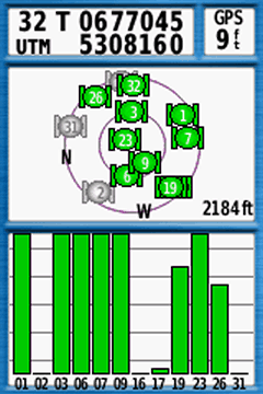
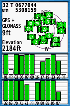
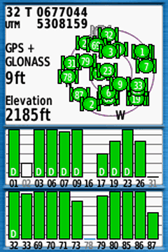
Screenshots (GPSMAP 64s, left to right)
- Satellites: 01 – 31 GPS
- Satellites: 01 – 32 GPS, 69 – 87 GLONASS
- Satellites: 05 – 32 GPS, 33 EGNOS, 69 – 87 GLONASS; "D": device receives and calculates EGNOS signal corrections
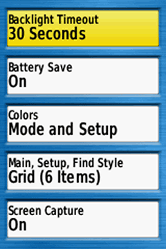
Backlight Timeout
Turns the backlight off after a given time.
Choose a timeout as short as possible for battery saving, timeout depends on your activity and profile (e.g. different for cycling and hiking profiles).
Battery Save
Turns the screen completely off when you choose "On" (depending on the time defined in "Backlight Timeout"; press a key for turning the display on again).
Recommendations: activate it e.g. for hiking (when you are rarely looking on the display), disable it e.g. for mountain biking (when you want to have a quick glance on the display, in addition set "Backlight Timeout = Stays On").
Colors
"Mode": Choose between "Auto, Day, Night":
- Auto: Automatic switch between day / night colors (at sunset/-rise)
- Day: Color as defined in "Day Background/Highlight Color" (recommended for most use case)
- Night: Color as defined in "Night Background/Highlight Color"
Main, Setup, Find Style
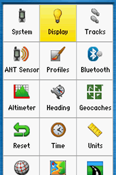
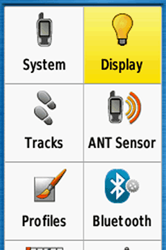
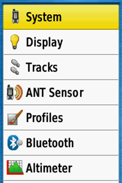
Style for the main, setup and find menus (see screenshots below):
- Grid (12 items)
- Grid (6 items)
- List (7 items) (probably the best choice)
Screen Capture
Capturing screenshots, turn "off" except you need it (tip: after a tour you can capture your trip computer for saving the statistics!)(screenshots are saved in the device folder "Garmin\scrn")
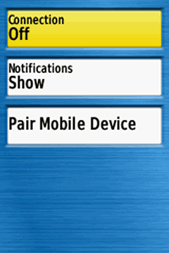
Bluetooth
Pair the device with a smartphone (Garmin Connect App must be installed) and show or hide smartphone notifications (e.g. e-mails), otherwise disable the function for saving energy ("Connection > Off").
When pairing watch for messages on your smartphone screen, you must enter a passcode provided.
Tip: The GPSMAP 64 and 65 device (with bluetooth) can be used with the Garmin Explore app (a prerequisite is connecting via the Garmin Connect app!)
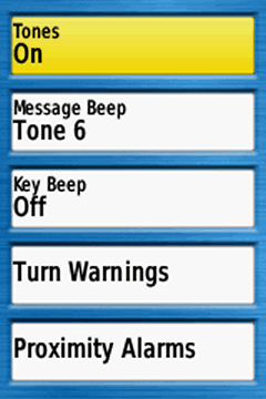
Tones
Recommendation: Tones "On" (useful for the message beep)
Message Beep
Choose one, the message beep keeps you informed e.g. when the battery is low or the GPS signal lost.
Key Beep
Annoying, turn "Off"
Turn Warnings
Choose different tones; warnings when navigating with routes from waypoint to waypoint or for autorouting (turn "Early / Final Turn Warning" off when you do not need it)
Proximity Alarms
Different options, e.g. when approaching a POI (turn "Proximity Tones / Alarms" off when not in use!) (highly sophisticated topic)
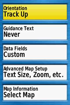
Orientation
Map orientation, depending on your activity (and profile):
- North Up: North is always at the top of the display / page, independent of the device orientation.
- Track Up: Direction of travel is always at the top of the page (recommended for active navigation and / or activities like cycling)
- Automotive Mode: Three dimensional look, direction of travel is always at the top of the page (recommended for automotive use)
Guidance Text
When navigating, guidance text with usefull information like "Arriving at …" appears at the top of the map.
"Always" should be avoided, because the text "Ready to Navigate" covers the map, even without active navigation.
Best choices are "When Navigating" or "Never", depending on you activity or profile (no matter what you choose, when using “Direct Routing“ you do not get a guidance text). Have a look at my free custom profiles for the GPSmap 64s.
Data Fields
Choose between different informations (data fields, graphics) on top of the map. Depending on your activity and preferences, e.g. "Dashboard > Geocaching" for geocaching.
My preference is "Custom": "When Navigating > 4 small", "When Not Navigating > 0" (while navigating you have four data fields on top of the map; otherwise the map is completely visible; see screenshots below).
Advanced Map Setup
- Auto Zoom: Turn off (except for car driving)
- Zoom Levels: Use "Auto"
- Text Size: Use "Small" or "Medium", "Large" is usually too much.
- Detail: "Normal" map detail level is usually enough
- Shaded Relief: The shaded relief provides a better visualization (e.g. hill-shades), but in deep woods the darker map screen can reduce the visibility. For a better readability use "Do not show". When you need the relief choose "Show if Available" or at least "Auto" (shaded relief disappears when zooming in the map).
Map Information
Enable/Disable maps
4 small data fields for hiking
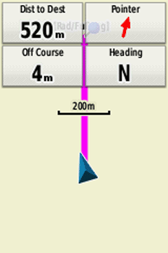
4 small data fields for geocaching
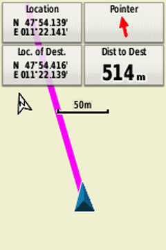
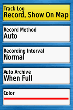
also Track Log
- Do Not Record: Recommended setting when you do not need a track log, e.g. automotive profile
- Record, Do Not Show: Starts the track log, but the log is not visible on the map.
- Record, Show On Map: Starts the track log, track is visible on the map. Recommended settings for your outdoor activities (Tip: At the start point, always reset the track and trip data; see next topic).
Record Method
Track recording method, my recommendation: "Auto" (good choice for most outdoor activities).
"Distance" is also recommended for hiking, "Time" when using the device as a data logger e.g. for geotagging.
Recording Interval
Settings for the track log recording interval depending on the "Record Method", the combination "Auto / Normal" is sufficent, for hiking e.g. "Distance / 10 m / 0.01 mi"
Auto Archive
Recommended "When Full"
Color
Track log color on the map, your choice!
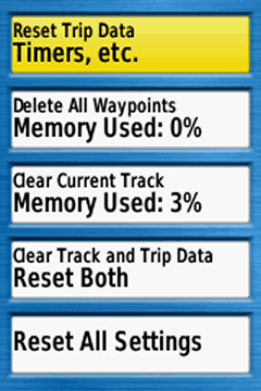
Reset Trip Data
Deleting all data from the current trip, e.g. like "trip odometer, ascent total" (but not the "odometer" = all recorded distance by the device).
Should be done before starting a new trip (alternative: “Clear Track and Trip Data” as described below).
Delete All Waypoints
Deletes all waypoints on the device.
Clear Current Track
Clears the actual track (active log). Should be done before starting a new trip (alternative: “Clear Track and Trip Data” as described below).
Clear Track and Trip Data
Resets the trip data AND the track log, should be done at the tour start point (immediately before leaving!).
Reset All Settings
Reset all settings (restores the gps device to factory default settings).
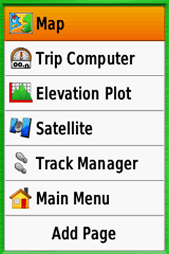
Page Sequence
Defining the page sequence (page order when pressing the "MENU" or the "QUIT" key on the device). You have two options:
- Press the "MENU" key when you are in the "Page Sequence" menu: You can remove/include all pages or activate the "Page Ribbon Display" (with different display speed options) (using the device: you can activate the pages in the "Page Ribbon Display" with the "QUIT" and "PAGE" keys).
- Select one element in the list with the "ENTER" key: Move or remove single items.
Keep it simple, less is more!
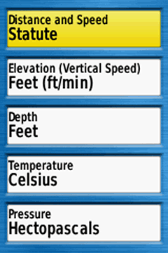
Your choice, depending on you region, activity, … (Hectopascals: international unit)
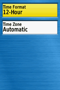
Time Format
Your choice
Time Zone
“Automatic” is recommended.
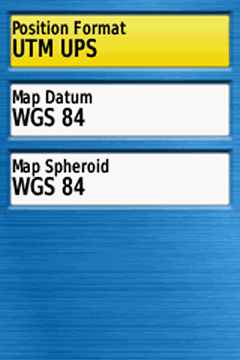
Position Format
Format for coordinates. For geocaching and marine use "hddd°mm.mmm'“, otherwise "UTM UPS“
Map Datum
“WGS 84”, except for working with paper maps (choose the same format as the paper map)
Map Spheroid
“WGS 84”, except for working with paper maps
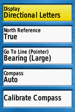
Display
"Directional Letters" or "Numeric Degrees" are the best choices for many outdoor activities ("Mils" for special use cases)
North Reference
Only relevant when navigating with compass and paper map (use the standard "True")
Go To Line
Use "Bearing" (small / large is your choice), "Course / CDI" (Course Deviation Indicator) e.g. for sea kayaking
Compass
Use "Auto" ("Off" when you do not need the compass, might save some battery)
Calibrate Compass
Calibrate the compass at the starting point
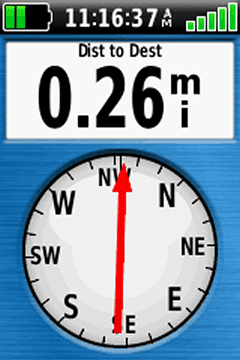
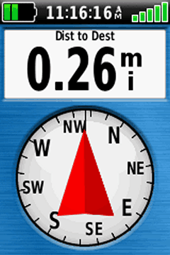
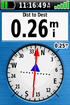
Screenshots (left to right)
- Compass: Bearing small, Directional Letters
- Compass: Bearing large, Directional Letters
- Compass: Course / CDI, Numeric Degrees
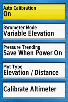
Altimeter Settings (1st screenshot)
Auto Calibration
- On: auto calibration activated
- Off: auto calibration disabled
Recommended altimeter calibration methods for outdoor activities:
- 1st choice: Manually by entering the elevation at your starting point and recalibration on tour (e.g. elevations from mountain tops)(auto calibration always "off")
- 2nd choice: Manually by entering the elevation at your starting point, on tour using auto calibration "On"
- 3rd choice: Use only auto calibration "On"
Barometer Mode
"Variable Elevation" as altimeter
Pressure Trending
"Save When Power On" as altimeter on tour
Plot Type
]"Elevation / Time" or "Elevation / Distance"
Calibrate Altimeter
Calibrate the altimeter by using one of these data:
- "Current Elevation" (e.g. from a paper or digital map)
- "Correct Pressure" (e.g. from weather data)
- "Current GPS Altitude" (from your gps device; tip: wait some minutes after power on)
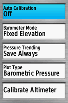
Barometer Settings (2nd screenshot)
Auto Calibration
"Off": auto calibration turned off
Barometer Mode
Use "Fixed Elevation"
Pressure Trending
"Save Always", reads pressure even when the device is turned off
Plot Type
"Barometric Pressure" (use preferably; ambient pressure calibrated to sea level, not compensate for humidity or temperature) or "Ambient Pressure" (sensor reading from the unit)
Calibrate Altimeter
Calibrate the altimeter by using one of these data:
- "Current Elevation" (e.g. from a paper or digital map)
- "Correct Pressure" (e.g. from weather data)
- "Current GPS Altitude" (from your gps device; tip: wait some minutes after power on)
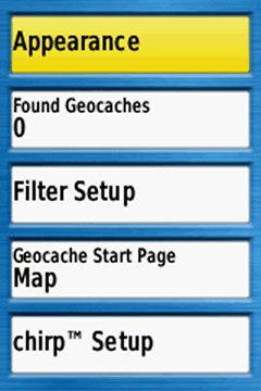
Appearance
- Geocache List: Preferably choose "Show Names" (e.g. "Welcome to Bavaria" instead of "GC2NJG9")
- Geocache Style: Select "Auto"
Found Geocaches
Number of found geocaches (automatically added, but you can manually edit the number by entering the menu item)
Filter Setup
Define filters for geocaches, e.g. for traditional geocaches
Geocache Start Page
Define the first visible page after starting the navigation to a geocache (e.g. "Map")
chirp Setup
Searching and programing a chirp
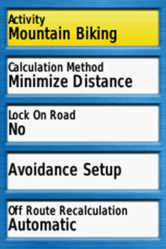
Activity
Choose your preferred activity (dependent on the active profile, e.g. "Mountain Biking" for a cycling profile)
- "Direct Routing": straight line from your current position to the destination (e.g. waypoint, geocache) or from point to point (e.g. waypoint to waypoint when navigating along a multipoint route). Direct routing is independent from trails, streets etc. on the map ("over hill and dale").
- "Cycling, Hiking, ...": Autorouting to the destination, along trails, streets etc. (requires a routable map)
- "Prompted": After setting the destination you can choose the activity, e.g. "Direct Routing", "Tour Cycling", ... (in addition, calculation method is automatically set to "Prompted")
Calculation Method
Depends on the activity and your preferences ("Prompted": you can select the calculation method after setting the destination)
Lock On Road
"No", except for activities like road cycling or automobile driving.
Avoidance Setup
Types of roads or transportations (e.g. ferry) you want to avoid.
Off Route Recalculation
When you detour from the calculated route the device recalculates a new route; choose the setting in dependency of the activity, e.g. "automatic" for automobile.
Route Transitions
This screen is only active when you use "Direct Routing" as activity.
"Auto" is normally fine
- "Auto": automatic transition to the next point of a multipoint route
- "Manual": manual transition to the next point of a multipoint route (use the function "Active Route")
- "Distance": when you are within the entered distance the device leads you to the next waypoint of a multipoint route
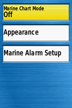
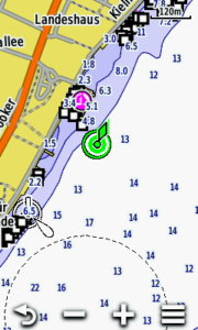
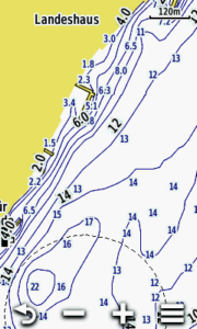
Marine Chart Mode
Displaying marine data, depends on the installed map (e.g. Garmin BlueChart) and the activity („Fishing“, „Nautical“).
Screenshots: top „Nautical“, down „Fishing“); otherwise turn it off.
Appearance
Different map settings (sorry, no experiences!)
Marine Alarm Setup
Different marine alarms, e.g. anchor drag alarm
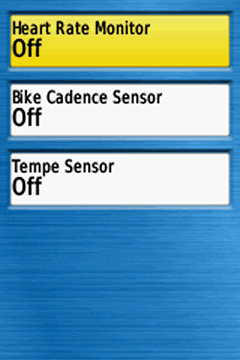
"Off", except you want to pair / use a ... sensor
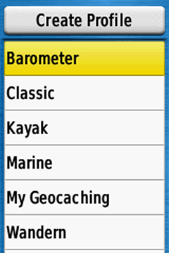
Profiles
Creating / Deleting / Naming / Moving profiles:
- Recommendation: Leave the Garmin default profiles untouched and create your own profiles.
- How-to: Activate a default Garmin profile (e.g. "Recreational", function "Profile Change"), go to "Setup > Profiles > Create Profile", your new profile has the same settings as the previously activated "Recreational" profile, then you can rename and tweak the new profile as you like (maximum number: 10 profiles).
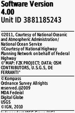
About
Software version, unit ID, licence informations
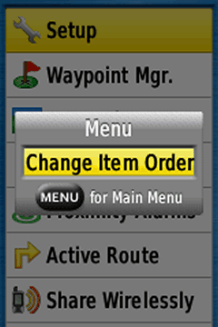
Main Menu
Go to the "Main Menu", press the "MENU" or the "ENTER" key and customize the main menu (e.g. remove all items except what you really need)
- "GPS only" (system)
- ANT+ sensors "off" (ant sensors)
- Bluetooth connection "off" (bluetooth)
- Use map orientation "north up" (map)
- Shaded relief "do not show" (map)
- Map detail "normal" (or less) (map)
- Auto zoom "off" (map)
- Avoid zooming and panning the map
- Backlight timeout as short as possible (display)
- Battery save "on" (display)
- Backlight as low as possible (on/off button)
- Key beep "off" (tones)
I having problem with Waypoint page no any result..
I have a GPSMAP 65s. On the Sight 'N Go screen, is there a way to adjust the scale? Currently, it is set at .25KM. I am trying to get it down to a few meters. Also, is there a way to set the "Dist to Dest"?
you can adjust the scale with the IN/OUT keys; the data field is changed via "MENU > change data fields" (and "change dashboard > e.g. large data field")
Using the IN/OUT keys, I can change the scale to 5.00KM, 1.25KM, or 0.25KM. I was hoping to change it to 5m.
As for the "Dist to Dest", is there a way to change the default from 55.6KM to 1KM?
Hi,
check this PDF:
Download GPSMAP Sight’N Go
Thank you for putting this together, I found it extremely helpful!
Hi, cannot find how to display time with seconds on display. GPSMap 65s.
Hi, that’s not possible!
Hi! Is it possible to mark a lap in "trip computer" or it works only in chronometer?
My idea is to use 64s as a metro meter during races with roadbook
Hi,
no, that’s not possible!
Hi, what do you mean by that? I dont see any „Comment” function nor button on that screen
sorry, something went wrong … see my answer
hi i have a gps64s garmin i by it when i wan to take mark it take me a err database is err please contact me
Do you use a microSD card, may be the card is corrupt, boot the GPSMAP without the card; otherwise I would do a master reset:
Ensure the device is powered off
Press and hold both Page and Enter simultaneously
Power on the device while continuing to press both buttons
Release the Power button when Garmin appears on the screen
Release the other buttons once the Do you really want to erase all user data? or This will remove all saved user data message appears
Arrow to Erase or Yes
Press Enter
If nothing helps ask garmin support
Bonjour Joachim,
After having chosen a track to follow (Find – Tracks- Go – Enter), the chosen track in which I have saved in blue (or any other color) is always displayed in purple. In a forest or with sunglasses this line is difficult to see. Is there a way of changing this default color?
Hi Dan,
no, it’s not possible – that is often criticized!
Hi,
Does Garmin 64S contain leg time, leg speed, and leg course in the daily archived .gpx? Or any other GPS handheld series support for that 3 calculations?
Hi,
yes, check this shot from an archive GPX file:
Hello
I paired a Heart Rate Sensor to my GPSMAP 64s, and it works alright, I can watch my heart rate when walking. But, so far I didn´t find any possibility to show my heart rate in Garmin Explore – is there a possibility, or will the heart rate only show as long as I use the GPSMAP device?
Hi,
no, you do not get the heart rate in Explore, only on GPSMAP.
Hi, and thanks for your answer. I was afraid that this was the case, but it is not really important, and doesn´t change my overall satisfaction with the device.
Leon
Hello
when I look at my "Map" settings, there are only "Orientation", "Data Fields", "Advanced Map Setup" and "Map Information" visible; the setting for "Guidance Text" is missing. How can I restore that field in the Map settings menu?
Thanks in advance for your help
Advanced Map Setup > Guidance Text
Thanks – I found it 😉
Is there a downloadable pdf version of these instructions?
no, I sell specific PDF E-Books on https://www.gps-manual.com (however, the GPSMAP version needs an update, but covers all topics)
I would like to be able to see all the waypoints I have saved on the screen at the same time while I am hiking/cycling/motorbiking. That way I can see where they are in relation to my current position along a route. How do I do that?
Hi,
all waypoints should be visible on the map screen (check your map settings, advanced map setup > adjust zoom ranges > zoom levels, may be the waypoints are not visible because they are off)
Check the "Active Route" application for all waypoints along the route.
I want to start a new track, but cannot seem to get rid of the blue line on screen from a historic position. I’ve cleared all waypoints, deleted all tracks, including archived but still I get a straight blue line from some historic point. How do I clear this?
Hi Matthew,
open the menu "Reset" and execute "Clear Track and Trip Data"; you should perform this after each new trip (after saving the current track!).
Cheers
mon gps 64x est bloquer apres avoir fait une mise a jour avec garmin expres plusieur fonction de pas disponible comme faire pour le mettre en francais
Quel message d’erreur obtenez-vous ? Avez-vous essayé une réinitialisation complète ?
Hi there,
I was wondering if there was a way to change the coordinates to display as decimal degrees instead of DMS on my 64x? Such as when I mark a waypoint or on the map display.
Thank you!
Hi,
yes you can:
Setup > Position Format > Position Format > hddd°mm.mmmm'
Cheers
I think you meant to say “hddd.ddddd” instead of “hddd.mm.mmm”
yes, you are right, sorry!
Hi. I couldn’t get the coordinates to display in decimal degrees after selecting them as indicated in this article. To get coordinates to actually display as selected, hit “menu” once then select “change data fields”. Highlight the data field containing the coordinates and hit enter. Scroll till you see “location (selected)” and hit enter. Do not choose “location (lat/Lon)” which sound right but goes back to the device default).
Hi I have just purchased a Garmin 64SX. I really like using it but when I put tracks onto the map using the Show on Map function the track appears on the map. When I turn the GPS off and then start it again the next day the tracks have disappeared from the map and have to be reentered. How do I set up the GPS so the tracks remain after shut down.
Hi,
the same happens with my device – so I guess it is a software bug; hopefully garmin will fix it.
cheers
Thanks for the response Joachim.
A friend’s 64sx keeps the track visible on the map after the unit has been turned off then restarted.
On ,my garmin gps 64s is it possible to get rid of the large blue flag and replace it with a coloured dot. At the moment the blue flag obscures the text entered at the waypoints
yes, e.g. when marking a new waypoint you can open the marker data field (top left, 1st screen) an change it
That’s ok when making a new waypoint on the Unit, but if I load a route from Memory-Map or Basecamp all the way[points are all Large Blue pins when viewed on GPS
Hi, yes, all waypoints from a route get these blue pins – you can not change it, even if you use different pins in Basecamp.
Hello,how do I create a New project using handheld GPS 64s
Thank you very much for the invitation :). Best wishes.
PS: How are you? I am from France 🙂
Hi where can i download maps from?
Check these posts:
https://www.navigation-professionell.de/en/free-maps-garmin-gps/
https://www.navigation-professionell.de/en/how-to-install-free-osm-maps-on-your-garmin-gps/
Hi Joachim
Thanks for your advice, I have a Oregon 650t, but have two questions, how can I show on the display both the battery charge and the signal, also, the unit has a very fine white line, does not disturb but can it be removed, is there even on auto rotate.
Thanks
Ken
Hi Joachim. I have found a Garmin GPSMAP64S for a good price. However, I am not sure if it has European Topo maps. If this is the case, is it possible to download OSM open source with extension .img into SD card and work from these? I already do this thing with my Etrex Touch 25 but have read somewhere that this is not possible on the GPSMap64s. Thanks for your kind assistance!
sorry… should have written "If this is NOT the case…"
Hi,
no problem, you can download and install OSM .img files like on any other Garmin device!
Cheers
Hi Joachim! Also I have install Openfiestmap on my 64s by the Basecamp. I can’t find the way to View this map. Only the topo drive view…
Thanks
Hi can anyone tell me which is the best Garmin Gps for very active seniors, I.e. for use in Austrian Alp, French Pyrenees and general wander touring.
Hi Ken,
I would recommend the Oregon 700. The Oregon is highly configurable (e.g. you can customize the user interface, so that you only have the really needed applications in the foreground) and you can configure it to switch between the pages by the user key (check: https://www.navigation-professionell.de/en/garmin-oregon-switch-between-data-screens/). Another advantage is the installation of free OSM maps, it has plenty of memory for this.
Cheers!
Hello Joachim,
Thanks for the info, just a quick question, is it worth starting out with a 600 as we do not have much knowledge about these things and there are many used 600s on the different market places.
Hi Joachim,
I`ve got quite an urgent problem: all of a sudden, my GPSMAP doesn´t show any of the tracks that are on the memory, neither when I store them on the internal drive, nor when I store them on the memory card. I`ve downloaded some tracks for my holidays here in Scortland, and now I can´t access them. When I connect the device to a computer, they are all there, in the folder Garmin\GPX.
Do you have any idea what could be the reason for the sudden disappearance? I´ve already made a complete reset, but without any results. As I need these tracks rather urgently for my tours, I would be extremely happy if you got help me as soon as possible.
Thanks
Leon
Hi,
let’s check:
1:Tracks in GPX format must be stored in the Garmin\GPX folder (internal memory or microSD) – seems to be okay
2:How are these gpx files named? Do they have strange characters in the name?
3: Can you open the tracks in a program like BaseCamp, may be they have some errors?
4: Where are you looking for the tracks? Tracks on the GPSMAP should be visible in the track manager.
However, you can send me one of these tracks by email, so I can have a look at it (kontakt@navigation-professionell.de)
Cheers
Hi Joachim,
thanks for your quick reply, I´ll send you one of the fails per mail. Regarding your questions: I downloaded them from the walkhighlands website, and they were visable and usable until Saturday, when I checked last before I started off to Scotland. The device seems perfectly alright in every other aspect, it stores new tracks and so on – it only doesn´t show any the of the ones I put into that folder. I don´t think the files are corrupted, but I have no idea what the reason could be…
Now I´ll send the email with a file.
Cheers, and thanks so far
Hi, Joachim, I´ve got the GPSMAPS 64s, and so far I am very pleased with it. There is only one minor setting I would very much like to change (if possible) – as far as I know it is one of the default settings of the device: after I started the device, whenever it wake it up again out of the backlight timeout, the page for adjusting this time (and some other information) appear first, and only after some seconds the device changes back to the map page (or wherever I was before the backlight timeout). Is ist possibel to change this, so that the page for the adjustment of the baklight timeout only appears when I want it to appear?
Hi Leon,
you should use any other key (e.g. the central 4-way key) for activating the device when the battery save mode is active – do not press the on/off key!
Cheers
Hi, Joachim, thanks a lot – that´s exactly what I was looking for!
Hi,
I’ve had my GPS for a while now and all of a sudden it has stopped recording tracks. When I click on Menu and Track Manager there is nothing under Current Track, even if I push enter. All the options there are no longer available and I can’t get past current track. Any suggestions?
Is the track log active? See tracks > track log, e.g. "Record, Show On Map"
Cheers
When I switch my Garmin 64s I get a Red box with a number in it. In my case I think it refers to another screen that has messages on it which somehow has transferred from my PC. How can I delete these messages and prevent any more appearing.
Hi,
I guess your GPSMAP is connected to your smartphone and tells you about new smart notifications – disable bluetooth or the notifications.
Cheers
When connecting my 64st via USB to Windows 10 on Surface Pro running Blue Marble Geotracker and MapInfo v15 the following message is displayed when I activate the GPS:
This device does not support position-velocity-time-polling
then the activation times out. I am using USB/Garmin Spanner interface.
Can the polling be activated?
Hi,
sorry, I have no experience with this topic, but found this:
https://groups.google.com/forum/#!topic/mapinfo-l/Nt2Gdd4xf9c
A novice question re use of GPSMAP64: I simply want the coordinates to display continuously in real time as I walk, instead of having to click "quit" and then (re) "enter" in the course of walking. Any suggestion? Thank you!
You can use a dedicated data field:
map > MENU-button > setup map > data fields > e.g. 2 small; back to map; MENU-button > change data fields > choose one > location (lat/lon) or location (selected)*
* location as selected in setup > poition format
cheers!
Hi
I am a bit of a novice, and I need some help on how to put a route from book pathfinder guides which has GPS waypoints for example SD 693 733 onto the garmin. Is there a tutorial I could go through to learn
Hi,
I guess this is a waypoint with British grid coordinates; setup > position format > british grid
https://forums.garmin.com/forum/on-the-trail/wrist-worn/fenix-3/106575-
https://www.go4awalk.com/ask/ask.php?q=37245
https://support.garmin.com/en-US/?faq=IDzd49h34h2Sj0DKCJeOv9)
regarding the route: how is it provided (GPX file?)?
cheers
I am having trouble setting up the instrument. I require to see map co-ordinates according to the British grid in large letters and be able to zero the instrument at the start of every new activity. Sounds simple.
Hi, I guess something like this:
Coordinates:
Setup > Position Format > British grid
Setup > Map > Data Fields > 1 large
Map page > Change Data Fields >Location (selected) !!!
Zero the device: Setup > Reset > Clear Track and Trip Data
Cheers!
How do I find how far I have walked at the end of my hike? I mark waypoint oneas my start point…press stop navigation wharn I finish but where do I find a record of the distance walked?
Sorry for the late response, have been off: You find it in the "Trip Computer", field "Trip Odometer"; but do not forget to reset the trip computer before you start a new hike: "Setup > Reset > Clear Track and Trip Data"
Cheers
I want my Garmin GPSmap 64s to display position in UTM format rather than LatLong.
Where ae the switches?
After going through the Main Menu block several times, I finally found the POSITION block. Then it went away again…… I do not understand.
Position format in the settings page!
Hi !
I have a Garmin 64S but I changed the battery and the background map has disappeared… Still are the track though. ( I’ve tried to disable/enable the map).
Do you know how to do ?
Thanks !
Hi,
when changing the battery nothing should go wrong … when the map is listed in the map settings (setup > map > map information) and is enabled it should be visible. If it is a preloaded map you can try to install it again with Garmin Express; if nothing helps you can perform a hard reset:
https://support.garmin.com/faqSearch/en-US/faq/content/Z41VbtQ1EH7F4wmdm0hfE6
https://support.garmin.com/en-US/?productID=140022&searchQuery=hard%20reset
Cheers !
In my 64s when that happens, I have to remove the batteries and properly seat the micro SD card and slide the chrome metal cover to the right to lock it in. That slide lock often dislodges, even slightly, when I change batteries.
I would like to download the Waypoints data to my computer. I’m using Windows Xp.
Use Garmin BaseCamp for downloading, organizing and sending the waypoints to your GPS device; but Basecamp might not be compatible to XP: https://www.garmin.com/en-US/shop/downloads/basecamp
When I first used the unit it beeped when I reached a point on a route I was following but it no longer does this. I am currently just getting used to using the different settings but can’t seem to find this option anywhere.
ckeck "setup > tones >tones: on" and "setup > tones >proximity alarms > proximity tones: on" and choose a tone for "proximity alarm" etc.
Great quick start guide! I moved up from a 10+ year old 60CSX.
I have the 64st newest software loaded, running eneloop pro 2550 batteries with a plastic piece covering button.
Does it ever stop charging? I can pull the batteries out and put in a smart charger and they say full, but when charging via cable in garmin I get a constant charging symbol (battery with lightning bolt and bars going from 1-4.)
I’m afraid there is no stop point and batts will go poof.
I’m aware Garmin says dont use non-garmin batteries, but just looking for a non binding/non liable personal opinion 😉
Thank you
Sorry, I can not help you – I never used this feature and did not found informations to this topic
Cheers
Comment
Hi Joachim
Do you know if there is a new model on the way that replaces garmin 64 pc?
Hi,
no, I have no informations about a new model!
Hej Joachim
Har kig på en Garmin 64 st som jeg skal bruge når jeg er på tur med min havkajak. Kan se at Garmin st har været på markedet i noget tid, og jeg overvejer om der måske er en ny model på vej lige rundt om hjørnet, og kan ikke finde svar på det nogen steder, ved du det?
VH Jesper
Hi Jesper,
please write english!
Cheers!
Hi this is urgent.
I need an coordinate system that is not listed in my device. The coordinate system is Gauss-Kruger 7 zone.
Where can I find it for download, in what format, and how to and in what folder of my divice to download it?
So I can get it on the list in my device and use it?
I can not provide such a position format, but you can define it on your own: Position format > user grid; map datum > user; otherwise you should asl in the Garmin forum connect.garmin.com forum
As I understand it, there are at least two modes to determine elevation:
1. Using GPS elevation data to autocalibrate barometric values (as determined from ambient pressure vs. altitude data), and
2. Pure, non-autocalibrated barometric (as determined from ambient pressure vs. altitude data).
However, is the method of using GPS determined values (no barometric involvement) also available as a third option?
Hi,
it’s a difficult topic as it is not explained by Garmin … as I know we have no 3rd option ("pure GPS elevation")!
Cheers
My husband has had Garmin equipment for years but this particular model is new to him and now wishes he had bought his old model. Both my sons use garmin equipment for their Ironman events or rallying so Garmin is in the family! Nothing wrong with the equipment just a confusion regarding the waypoint system
When I am tracking a walk to get distance time and speed. How do I get it to stop when i reach my destination? If i turn off the gps and turn it back on it is still recording. I want it to stop so I can look at it later to record my info on paper log i am keeping.
Hi, you do not need turn off GPS, open the setup menu and set "tracks > track log > do not record" after your walk (and activate it before your next tour)
I now have 2 NEW 64st units both of which state they shipo w USA TOPO 100k map included and enabled. BUT – when I view map pages at any distance from a few hundred feet to 15 or more miles I do not see any topo contour lines anywhere. Clearly I do not have some feature or other engaged but cannot find anything that remotely addresses this issue and helps me to turn on the topo map features. Can anyone help w this. The Garmin chat tech spent over an hour with me and could not seem to resolve this issue – did not seem particularly familiar with the unit, the topo feature or what it should look like so I may try that again during the business week as weekend tech help is pretty much useless for anything beyond very basic issues.
Hi,
you can try to change the map details: setup > map > advanced map setup > detail: most or you can try to play with the zoom levels (same menu), e.g. land cover – thats ist – may be it is not possible to view the contour lines "by design" in the distance you need.
Cheers
Hi this is urgent.
I need an coordinate system that is not listed in my device. The coordinate system is Gauss-Kruger 7 zone.
Where can I find it for download, in what format, and how to and in what folder of my divice to download it?
So I can get it on the list in my device and use it?
My gps 64s thinks it is in the USA. There for when i try to put an address it insists I put a state or province. But then goes to a list of USA states etc
I Am using it in the UK
Please advise host to get it understand we are not in the USA
Thank you
Hi,
I do not believe that the 64s thinks you are in the USA – I guess you try to search for an address in the included TOPO UK map – as I know address search is only possible for a few countries – so this might be the problem; in the 64s settings you can not change or set your country (only byGPS position).
Cheers
My children changed the language to an Arabic setting. I cannot find the proper setting to change it back to English. Can you help ?
Hi, best would be a master reset:
Ensure the device is powered off
Press and hold Page and Enter simultaneously
Power on the GPS while continuing to press both buttons
Release the buttons once the Do you really want to erase all user data? message appears
Select Yes
https://support.garmin.com/faqSearch/en-GB/faq/content/Z41VbtQ1EH7F4wmdm0hfE6
Cheers!
I really like the gps 64s. Just one problem can you help me get my gps back to normal?
My Waypoints are in different format and I don’t know how to get it back to normal.
The Waypoints are OK, but the line is not drawn only the Marks are shown, I mean when I send the waypoints to my friend in Australia the lines are missing, please, help me set my gps 64s back to normal like first bought.
Regards,
Osivo Ombuano
You can reset your 64s:
https://support.garmin.com/faqSearch/en-US/faq/content/Z41VbtQ1EH7F4wmdm0hfE6
Hi Joachim, can you please confirm for me how to make a route from 4 sets of coordinates, Im in Australia and am set to WGS84 and UTM. The unit is a 64 s
Many Thanks in advance
Ade
Hi,
first I would add four waypoints (MARK button, change the location / coordinates, rename), then open the main menu, Route Planner, Create Route, Select First Point, Waypoints and add you 4 waypoints to the route. Start navigation with FIND button (open Routes). Otherwise you can create the waypoints in Garmin BaseCamp and send it to the device.
Cheers
How do I measure the distance walked or cycled ?
Settings > Tracks > Track log: Record, …
Settings > Reset > Clear Track and Trip Data
Trip Computer: Trip Odometer (if not visible: Menu button > change data fields > select trip odometer)
That’s it!
Great! An excellent 'how-to' guide for the first-time user opening the box and presented with what, at first glance, is a befuddling piece of wizardry. Very informative and easy to follow page that is much better than trawling through the wordy text accompanying the device. Easy too to get the hang of pressing the little buttons in sequence to bring up additional menus. After just 3 days I’m proficient in scooting through menus (but I must always put my glasses on, lol!!).
can you tell me how to change my format to at least 6 decimal places, instead of the 5 decimal places?
Units? You can not change it!
Hi,
I have a Garmin GPSMAP 64 Handheld Navigator. I didnt use it for a couple of months and despite putting in new batteries I can not get it to turn on. Could you give me any advice on this please?
Many Thanks
Hi,
quite strange when the device is not powering up with new batteries – try it with the usb cable attached to a PC/laptop – does it start?
Cheers!
I was having this problem as well. First I removed the batteries and re-installed them, then I connected to our computer with a USB cable and updated the software using WebUpdater to the latest version 5.0 and that fixed it.
How do I arrase and put in my own Locations
Hi
1: Creating waypoints in Garmin Basecamp and sending to the device (http://www.garmin.com/en-US/shop/downloads/basecamp)
2: Press "MARK" (you can change the location / coordinates)
3: Waypoint Manager; press "MENU" and "Delete All" or open a waypoint with "ENTER", press "MENU" and "Delete"
Cheers!
Hi Joachim,
I’m looking into buying GPSMAP 65s, and I can’t find info on the custom maps option, whether you can put few kmz files in and then enable/disable in the mapinfo setting. I have an Oregon 450 and this is not an option, all custom map files are grouped under one custom map option, so it’s either all of them or none of them. I have seen that 66 can do this, but I’m not sure on the 65. Can you help please?
Thanks,
Marjan
Hi Marjan
yes, you can disable/enable every single custom map!
The GPSMAP 65s is similar to the 64s/64sx; the screenshots from the 64sx show the settings for several custom maps.