Garmin fenix and Garmin epix multisport watches are perfect for long-distance hiking. In combination with an outdoor specific smartphone, a fenix 7X Sapphire Solar in particular is the measure of all things – lightweight and with fabulous battery runtimes.
However, the fenix and the epix have a disadvantage: To follow a track, you have to start an activity or load the track as a course. However, recording is not absolutely necessary (data garbage, power consumption), the same applies to navigation along the course.
On such long-distance trails it is usually enough to take a quick look at the display:"Am I still on the right track?"
For this very purpose, the fenix and epix have a practical application called "Map". However, no tracks can be loaded and visualized – so following without activity recording is not possible. Only outdoor handhelds from Garmin offer this functionality.
Unfortunately, the "Map" application has a weakness that has to be accepted: After a certain time, it stops by itself, but is quickly restarted with a few clicks!
Therefore, it is a good idea to convert the required GPX tracks into a map (IMG file) and activate it in addition to a topographic map. Then the tracks will be displayed as additional layers.
How are the GPX tracks converted into a map?
Fortunately, there are tools with IMGfromGPX and gpx2img. The software is no longer updated or developed further, but still runs under Windows 10.
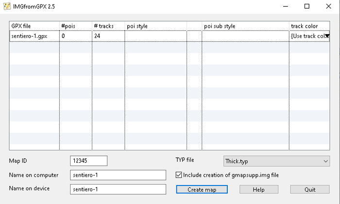
I took a closer look at IMGfromGPX. After the installation is done in a few minutes (incl. a 32-bit Java environment), only one or more GPX file(s) with tracks have to be loaded and output as IMG file. The generated"gmapsupp.img" file should be renamed before copying it to the fenix or epix.
The following figure contains an example. The GPX file exported from Garmin BaseCamp contains 24 tracks. The procedure is self-explanatory. It can be useful to select"Use track color" as "track color" so that the colors set in BaseCamp are retained.
And how does the map with the GPX tracks looks on the fenix or epix?
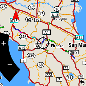
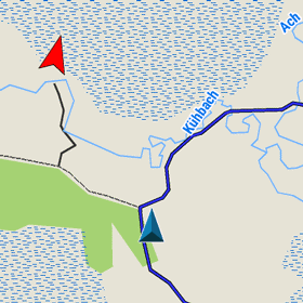
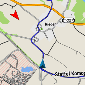
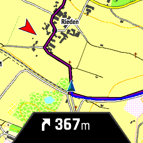
The first screenshot shows a long-distance trail in overview, following a trail (blue) is shown in the following two screenshots.
What it does not have, of course, are turn-by-turn directions, vibration alerts when deviating or distance information (last picture, fenix 7).
In my experience, however, there’s no need for all that fuss – after all, humans (mostly) still have an unbeatable navigation system at their disposal … ! And if it should be necessary, the additionally saved track can be quickly loaded as a course in an activity such as "Hike".
Alternative – OSM map layer with paths
I have already presented an alternative method in the article OSM trails on Garmin devices. However, I think the procedure described above is better, because the desired tracks can be displayed specifically.