Garmin GPSMAP 66sr – the brand new GPS handheld with Garmins latest satellite technology reviewed!
Garmin extends the popular GPSMAP 66 series – for 2021/2022 there are four models to choose from:
- GPSMAP 66s – the basic model without pre-installed maps
- GPSMAP 66st – like the 66s, but with additional topographic maps (depending on your country, not routable)
- GPSMAP 66i – with inReach communication and routable TopoActive maps
- GPSMAP 66sr – similar to the 66st, but with routable TopoActive maps, multi-GNSS & multi-band, internal battery and a few minor improvements
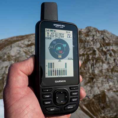
I have already talked about the GPSMAP 66s/66st in a detailed review – a GPS handheld device for a variety of outdoor activities, which features a large & excellent readable display, excellent GPS reception even without multi-GNSS & multi-band, button operation, extensive features and extensive connectivity – including wireless import of data (courses, tracks, routes, waypoints, …) from a smartphone.
Now Garmin takes it one step further and adds a state-of-the-art GPS receiver with multi-GNSS and multi-band technology to the GPSMAP 66sr to further improve accuracy in difficult conditions!
Garmin has changed a few other things with the GPSMAP 66sr (compared to the GPSMAP 66s/66st), both in terms of technology and in the menu and functions.
Display – Garmin GPSMAP 66sr Review
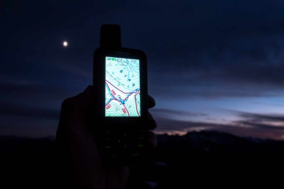
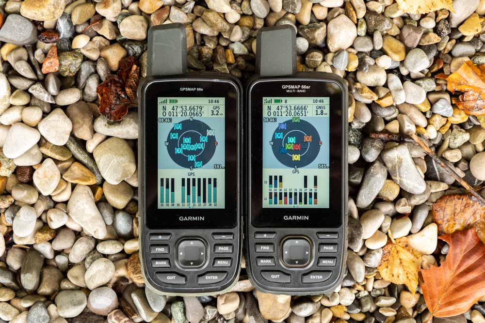
I don’t want to go into detail about the display, as it is simply excellent.
But what is noticeable: The display is brighter than the GPSMAP 66s/66st display! If the backlight of the 66s/66st is set to 100%, the 66sr only needs 60% (*) to achieve the same brightness. At 50%, the 66sr needs only 10% (actually even less, but there is no 5% setting). At 100% the 66sr shines much more.
(*) subjective estimation
Battery – Garmin GPSMAP 66sr Review
The power is provided by an internal, not changeable lithium-ion battery, similar to the GPSMAP 66i. The change from AA batteries to a lithium battery is probably due to the energy-consuming combination of a 3 inch display and a powerful GPS receiver.
Not changeable – this might be annoying for some outdoor enthusiasts. Opposite to the 66s/66st, inserting new AA batteries is no longer possible. When empty, the only thing that helps is recharging via power bank or power outlet.
In my opinion the decision AA or fixed battery depends primarily on the use cases. If the main focus is on day or weekend tours or vacations with access to a power outlet, there is nothing wrong with the internal battery. Because Garmin specifies up to 36 hours as battery life – in expedition mode even up to 450 hours should be possible. With the 66s/66st it is 16 hours or 170 hours with one set of batteries.
Which factors have a particularly large impact on battery life?
I have tested the GPSMAP 66sr in two different settings.
When all consumers are on, the battery life is about 13 to 14 hours. Multi-GNSS & multi-band on or off does not make a big difference.
It gets interesting when the "battery save" mode is activated. The automatic shutdown of the display leads to a significant increase in runtime, the "GPS only" mode contributes additionally.
These are rather theoretical values, but they reflect the approximate range. In practice, the runtimes to be achieved are somewhere in between – depending on how you use the GPSMAP.
Summing up: The 66sr can easily be used for several days.
| Power mode, 100% backlight | |
| Multi-GNSS & Multi-Band active |
|
| GPS only |
|
| Power mode, 50% backlight | |
| Multi-GNSS & Multi-Band active |
|
| GPS only |
|
| battery save mode | |
| Multi-GNSS & Multi-Band active |
|
| GPS only |
|
power mode: all consumers on (e.g. backlight, map orientation north up); battery save mode: all consumers off); in brackets: remaining capacity
Memory – Garmin GPSMAP 66sr Review
With the permanently installed Li-battery, there is also a change in the slot for the microSD slot. Instead in the battery compartment, it is now located on the right side; well protected under a rubber cover.
The microSD size may not exceed 32 GB – in combination with the 16 GB* internal memory, of which about 5.5 GB are still free, there is enough space for data and maps (see overview).
*the Mac-Finder shows 15.52 GB
- 20,000 points per track log
- 2,000 gpx files
- 250 saved gpx tracks
- 2,000 archive tracks
- 300 saved fit activities
- 10,000 waypoints
- 250 courses
- 250 routes (250 points each, 50 points for on-road)
- Geocaches without limit (depending on the memory)
- 15,000 map segments
- 500 custom map tiles
- 250 BirdsEye maps
GPS Receiver – Garmin GPSMAP 66sr In-Depth Review
Thanks to multi-GNSS and multi-band, the GPSMAP 66st is expected to provide better accuracy in challenging reception conditions such as deep valleys, surrounding rock walls, street canyons and dense forest.
Multi-GNSS means the simultaneous reception of GPS (USA), GLONASS (Russia), Galileo (Europe), OZSS (Japan) and IRNSS (India) satellite signals. Since OZSS and IRNSS are only regional systems (Asia-Pacific and India), "only" GPS, GLONASS and Galileo satellites are available in most parts of the world.
The GPSMAP 66s/st – besides "GPS only" – allows the combinations "GPS + GLONASS" or "GPS + Galileo".
Multi-Band allows the simultaneous evaluation of L1 & L5 (GPS) and E1 & E5a (Galileo) signal frequencies; the GPSMAP 66s/st only provides L1 and E1.
To further optimize the position determination, the file EPO.bin with current satellite data is downloaded via Garmin Express or Garmin Connect App.
The following satellite settings are possible:
- GPS only without multi-band
- Multi-GNSS without multi-band
- Multi-GNSS with multi-band
- Demo mode (GNSS disabled)
The new technology leads to
- a really fast position determination,
- a GPS accuracy that is almost always "1.8 m" in the ideal case ("3 m" for the GPSMAP 66s/st),
- no position drift when stationary and
- to track recordings that can be a bit more accurate compared to the GPSMAP 66s/st (anyway, the 66s/st receiver is already outstanding)
You can have a look at some tracks on the map below and form your own opinion. The logs are from some hikes in challenging environments: mountain valleys, deep forests and urban canyons (Munich/Germany).
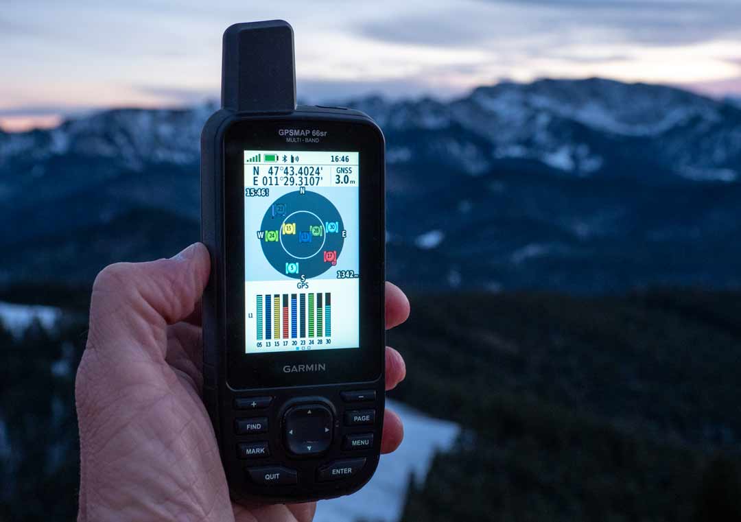
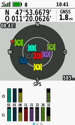
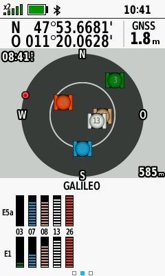
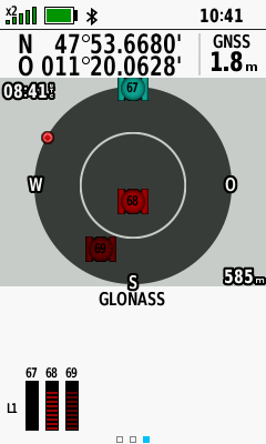
The following screenshots show the satellite page in multi-GNSS & multi-band mode.
Note: An increase of accuracy from 3 m to 1.8 m is always achieved by activating multi-band!
More examples are available in my article GPS accuracy of cycling devices.
Interactive map for reviewing the quality of track recordings
- Use "Select" to display a course.
- Select a map via the layer icon (right).
- Since extensive original files are used, the loading can take.
- It is recommended to select only the devices in focus via "Tracks"; this makes interpretation easier.
- To display the color coding, move the mouse pointer to "Tracks"; individual tracks can also be hidden there.
The new technology provides another advantage: no position drift.
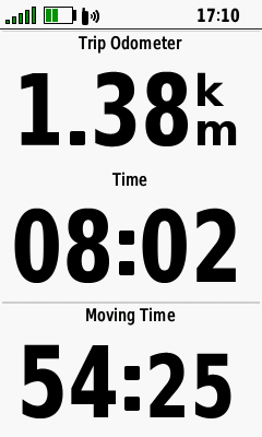
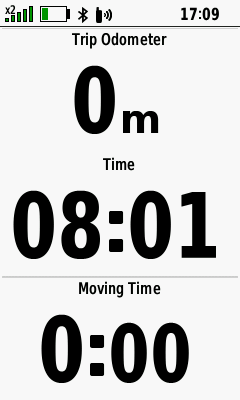
The screenshots from the trip computer tell the differences (the devices are in a stationary state).
The GPSMAP 66sr shows no drift compared to the GPSMAP 66s. Check the "trip odometer" and the "moving time".
Operation & Menu – Garmin GPSMAP 66sr Review
The robust and IPX7 & MIL-STD-810 tested GPSMAP 66sr is a keypad device par excellence – and therefore absolutely glove friendly. A further advantage is: since the keys are on top, it is also very easy to use on the handlebars of a bike.
However, there is one annoying thing I would not like to conceal. To end the important "battery save mode" (the GPSMAP turns off the display after a given time) you have to press the on/off button. When hiking, you need to move your hand or you need the help of the second hand – provided it is not used for other purposes.
Also, this unfortunate combination can occasionally cause me to turn the GPSMAP on by mistake, unlike the GPSMAP 64 or 65 series, which have a battery save mode that can be turned off with any button.
The keypad on top, the large display and the protruding helix antenna have advantages in operation, (map) overview and GPS reception. On the other hand, the case is relatively large, which should be taken into account when considering a purchase.
The menu with all its functions requires a certain amount of training.
However, the extensive configuration options – in combination with the various preconfigured profiles (hike, mountain bike, …) – lead to a target-oriented and practical operation.
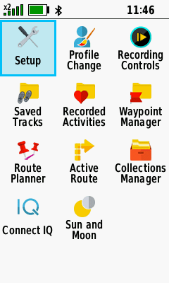
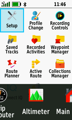
For example, the "hike" profile can be configured differently than the "mountain bike" profile. The figures show an example of an individually configured main menu, in which the displayed applications are reduced to the most necessary.
Some GPSMAP 66 users may be bothered by the fact that the map page only has the options "large data field" (= one field) and "small data fields" (= four fields) for showing data. It would make more sense – analogous to the GPSMAP 64 or 65 handheld devices – to differentiate between "1 large", "2 small" or "4 small". With two fields there is more visible map area than with four fields. There is only one thing you can do: temporarily deactivate the data fields by pressing "MENU-Button > Hide Dashboard".
Since this point of criticism of the 66 series already exists since the beginning I must state: It’s a pity that Garmin doesn’t respond to such and other long existing customer requests, especially since an implementation should only require a minimal effort.
Apart from that, compared to the 66st or 66st almost everything remains the same – in the menu there are only a few cosmetic changes in a few places.
TopoActive Map – GPSMAP 66sr In-Depth Review
The pre-installed TopoActive maps of Europe and other parts of the world – based on OSM data – are in my opinion a very good introduction to the world of cartography and are a solid basis for navigation, especially with tracks.
In addition, they are routable (= automatic calculation of routes along the road network) and offer an extensive POI collection.
However, searching for addresses is limited to only a few countries (Europe: Belgium, Germany, Luxembourg, Netherlands, Poland).
Contour lines are missing – elevation data for the whole of Europe would just be some gigabyte more. But with some know-how you can install them for individual countries (read How to install contour lines).

One argument for buying Garmin GPS devices is the huge range of additional maps – from commercial Garmin maps to free OSM. Of course, this also applies to the GPSMAP 66sr, there is sufficient memory available.
In addition to the pre-installed TopoActive, the 66sr includes a free subscription of BirdsEye satellite images; the download is via Wi-Fi. Whether the satellite images provide additional value depends on the region – in my experience they are less useful in the mountains.
Features – Garmin GPSMAP 66sr
A comparison chart (66s vs. 66st vs. 66sr vs. 66i) is provided in my Garmin GPSMAP buyers guide!
In this discipline, the GPSMAP 66sr offers all the outdoor features you would expect from Garmin – whether for a bike ride, a hike, a geocaching hunt or a kayaking trip:
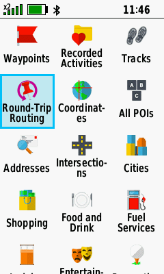
Navigation with tracks / routes / waypoints / POI / geocaches / …, ActiveRouting (activity-specific routing along the route network of the map), Roundtrip-Routing (calculation of round trips), Back to Start, TracBack and specialties such as direct routing in combination with course (CDI) – the latter is a function that certainly only few users need, but which can be immensely important, for example when kayaking.
There are also altimeter & barometer functions, an integrated flashlight with SOS function, proximity alarms, wireless transmission from device to device, various calendars, extensions via Connect IQ … to name just a few.
Extensive smartphone connectivity is also available, but the question is whether functions such as weather reports are really necessary – a smartphone is on tour anyway.
In outdoor practice, there are only two frequently used online functions: live tracking via Garmin Connect App and data exchange with the smartphone, either via Connect IQ apps (e.g. with komoot) or via the Garmin Explore App.
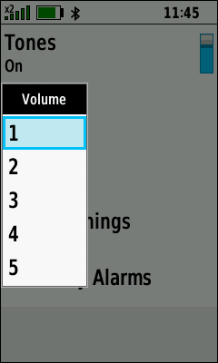
There is an almost sensational innovation in the functions: The volume for the tones emitted by the beeper can now be regulated!
Levels 1 to 5 are available for key tones, system messages, turn warnings and proximity alarms – for all together and not separately for each type.
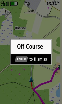
Note – Garmin has published an important update in November 2022 for all GPSMAP 66 devices. Now you can use courses in addition to tracks and routes, you can copy courses from the Connect App to the device and you get on and off course alerts – even for tracks!
- VORINSTALLIERTE EUROPAKARTE: Für die perfekte Navigation beim Wandern, Bergsteigen oder auch Geocachen sorgt die vorinstallierte topographische Karte TopoActive Europa. Mit dieser routingfähigen Karte finden Sie mit Adresseingabe oder auch POIs Ihr Ziel.
- BEHALTEN SIE DIE ORIENTIERUNG: Neben den gängigen Satellitensystemen GPS, GLONASS und Galileo sind auch QZSS und IRNSS verfügbar. Zusammen mit der Multi-Frequenz-Technologie erhältst du so überall und jederzeit den besten Satellitenempfang.
- SUPER ABLESBAR UND WASSERDICHT: Das transflektive 2,6“ Farbdisplay ist auch bei Sonnenlicht sehr gut ablesbar. Dank Tastenbedienung können Sie das Gerät auch mit Handschuhen und unter allen Bedingungen bedienen. Wasserdicht nach IPX 7 Standard.
- BAROMETER UND 3-ACHSEN-KOMPASS: Der GPSMAP 65s ist zusätzlich mit einem barometrischen Höhenmesser und einem 3-Achsen-Kompass ausgestattet. Der Barometer gibt noch präzisere Höhendaten aus und der 3-Achsen-Kompass sorgt für die ideale Orientierung.
- PERFEKT VERNETZT: ANT+ und Bluetooth-Kompatibilität machen es möglich. Verbinden Sie bspw. Geschwindigkeits- oder Herzfrequenzsensoren mit Ihrem GPSMAP. Mit dem Smartphone gekoppelt erhalten Sie Telefonbenachrichtigungen direkt aufs Display.
- 16 Stunden Akkulaufzeit: Der GPSMAP 65 kann mit AA-Batterien sowie dem Garmin Akku Pack betrieben werden (beides separat erhältlich). Mit diesem dualen System sind Sie immer flexibel und können nach dem Batteriewechsel sofort wieder loslegen.
- GARMIN EXPLORE APP: Nutzen Sie die Garmin Explore App oder das Explore Portal, um Ihre Tour auf dem Smartphone oder am PC zu planen, Wegpunkte zu erstellen oder Ihre Tour im Nachhinein nochmal anzusehen.
Summary – Garmin GPSMAP 66sr Review
With the GPSMAP 66sr (and the GPSMAP 65s) Garmin has launched an exciting new development. Multi-GNSS and multi-band do not lead to the absolute wow effect when hiking or cycling, but they still make the GPSMAP the ultimate outdoor handheld device in terms of accuracy.
Otherwise, the GPSMAP 66sr plays all the strengths of the GPSMAP 66 series: display, features, buttons, connectivity, …!
These features make the 66sr ideal for many outdoor activities – unless "small & light" is the key. Another sticking point is the built-in rechargeable battery, which is certainly a no-go for some users.
Pros – GPSMAP 66sr
- Fast & very accurate GNSS receiver
- Excellent & bright display
- Battery life
- Keyboard, glove friendly
- Feature set
- Preloaded maps
- Connectivity (ANT+, Bluetooth, USB, Wi-Fi)
- Smartphone connectivity
Cons – GPSMAP 66sr
- Relatively large & heavy
- Disabling the battery save mode
- No USB-C
- No exchangeable batteries (relevant for certain activities)
- Confusing combination of activities, tracks, routes & courses
Rating – GPSMAP 66sr
- GPS: 100%
- Speed: 80%
- Battery: 100%
- Display: 100%
- Operation: 80%
- Navigation: 100%
- Features: 100%
- Maps: 100%
- Score: 100%
- VORINSTALLIERTE EUROPAKARTE: Für die perfekte Navigation beim Wandern, Bergsteigen oder auch Geocachen sorgt die vorinstallierte topographische Karte TopoActive Europa. Mit dieser routingfähigen Karte finden Sie mit Adresseingabe oder auch POIs Ihr Ziel.
- BEHALTEN SIE DIE ORIENTIERUNG: Neben den gängigen Satellitensystemen GPS, GLONASS und Galileo sind auch QZSS und IRNSS verfügbar. Zusammen mit der Multi-Frequenz-Technologie erhältst du so überall und jederzeit den besten Satellitenempfang.
- SUPER ABLESBAR UND WASSERDICHT: Das transflektive 2,6“ Farbdisplay ist auch bei Sonnenlicht sehr gut ablesbar. Dank Tastenbedienung können Sie das Gerät auch mit Handschuhen und unter allen Bedingungen bedienen. Wasserdicht nach IPX 7 Standard.
- BAROMETER UND 3-ACHSEN-KOMPASS: Der GPSMAP 65s ist zusätzlich mit einem barometrischen Höhenmesser und einem 3-Achsen-Kompass ausgestattet. Der Barometer gibt noch präzisere Höhendaten aus und der 3-Achsen-Kompass sorgt für die ideale Orientierung.
- PERFEKT VERNETZT: ANT+ und Bluetooth-Kompatibilität machen es möglich. Verbinden Sie bspw. Geschwindigkeits- oder Herzfrequenzsensoren mit Ihrem GPSMAP. Mit dem Smartphone gekoppelt erhalten Sie Telefonbenachrichtigungen direkt aufs Display.
- 16 Stunden Akkulaufzeit: Der GPSMAP 65 kann mit AA-Batterien sowie dem Garmin Akku Pack betrieben werden (beides separat erhältlich). Mit diesem dualen System sind Sie immer flexibel und können nach dem Batteriewechsel sofort wieder loslegen.
- GARMIN EXPLORE APP: Nutzen Sie die Garmin Explore App oder das Explore Portal, um Ihre Tour auf dem Smartphone oder am PC zu planen, Wegpunkte zu erstellen oder Ihre Tour im Nachhinein nochmal anzusehen.

that’s a lot of information thank you is there some kind of booklet that I can obtain I have the 66sr and I have not been able to inpute the cordinates to locate a piece of land that I bought I am a novice not very good with tech stuff I could sure use your help thank you.
Thank you. Im going to buy one.
In my opinion you are mistaken. I suggest it to discuss.
I just got a Garmin 66sr, your review was very helpful. But you missed one point. Auto and Motorcycle routable navigation is 'disabled' on this device unless you buy the $99 City Navigator maps. My previous much older Garmin handheld (b&w) did Auto/Moto navigation without issue. I can load Open Street Maps routable maps from online, but their colors are somewhat ugly and it really should be something that comes with the device. Should update the CON to "No Auto/Moto routable navigation without downloading extra maps or purchasing City Navigator."
Der Inhalt ist geschützt!
What a hostile behavior towards your reader.
no, it is not, there are too many copycats who use the content for their own websites
Trying to decide between the Garmin 66sr and 66i. Would use for hiking, primarily in the US, occasionally in Europe. Which is the better choice and why? Cost difference is only $50 more for the 66i.
I guess most people buy the 66i because of the inReach integration – in my opinion, two separate devices are better (GPSMAP 66s/st/sr + inRech Mini), if one fails the other still works; so the 66sr is a better choice (plus a better accuracy in difficult conditions)
Hi! Thanks for this review.
Do you think the GPSMAP 66sr is a good device for MTB / Bikepacking in the Alps or europeans mountains?
I am curently using an Etrex 30x to follow a GPX route and i record my activity on a Instinct Solar. The Etrex is very slow for map navigation/exploration and it lacks of connectivity with a phone.
Cheers
Hi Kamil,
yes, it is, it has only one drawback regarding your activities: no replaceable batteries; so you should keep an extra power bank for charging.
Cheers
Hi Joachim. I’ve just discovered your site as I am now looking to buy a Garmin GPS unit. Very impressive reviews, thank you. Can you tell me if this unit can operate continuously when being powered by a power bank? I have a sound recording device, and a camera, both of which will operate using the power bank preferentially, and only using their batteries when disconnected from the power bank. Can this unit be powered from the power bank, as opposed to just being recharged? I hope you can help. Again, thank you.
Carl.
Hi Carl,
yes, you can!
Can the 66sr be in use and monitor by a 3rd party? So if my wife goes out I can see her movements from home. If buy sending location manually or by automatic from some setting that can be activated.
Hi,
yes, you can; the GPSMAP 66sr is compatible with the Garmin Connect App; the app has a live tracking function via mobile network (works with the GPSMAP, but not always reliable).
The best full review I’ve ever found!
I have had a lot of Garmin navigators in the past, such as Etrex Touch 35, Oregon 700, Montana 680, I was looking for something that met my new needs I got a very good Gsmap66s but I would like to have more autonomy and precision.
After many searches on the web I fortunately found your reviews that made me understand many things, they are very well done and are very useful for me.
If I had found them before I would have understood a lot without wasting time for many not so complete reviews.
A month ago I ordered the new Gpsmap66sr and I am looking forward to have it.
If you have any channels I would like to follow you because you are very competent.
Thanks again you have been very helpful thanks
Bye from Italy
Thinking of buying the GPS Map66sr, primarily because it seems one of the few handheld units to be able to connect to QZSS, as living and wanting to use it Asia-Pacific. But I will use it mainly on a boat and may be under a roof sometimes, or not with clear line to satellites. I appreciate this will restrict its connectivity and accuracy, but wonder to what extent, as I see some promotion that it states it works okay in dense forests. So weighing up if I should go for the Montana 700i, which can be connected to an external antenna, unlike the 66sr which cannot. But the 700i does not connect to QZSS. Thanks.
Hi Bill,
sorry I missed your comment … another option would be the GPSMAP 79s (+ QZSS, but no external antenna). A few years ago I was sailing in canada, the skipper used an iPad in his cockpit to navigate even in difficult waters – his place was covered with thick canvas (or whatever) – there were no problems with the reception. In my opinion the GPSMAP 66sr or 79s should provide an absolutely sufficient accuracy (except in a cabin with metal housing).
Cheers
"Garmin has published an important update in November 2022" … you can see the future? wow 😛
what about? can i have some information?
Ciao Gianni,
November 2021 🙂
Garmin added courses (a function that is not yet fully developed)
https://www8.garmin.com/support/download_details.jsp?id=15447
Hello,
With the new version 4.90, as soon as I switch on the 66sr, I immediately have the fixed satellites without waiting and at home in the house, now are they taken into account to start a hike or should they be- he wait a few minutes?
I have to test in the field but since it has been raining for a few days I was unable to do a test même dans le sud de la France…..
Hello,
The new firmware version 4.90 corrects this blinking that I had on my 66sr, now the Galileo satellites are like other GNSS systems and no longer blink, they will be fixed as soon as the 66sr is switched on.
Great review, thank you very much!
Thanks, your comment is appreciated!
Hello,
I now have the 66sr which replaces the 65s that I sold.
The 66sr has the same problem as the 65s, i.e. the acquisition of Galileo satellites is sometimes very long, after two hours of operation, several Galileo satellites are still flashing and are therefore not taken into account, this is an operation. unnatural
Hello. I have a problem with the altimeter. The recording is very jagged. In the result I have twice more meters climbed than in reality – either by map or Fenix 6X PRO. There was a small improvement when I stopped taking the device out of my pants pocket and hung it around my neck on my camera strap. Every time I grab the device and do some activity with it, it causes a jump in the graph. I had a similar problem with the Instinct when I rolled up my jacket sleeve in the winter and solved it with a software adjustment to the recording. With a device this expensive, I’d want the result straight away. You just can’t rely on the altimeter. Can someone please advise me? I have the updates installed. The watch measures with an accuracy of +- 10 m. Thank you.
Hi,
sounds strange, my experience with the 66sr is very good.
Do you calibrate the altimeter before you start a tour? I recommend a manual calibration in combination with the auto calibration feature (= continuous).
In this post you can check several elevation profiles compared to cycling devices – looks great!
https://www.navigation-professionell.de/en/gps-accuracy-cycling-devices/
Cheers
Could you please tell me what changes occur when you switch the unit from power mode to battery saver mode other than the display turning off automatically when not in use? For example, will the unit continue to record my track in battery saver mode?
Hi,
If battery save mode is active, the display will be completely switched off according to the duration selected in "Backlight Timeout". Other functions such as the track recording are not affected. The display can be reactivated by pressing any key; alternatively, it switches on automatically when system messages are displayed (e.g. turn instructions).
No calcula bien el ascenso total. He hablado con el servicio tecnico de Garmin y me ha propuesto procedimientos que no resuelven el problema. Si alguien tiene el mismo problema, que lo comente. Saludos
Hola, José,
utilizo el garmin muy intensamente – pero este problema nunca lo he tenido. ¿Qué ajustes utiliza? ¿Está desactivada la calibración automática? ¿Se calibra el altímetro manualmente antes del recorrido?
Saludos
Hi, I’m interested whether the comparison of positional drift between 66s and 66sr what the 66s satellite was set on. Was it just set on GPS only or GPS + GLONASS" or "GPS + Galileo? It seems an excessive the drift suggesting GPS only.
thanks
Anthony
Hi,
66sr: Multi-Band & Multi-GNSS
66s: GPS + GLONASS (did not check it with GPS only)
Thanks for the review, how fat we’ve come from the Magellan 315 or the eTrex Legend (still have mine somewhere I’m sure !) very interesting to see a consumer device with a "real" GPS antenna (not a smartphone) and multi-band. I realize that this is mostly a "hiking" device but is there any chance you could run your track comparisons downtown in urban canyons ? That’s where the multi-band should really help, particularly by mitigating the effect of multipath if the implementation is well done.
You all not be a professional because you cannot even spell it correctly!
well, the website title comes from the german word "Professionell" and is not translated
Always one petty comment..the review was excellent.
haha I agree. Probably the best review of the device I have seen so far! Thank you! I will be purchasing now 🙂 ps OP actually kinda funny
Indeed, a terrific review, a silly comment. One can easily deduce that the author is multi-multi-linguial.
Sir,
I have become a huge fan of your reviews. Your in Europe, so I ask if you test with eGNOS on as an augmentation resource or even WAAS that has now a Geo sat far to the East of CONUS US> Have you found or tested with the EGNOS for stability or "settling of position? This might not be found in the accuracy display, but when the 66sr is set on a survey control, curious if, once datum transformation is done if you get closer to a mark.
Again, a real great resource. nice job.
Hi,
the GPSMAP 66sr (and the GPSMAP 65s) has no setting for SBAS (as other Garmin devices); it is not known if it uses SBAS satellites and it does not show these satellites on the satellite page (and no "D" indicator).
Cheers
The GPSMAP 66sr and GPSMAP 65/s do not use SBAS. THis is not necessary with Multi-Band GPSr as they can perform live correction with L1/L5 and E1/E5a signals in real time!
Hi,
if the 66sr and 65/s use a Sony chip it could be possible that SBAS is active in the background (I do not think so, but you never know …); this presumably built-in Sony dual-band chip provides SBAS: https://www.sony.net/SonyInfo/News/Press/202008/20-069E/
Yeah, SBAS was really designed for safety, not accuracy. The goal was to warn in real time of degraded satellite signals and prevent them from being used in the fix. Unlike dual band it didn’t help at all for multipath for instance.