GPSMAP 65s and GPSMAP 65 – Garmin has launched two new handheld devices in the tradition of the popular and successful Garmin GPSMAP 64 series.
In this review I’ll take a closer look at the GPSMAP 65s – a workhorse with Garmins latest state-of-the-art satellite technology.
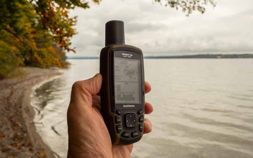
What are the differences between the GPSMAP 65s and the GPSMAP 65?
The only difference between the two handheld devices concerns the sensors. The 65s also features a barometric altimeter and a tilt-compensated 3-axis compass (check).
Two features that I think are worth the extra $50.
The barometric altimeter provides accurate altitude readings (compared to the GPS measurements on the GPSMAP 65) and altitude profiles e.g. along tracks; furthermore the 65s can be used as a weather station.
The compass ensures correct orientation of the map or compass when stationary and at very low speeds. With the GPSMAP 65 – the alignment is done by GPS – this requires some movement.
What does the GPSMAP 65s offer compared to the GPSMAP 64sx?
The GPSMAP 65s is best compared to the GPSMAP 64sx.
The 65s offers only few new functions than the 64sx:
- The Multi-GNSS & Multi-Band Receiver (64sx: two GNSS simultaneously, L1/E1 band only)
- The internal memory is now 16 GB (about 8.4 GB free, depending on the preloaded maps) compared to 8 GB (about 7.7 GB free).
The 64sx handheld unit has – in contrast to the 65s – a connector for an external GPS antenna. May be because only a few users need an external antenna, the construction costs can be reduced or the multi-GNSS & multi-band receiver makes an external antenna superfluous.
GPS Reception – Garmin GPSMAP 65s Review
The exciting new feature of the 65s is the multi-GNSS and multi-band receiver – this is intended to provide better accuracy in challenging environments (valleys, urban canyons, dense forests, …).
Multi-GNSS means the simultaneous reception of GPS, GLONASS, Galileo, OZSS and IRNSS satellite signals. However, since OZSS and IRNSS are only regional systems in the Asia-Pacific region and India respectively, we only have GPS, GLONASS and Galileo satellites available e.g. in Europe and North America.
Multi-Band allows the simultaneous evaluation of L1 and L5 (GPS) or E1 and E5a (Galileo) signal frequencies.
The GPSMAP 65s offers the following satellite settings:
- GPS only without multi-band
- Multi-GNSS without multi-band
- Multi-GNSS with multi-band
- Demo mode (GNSS disabled)
The GPSMAP 64sx only allows the combinations GPS + GLONASS or GPS + Galileo – in addition to "GPS only" and SBAS (WAAS/EGNOS); the frequencies are L1 and E1.
The new technology leads in outdoor practice to
- a fast position determination (especially compared to the 64sx),
- a GPS accuracy that ideally is always "1.8 m" ("3 m" for the GPSMAP 64sx) and
- no position drift when stationary.
- Track recordings can be a bit more accurate than on a GPSMAP 64sx; however, I do not see any great differences between the devices.
You can have a look at some tracks on the map below and form your own opinion. The logs are from some hikes in challenging environments: mountain valleys, deep forests and urban canyons in Munich/Germany.
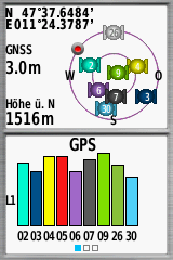
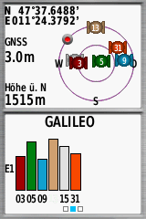
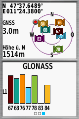
The following screenshots show the different GNSS settings in practice. You can see: An increase of accuracy from 3 m to 1.8 m is achieved by activating multi-band.
Multi-GNSS & Multi-Band
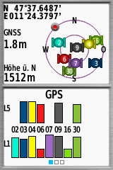
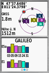
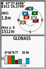
Multi-GNSS
GPS & Multi-Band
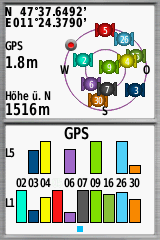
GPS only
Interactive map for reviewing the quality of track recordings
- Use "Select" to display a course.
- Select a map via the layer icon (right).
- Since extensive original files are used, the loading can take.
- It is recommended to select only the devices in focus via "Tracks"; this makes interpretation easier.
- To display the color coding, move the mouse pointer to "Tracks"; individual tracks can also be hidden there.
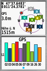
The new technology provides another advantage: no position drift.
The screenshots from the trip computer tell the differences (the devices are in a stationary state).
The GPSMAP 65s shows no position drift compared to the GPSMAP 64sx.
Battery life – Garmin GPSMAP 65s review
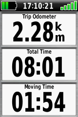
For the 65s, Garmin continues to rely on replaceable AA cells. This makes it clearly different from the new GPSMAP 66sr with its non-replaceable Li-battery. With the 66sr, the change from AA to Li-battery is probably due to the power-sucking combination of a large display and a powerful GNSS receiver.
The Garmin GPSMAP 64 series offers a great battery life. The question arises how the new satellite technology will affect the power consumption of the GPSMAP 65 series and whether this GPSMAP 64 strength will be maintained.
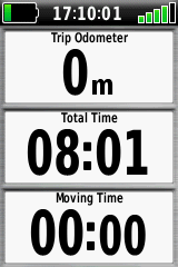
I tested the the Garmin GPSMAP 65s in combination with white eneloop batteries (in hh:mm):
- Power mode* – Multi-GNSS & Multi-Band: 10:15 / 11:20
- Power mode* – GPS only: 12:27 / 11:50 / 12:10
- Battery save mode** – Multi-GNSS & Multi-Band: 19:05
- Battery save mode** – GPS only: 21:45
*continuous 100% display backlight, all consumers activated, **battery save mode on, all consumers deactivated if possible
Even if these are rather theoretical values, it seems that the 16 hours specified by Garmin are feasible – provided the battery save mode is activated. Not using the new satellite technology will further increase battery life.
Memory – Garmin GPSMAP 65s review
The amount of data the GPSMAP 65s can handle is listed on the right. There is sufficient space available in the internal memory for this purpose; additional maps are best stored on the up to 32 GB microSD card.
200 stored tracks and 2,000 archived tracks is a lot – but unfortunately, even in the new generation there are no functions for searching or sorting the tracks. The track manager only lists the tracks according to their distance from the current position. What a pity – especially under the aspect that there are such helpful functions in the waypoint manager!
- 10.000 points per track
- 2.000 GPX fies
- 200 saved tracks
- 2.000 archived tracks
- 5.000 waypoints
- 200 routes (250 points/route, 50 points for on road navigation)
- Geocaches only limited by the available memory
- 3.000 mapping segments
- 500 custom map tiles
- 250 BirdsEye imagery files
Operation & Menu – Garmin GPSMAP 65s Review
The IPX7 waterproof GPSMAP 65s is a glove-friendly device par excellence. Bicyclists can enjoy another advantage: Thanks to the front buttons, the 65s can also be operated easily on the handlebars.
The keyboard and the helix antenna result in a relatively large housing. The 65s is not necessarily a device for the jacket pocket. When hiking, it is best attached to the shoulder straps of the backpack carrier with the carabiner clip included, for cycling there is a holder available as an accessory.
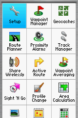
The menu with all its functions undoubtedly needs a certain training period. But the different configurable activities (recreational, geocaching, …) lead to a target-oriented and practical handling.
An activity like "hiking" can be configured differently than an activity like "mountain bike".
The following figures show an example of an individually configured main menu, the applications are reduced to the absolutely necessary, further important functions are arranged in the page ribbon. Figures 1 + 2 show the standard menu.
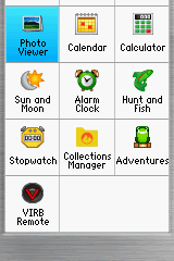
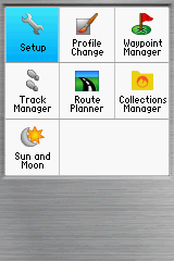
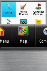
Operation & menu – Garmin GPSMAP 65s review
The pre-loaded TopoActive map of Europe (or your specific region) based on OSM data is a first step into the world of cartography. It is particularly suitable for navigating with tracks. In addition – as part of Garmins ActveRouting technology – it is routable (= automatic calculation of routes along the road network) and offers an extensive collection of POIs.
However, searching for addresses in Europe is limited to only a few countries (Belgium, Germany, Luxembourg, Netherlands, Poland).
Contour lines are not available – elevation data for all of Europe would be a few GB of data more.
One reason to buy Garmin GPS devices such as the GPSMAP 65s is the huge amount of additional maps available – from commercial Garmin maps to free OSM.
Features – GPSMAP 65s Review
The GPSMAP 65s is suitable for just about any outdoor activity such as cycling, geocaching, kayaking or hiking.
It provides all the typical Garmin outdoor functions like:
- Follow a track or a route created with the route planner
- Navigate on the route network of the map
- TracBack
- Direct routing in combination with course (CDI)
- Searching for addresses
- Entering coordinates
- Using POIs and waypoints
- Altimeter & barometer functions
- Proximity alarms
- Using sensors via ANT+ or Bluetooth (heart rate, bike speed, bike cadence, Garmin tempe, Garmin VIRB)
- Data transfer from device to device (e.g. tracks)
- Various calendars …
The only thing I would expect is the implementation of user requirements that have been in place for years, such as resetting the total odometer without a complete reset or individually changing the magenta color when navigating!
Comfort functions like roundtrip routing, Connect IQ extensions, inReach compatibility or an integrated flashlight with SOS function are missing, only the GPSMAP 66 series offers this.
Smartphone connectivity is also provided; you get notifications and live tracking via the Connect App and data exchange. The complex Explore App allows to exchange data such as routes, tracks and waypoints with the smartphone (and the Explore cloud).
- Large 2.6” sunlight-readable color display for easy viewing
- Expanded global navigation satellite systems (GNSS) and multi-band technology allow you to get optimal accuracy in challenging locations, including steep country, urban canyons and forests with dense trees
- Includes routable TopoActive mapping and federal public land map (U.S. only)
- Go-anywhere navigation with 3-axis compass and barometric altimeter
- Compatible with the Garmin Explore website and app (compatible smartphone required) to help you manage tracks, routes and waypoints and review statistics from the field
Review Summary – Garmin GPSMAP 65s
There is almost no reason to buy a handheld device like the GPSMAP 64sx anymore. For ¢50 more you get one of the latest outdoor device from Garmin, equipped with the best GNSS receiver available at the moment.
The GPSMAP 65s is a solid upgrade and still a workhorse for most types of outdoor activities; it offers all functions you really need for hiking, mountaineering, kayaking and other activities.
Pros – GPSMAP 65s
- Fast & super accurate GNSS receiver
- Keyboard
- Battery life
- Functions for almost all outdoor activities
- Pre-loaded maps
- Huge rage of available maps
- Smartphone connectivity
Cons – GPSMAP 65s
- No USB-C
- Small & low resolution display
Rating – GPSMAP 65s
- GNSS: 100%
- Speed: 80%
- Battery: 100%
- Display: 80%
- Operation: 80%
- Navigation: 80%
- Features: 80%
- Maps: 100%
- Overall: 80%
- Large 2.6” sunlight-readable color display for easy viewing
- Expanded global navigation satellite systems (GNSS) and multi-band technology allow you to get optimal accuracy in challenging locations, including steep country, urban canyons and forests with dense trees
- Includes routable TopoActive mapping and federal public land map (U.S. only)
- Go-anywhere navigation with 3-axis compass and barometric altimeter
- Compatible with the Garmin Explore website and app (compatible smartphone required) to help you manage tracks, routes and waypoints and review statistics from the field

Nice review. I went from the map 64s to the 65s. I always have to remember to reset my unit when I begin a new hike. Otherwise it includes my drive to the hike location and the previous hike data.
Hi,
in this respect, the GPSMAP 65s is somewhat outdated (the GPSMAP 66 series is more comfortable); however, it’s a great workhorse.
Is the 65s more accurate than the 64s? And does the 65s still give GPS drift like the 64s when you’re still?
In my experience, all GPSMAPs are quite excellent in terms of accuracy (I guess because of the helix antenna) – but the multiband devices can provide slightly better accuracy under certain conditions; I have compared the drift between the 64sx and 65s, in this respect the 65s is clearly better (no drift, check the screenshots in my review).
Hello,
The 65s has serious problems concerning the satellites, for quite a long time the Galileo satellites were flashing and therefore were not taken into account in multiband, after some time and doing some manipulations, like stopping the satellites, then putting in auto locate, then by turning on the satellites, I succeeded in restarting Galileo and the satellites no longer flash but it still happens and I have to redo the operations described, it is valid on every 65s and also on the 66sr. Either it comes from the firmware which manages the Sony GPS chip or it comes from the Sony chip which is not working properly. The cpe.bin file in the GPS folder of the 65s has its role to play, it is a predictive ephemeris file that greatly helps in the acquisition of satellites, it is updated every time you connect the 65s to Garmin Express, it updates this file and it’s better.
Hi,
check this: https://www.gpsrchive.com/Discussion/viewtopic.php?f=69&t=1262&start=50
Can you elaborate more on the differences between 64sx and 65s? It is only receiver? Not any software/speed/function differences?
I can get the 64sx at 290eur and the 65s at 370eur, still a big difference.
Also another question, it is possible to upload gpx routes on the go via Garmin connect app (via Bluetooth ) right?
Hi,
no differences, only what I have already written above.
You can not upload a gpx route with Connect app, only with Garmin Explore app.!
Hello,
Today I ordered a 65S in Germany cheaper than in France and on Amazon, (345.30 €) I had a 64s that I sold because not too happy with its precision, my two Twonav Trail2 and Cross are good mailers, however, without being multi-band.
I’ll get it right when I get it to see if the precision is OK.
How does the 65s compare with the old 66s?
Is the new multi band receiver that much more effective in challenging environments ?
Hi,
I guess the same as compared to 64sx, my statement: "Track recordings can be a bit more accurate than on a GPSMAP 64sx; however, I do not see any great differences between the devices."