Garmin has been distributing GPS devices under the brand name "GPSMAP" for almost 20 years. These are rugged GPS handheld devices especially for
- outdoor &
- marine applications.
A key feature of many GPSMAP models is the typical quad helix antenna. This type of antenna usually provides an excellent GPS reception – a particular strength of GPSMAP devices!
In contrast, the floating marine handhelds are mostly equipped with a patch antenna – accordingly the antenna stub is missing (exceptions: 86i/86s)
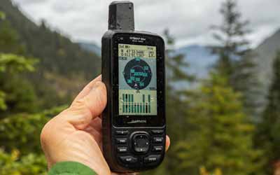
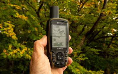
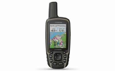
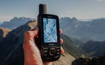
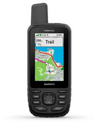
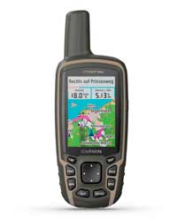
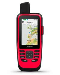
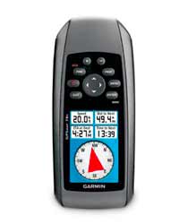
The following pictures show four typical GPS models (from left: 66st, 64sx, 86i, 78s; ©Garmin)
How has the GPSMAP series evolved over the years?
The Garmin GPSMAP success story began in 2001 with the GPSMAP 76 marine unit and in 2003 with the GPSMAP 60C outdoor unit!
The models in detail
Outdoor
- 60C / 60CS
- 60Cx / 60CSx
- 62 / 62s / 62st
- 62sc / 62stc
- 64 / 64s / 64st / 64sc
- 64x / 64sx / 64csx
- 65* / 65s*
- 66s / 66st / 66i / 66sr*
* 2020
Marine
- 76
- 76s
- 76C / 76CS
- 76Cx / 76CSx
- 78 / 78s / 78sc
- 86s / 86i
- 79s / 79sc
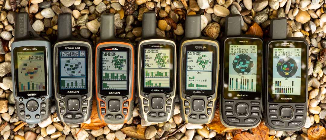
Which GPSMAP devices are available 2021?
Outdoor devices (*)
- GPSMAP 66 series (66i, 66s, 66st, 66sr)
- GPSMAP 65 series (65, 65s)
- GPSMAP 64 series (64x, 64sx, 64csx)
Marine devices (*)
- GPSMAP 86 series (86i, 86s, 86sc, 86sci)
- GPSMAP 78 series (78, 78s, 78sc)
- GPSMAP 79 series (79s, 79sc)
(*) depending on your country
- VORINSTALLIERTE EUROPAKARTE: Für die perfekte Navigation beim Wandern, Bergsteigen oder auch Geocachen sorgt die vorinstallierte topographische Karte TopoActive Europa. Mit dieser routingfähigen Karte finden Sie mit Adresseingabe oder auch POIs Ihr Ziel.
- BEHALTEN SIE DIE ORIENTIERUNG: Neben den gängigen Satellitensystemen GPS, GLONASS und Galileo sind auch QZSS und IRNSS verfügbar. Zusammen mit der Multi-Frequenz-Technologie erhältst du so überall und jederzeit den besten Satellitenempfang.
- SUPER ABLESBAR UND WASSERDICHT: Das transflektive 2,6“ Farbdisplay ist auch bei Sonnenlicht sehr gut ablesbar. Dank Tastenbedienung können Sie das Gerät auch mit Handschuhen und unter allen Bedingungen bedienen. Wasserdicht nach IPX 7 Standard.
- BAROMETER UND 3-ACHSEN-KOMPASS: Der GPSMAP 65s ist zusätzlich mit einem barometrischen Höhenmesser und einem 3-Achsen-Kompass ausgestattet. Der Barometer gibt noch präzisere Höhendaten aus und der 3-Achsen-Kompass sorgt für die ideale Orientierung.
- PERFEKT VERNETZT: ANT+ und Bluetooth-Kompatibilität machen es möglich. Verbinden Sie bspw. Geschwindigkeits- oder Herzfrequenzsensoren mit Ihrem GPSMAP. Mit dem Smartphone gekoppelt erhalten Sie Telefonbenachrichtigungen direkt aufs Display.
- 16 Stunden Akkulaufzeit: Der GPSMAP 65 kann mit AA-Batterien sowie dem Garmin Akku Pack betrieben werden (beides separat erhältlich). Mit diesem dualen System sind Sie immer flexibel und können nach dem Batteriewechsel sofort wieder loslegen.
- GARMIN EXPLORE APP: Nutzen Sie die Garmin Explore App oder das Explore Portal, um Ihre Tour auf dem Smartphone oder am PC zu planen, Wegpunkte zu erstellen oder Ihre Tour im Nachhinein nochmal anzusehen.
Garmin GPSMAP outdoor handhelds – buyer’s guide
GPSMAP – suggested outdoor and cycling activities
Depending on the model, the GPSMAP outdoor handheld devices are particularly suitable for
- Mountaineering (*)
- Bicycle touring
- Mountain biking
- Kayaking (*)
- Trekking (*)
- Long distance hiking (*)
- Hiking
- Geocaching
(*) especially 64 and 65 series
How do the GPSMAP outdoor devices differ?
GPSMAP 64 series
The GPSMAP 64 series is currently represented by the 64x, the 64sx and the 64csx. The 64sx and the 64csx have the following functions compared to the 64x:
- ANT+ & Bluetooth LE to connect to a smartphone or to sensors
- Smartphone notifications and live tracking
- Sending and receiving data wirelessly from compatible Garmin outdoor devices (e.g. tracks, routes, waypoints, geocaches)
- Data exchange via the Explore App
- 3-axis compass for accurate directional information when stationary or at low speeds
- Barometric altimeter for exact altitude readings or for weather forecasting
- 8 MP camera and flashlight (64csx only)
Compared to the predecessors (64, 64sx, 64st), the current models (64x, 64sx, 64csx) offer with Galileo an additional satellite system, more internal memory (8 GB vs. 4 GB) and a few small changes in the menu.
GPSMAP 65 series
The brand new 65 and 65s models stand out from the GPSMAP 64x series as follows:
- Multi-GNSS (GPS, GLONASS, Galileo, OZSS, IRNSS)
- Multi-Band L1/L5 (GPS) and E1/E5a (Galileo) frequencies
- No SBAS (WAAS/EGNOS)
- Preinstalled TopoActive maps (routable)
- 16 GB internal memory
GPSMAP 66 series
The models differ as follows:
- The 66st has pre-loaded maps (*) compared to the 66s.
- The 66i also features inReach technology (communication via Iridium satellites) and a built-in lithium battery.
- The 66sr has multi-GNSS & multi-band (same as the 65 series), a built-in lithium battery (same as the 66i) and the tone volume is controllable.
(*) depending on your country
The GPSMAP 66s, 66st and 66sr offer additional features over the 64 and 65 models (selection):
- Large 3-inch display
- Universal connectivity via ANT+, Bluetooth & Wi-Fi
- RINEX logging
- Navigation with courses (like a track or a route)
- Converts tracks and routes to courses
- Track navigation with on course and off course alerts
- Additional online functions via smartphone (geocaching live, weather)
- Extensions with Garmin Connect IQ apps (e.g. gimporter, komoot), widgets and data fields
- Pairs to Garmin Explore App without first pairing to Garmin Connect Mobile App.
- Expedition mode for extra long battery life
- LED Flashlight
- Download BirdsEye satellite images via Wi-Fi (free subscription included)
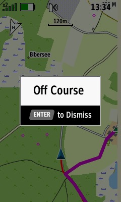
With the GPSMAP 66i it is even more:
- Worldwide communication independent of the mobile network via the Iridium satellite system (inReach technology)
- Send SOS messages
- Send & Receive Text Messages
The latest GPSMAP 66sr offers additional features:
- Extra bright display
- Super accurate GNSS receiver (also 65 series; however, all GPSMAP devices provide a great satellite reception and accuracy)
- Adjustable tone volume
- Long battery life
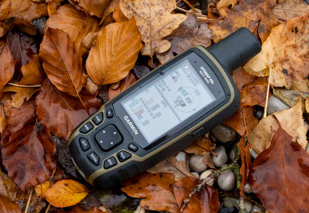
Comparison – GPSMAP 66s/66st vs. 66sr vs. 65s vs. 64sx
- VORINSTALLIERTE EUROPAKARTE: Für die perfekte Navigation beim Wandern, Bergsteigen oder auch Geocachen sorgt die vorinstallierte topographische Karte TopoActive Europa. Mit dieser routingfähigen Karte finden Sie mit Adresseingabe oder auch POIs Ihr Ziel.
- BEHALTEN SIE DIE ORIENTIERUNG: Neben den gängigen Satellitensystemen GPS, GLONASS und Galileo sind auch QZSS und IRNSS verfügbar. Zusammen mit der Multi-Frequenz-Technologie erhältst du so überall und jederzeit den besten Satellitenempfang.
- SUPER ABLESBAR UND WASSERDICHT: Das transflektive 2,6“ Farbdisplay ist auch bei Sonnenlicht sehr gut ablesbar. Dank Tastenbedienung können Sie das Gerät auch mit Handschuhen und unter allen Bedingungen bedienen. Wasserdicht nach IPX 7 Standard.
- BAROMETER UND 3-ACHSEN-KOMPASS: Der GPSMAP 65s ist zusätzlich mit einem barometrischen Höhenmesser und einem 3-Achsen-Kompass ausgestattet. Der Barometer gibt noch präzisere Höhendaten aus und der 3-Achsen-Kompass sorgt für die ideale Orientierung.
- PERFEKT VERNETZT: ANT+ und Bluetooth-Kompatibilität machen es möglich. Verbinden Sie bspw. Geschwindigkeits- oder Herzfrequenzsensoren mit Ihrem GPSMAP. Mit dem Smartphone gekoppelt erhalten Sie Telefonbenachrichtigungen direkt aufs Display.
- 16 Stunden Akkulaufzeit: Der GPSMAP 65 kann mit AA-Batterien sowie dem Garmin Akku Pack betrieben werden (beides separat erhältlich). Mit diesem dualen System sind Sie immer flexibel und können nach dem Batteriewechsel sofort wieder loslegen.
- GARMIN EXPLORE APP: Nutzen Sie die Garmin Explore App oder das Explore Portal, um Ihre Tour auf dem Smartphone oder am PC zu planen, Wegpunkte zu erstellen oder Ihre Tour im Nachhinein nochmal anzusehen.
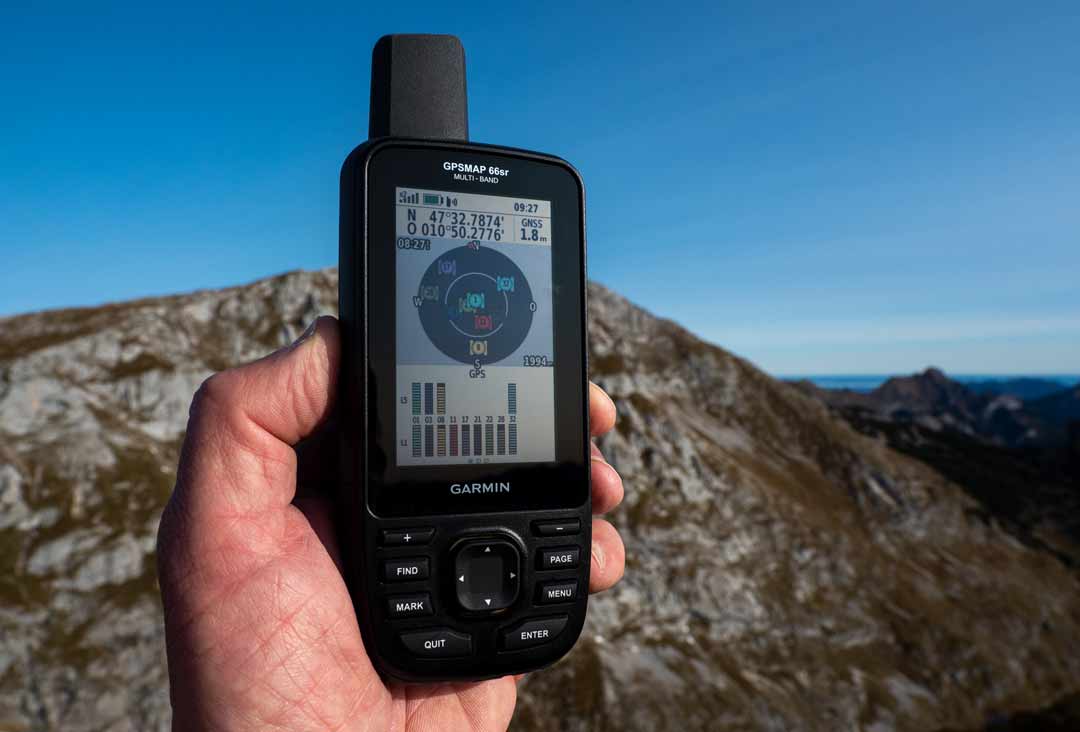
What are the strengths and weaknesses of the Garmin GPSMAP outdoor handhelds?
Advantages of the GPSMAP outdoor devices
All models
- Excellent GPS reception by GPS, GLONASS, Galileo, SBAS or by GPS, GLONASS, Galileo, QZSS, IRNSS in combination with L1/L5/E1/E5a frequencies
- Helix antenna
- Excellent displays
- Very good battery life
- Operation with gloves
- Keyboards on the front (practical for cyclists)
- Illuminated keyboards
- More than sufficient memory space
- All important outdoor functions
- ActiveRouting technology (activity specific routing)
- Paperless geocaching
- Data transfer from device to device (not GPSMAP 64x)
- Large selection of commercial maps from Garmin
- Compatible with free OSM maps
- Waterproof & rugged
- Proven design & functionality
GPSMAP 64 series
- Lighter and handier than the 66 series
- External GPS antenna connector
- Reliable software
- No "unfortunate" combination of GPX tracks and FIT activities
- Compatible with Garmin Explore (models with Bluetooth)
GPSMAP 65 series
- Multi-GNSS & multi-band
- Compatible with Garmin Explore
- Otherwise similar to the 64 series (but no external antenna is possible)
GPSMAP 66 series
- Best-of-class GNSS reception (especially the 66sr with multi-GNSS & multi-band)
- Immense range of functions
- Connectivity
- Large displays
- Bright displays (especially 66sr)
- Plenty of memory for waypoints, routes and tracks
- Tracks with 20,000 points
- Course navigation
- RoundTrip routing
- Connect IQ (installation of apps, data fields, widgets)
- Compatible with Garmin Explore
- Course download via Garmin Connect App
- Built to military standard MIL-STD-810
- RINEX logging and EPO download
- VORINSTALLIERTE EUROPAKARTE: Für die perfekte Navigation beim Wandern, Bergsteigen oder auch Geocachen sorgt die vorinstallierte topographische Karte TopoActive Europa. Mit dieser routingfähigen Karte finden Sie mit Adresseingabe oder auch POIs Ihr Ziel.
- BEHALTEN SIE DIE ORIENTIERUNG: Neben den gängigen Satellitensystemen GPS, GLONASS und Galileo sind auch QZSS und IRNSS verfügbar. Zusammen mit der Multi-Frequenz-Technologie erhältst du so überall und jederzeit den besten Satellitenempfang.
- SUPER ABLESBAR UND WASSERDICHT: Das transflektive 2,6“ Farbdisplay ist auch bei Sonnenlicht sehr gut ablesbar. Dank Tastenbedienung können Sie das Gerät auch mit Handschuhen und unter allen Bedingungen bedienen. Wasserdicht nach IPX 7 Standard.
- BAROMETER UND 3-ACHSEN-KOMPASS: Der GPSMAP 65s ist zusätzlich mit einem barometrischen Höhenmesser und einem 3-Achsen-Kompass ausgestattet. Der Barometer gibt noch präzisere Höhendaten aus und der 3-Achsen-Kompass sorgt für die ideale Orientierung.
- PERFEKT VERNETZT: ANT+ und Bluetooth-Kompatibilität machen es möglich. Verbinden Sie bspw. Geschwindigkeits- oder Herzfrequenzsensoren mit Ihrem GPSMAP. Mit dem Smartphone gekoppelt erhalten Sie Telefonbenachrichtigungen direkt aufs Display.
- 16 Stunden Akkulaufzeit: Der GPSMAP 65 kann mit AA-Batterien sowie dem Garmin Akku Pack betrieben werden (beides separat erhältlich). Mit diesem dualen System sind Sie immer flexibel und können nach dem Batteriewechsel sofort wieder loslegen.
- GARMIN EXPLORE APP: Nutzen Sie die Garmin Explore App oder das Explore Portal, um Ihre Tour auf dem Smartphone oder am PC zu planen, Wegpunkte zu erstellen oder Ihre Tour im Nachhinein nochmal anzusehen.
Weaknesses of the Garmin GPSMAP outdoor devices
All models
- Due to the protruding helix antenna they do not fit in every pocket.
- Not everybody likes the size.
- The operation via keyboard might not be loved by touch screen fans.
GPSMAP 64 series & GPSMAP 65 series
- Outdated USB interface
- Relatively small display
- Low display resolution
- Position determination after power-on takes a comparatively long time (only 64x/64sx)
GPSMAP 66 series
- Quite big and heavy
- Not so handy
- Switching off the battery save mode is only possible via on/off key
- No connection for an external GPS antenna
- No USB-C
- Fixed battery pack (66sr & 66i only)
- Complex mix of activities, courses, tracks & routes

